Trail Walking Saint-Gervais-des-Sablons - saint Gervais des Sablons - Photo

saint Gervais des Sablons

© OpenStreetMap contributors
Length
Length
13.3 km
Max alt
Max alt
236 m
Uphill gradient
Uphill gradient
272 m
Km-Effort
Km-Effort  
16.9 km
Min alt
Min alt
118 m
Downhill gradient
Downhill gradient
271 m
Boucle
Boucle
Yes
Creation date :
2018-04-17 00:00:43.776
Updated on :
2018-04-17 00:00:43.776

(0 Reviews)

Walking
Walking
2h54
Difficulty : Medium

Scan this QR Code to open this trail in the SityTrail application

FREE GPS app for hiking

Logo SityTrail SityTrail

IGN / Geographical institutes

Download SityTrail from the App Store Download SityTrail from Google Play

Logo SityTrail SityTrail World

The world is yours!

Download SityTrail from the App Store Download SityTrail from Google Play Download SityTrail on Huawei AppGallery

About

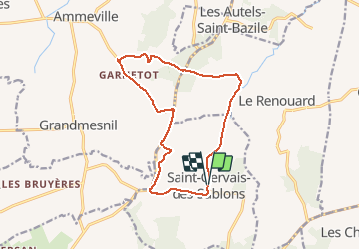
Trail Walking of 13.3 km to be discovered at Normandy, Orne, Saint-Gervais-des-Sablons. This trail is proposed by floup6138.

Description

belles vues du pays d'Auge mais beaucoup de routes

Elevation profile

Positioning

Country:
France
Region :
Normandy
Department/Province :
Orne
Municipality :
Saint-Gervais-des-Sablons
Location:
Unknown
Start:(UTM)
285731 ; 5420773 (31U) N.

Trails nearby

Trail Walking Crouttes - crouttes2017 - Photo
Walking
floup6138

Walking

Medium
Crouttes, Normandy, Orne, France
11.2 km | 15.5 km-effort
2h 39min
Yes


Close
My subscriptions