Trail Walking Cànoves i Samalús - El Sull - Photo
 dominiq
dominiq

User

© OpenStreetMap contributors
Length
Length
17 km
Max alt
Max alt
1307 m
Uphill gradient
Uphill gradient
913 m
Km-Effort
Km-Effort  
30 km
Min alt
Min alt
454 m
Downhill gradient
Downhill gradient
1054 m
Boucle
Boucle
No
Creation date :
2018-04-16 23:40:11.573
Updated on :
2018-04-16 23:40:11.573

(1 Reviews)

Walking
Walking
6h05
Difficulty : Medium

Scan this QR Code to open this trail in the SityTrail application

FREE GPS app for hiking

Logo SityTrail SityTrail

IGN / Geographical institutes

Download SityTrail from the App Store Download SityTrail from Google Play

Logo SityTrail SityTrail World

The world is yours!

Download SityTrail from the App Store Download SityTrail from Google Play Download SityTrail on Huawei AppGallery

About

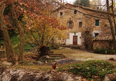
Trail Walking of 17 km to be discovered at Catalonia, Barcelona, Cànoves i Samalús. This trail is proposed by dominiq.

Description

Tres belle randonnee dans le massif du Montseny.

Elevation profile

Photos

Positioning

Country:
Spain
Region :
Catalonia
Department/Province :
Barcelona
Municipality :
Cànoves i Samalús
Location:
Unknown
Start:(UTM)
445625 ; 4618859 (31T) N.

Comments

Please log in to post a review or rate the element


Trails nearby

Trail On foot Cànoves i Samalús - SL-C 90 Riera de Vallfornes - Photo
On foot
PRO

On foot

Easy
Cànoves i Samalús, Catalonia, Barcelona, Spain
3.3 km | 4.4 km-effort
1h 0min
No


Close
My subscriptions