![](/images/other/stat-length.png)
![Trail Mountain bike Hanviller - Decouverte des vosges du nord a Roppeviler - Photo](https://media.geolcdn.com/t/1900/400/ext.pjpeg?maxdim=2&url=https%3A%2F%2Fservices.sitytrail.com%2FGeolivesWS%2FDownloadMedia.ashx%3FTrailID%3D834191%26Media%3Dfix__20170226160555.jpg)
Decouverte des vosges du nord a Roppeviler
JPMEGEL
User
![Length](/images/other/stat-length.png)
![Max alt](https://static1.geolcdn.com/siteimages/upload/files/1508320355ic_sort_altitude_max_24dp.png)
![Uphill gradient](https://static1.geolcdn.com/siteimages/upload/files/1508320355ic_sort_den_pos_24dp.png)
![Km-Effort](/images/other/stat-length.png)
![Min alt](https://static1.geolcdn.com/siteimages/upload/files/1508320355ic_sort_altitude_min_24dp.png)
![Downhill gradient](https://static1.geolcdn.com/siteimages/upload/files/1508320355ic_sort_den_neg_24dp.png)
![Boucle](https://static1.geolcdn.com/siteimages/upload/files/16400158638029165_repeat_loop_refresh_sync_direction_icon.png)
![Mountain bike](https://static1.geolcdn.com/sitytour/trail-icons/202.png)
2h03
Difficulty : Medium
![Scan this QR Code to open this trail in the SityTrail application](https://capi.geolives.com/qq0zvz2zws4bq2lad0pu/sitytour/trails/834191/qr.png?size=200)
FREE GPS app for hiking
About
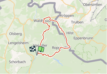
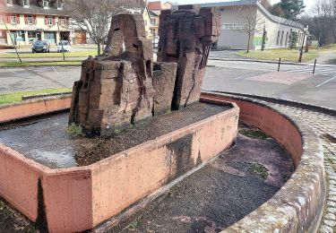
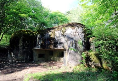
Trail Mountain bike of 24 km to be discovered at Grand Est, Moselle, Hanviller. This trail is proposed by JPMEGEL.
Description
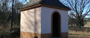
Depart de la Schwingmuehle, piste cyclable vers Walshbronn, Montée vers Schweix (Allemagne)puis Liederschied et Roppeviller par le rocher de Diane. Ensuite Haspelschiedt en passant par la chapelle Saint Wendelin, et retour au point de depart par les hauteur vers Bousseviller. Attention certains passages sont techniques mais les paysages sont beaux
Positioning
Comments
Trails nearby
![Trail Walking Roppeviller - Le rocher de l'Altschlossfelsen - Photo](https://media.geolcdn.com/t/375/260/ext.jpg?maxdim=2&url=https%3A%2F%2Fservices.sitytrail.com%2FGeolivesWS%2FDownloadMedia.ashx%3FTrailID%3D507904%26Media%3Dfix__20151230144825.jpg)
![Walking Walking](https://static1.geolcdn.com/sitytour/trail-icons/101.png)
Walking
![](/images/other/stat-length.png)
![](https://static1.geolcdn.com/siteimages/upload/files/16400158638029165_repeat_loop_refresh_sync_direction_icon.png)
![Trail Walking Bitche - Circuit panoramique de Bitche - Photo](https://media.geolcdn.com/t/375/260/ext.jpg?maxdim=2&url=https%3A%2F%2Fservices.sitytrail.com%2FGeolivesWS%2FDownloadMedia.ashx%3FTrailID%3D118677%26Media%3D12842_6.jpg)
![Walking Walking](https://static1.geolcdn.com/sitytour/trail-icons/101.png)
Walking
![](/images/other/stat-length.png)
![](https://static1.geolcdn.com/siteimages/upload/files/16400158638029165_repeat_loop_refresh_sync_direction_icon.png)
![Trail On foot Hanviller - Chevalet jaune - Photo](https://media.geolcdn.com/t/375/260/5ef45392-b749-445c-a602-485042878f58.jpeg&format=jpg&maxdim=2)
![On foot On foot](https://static1.geolcdn.com/sitytour/trail-icons/100.png)
On foot
![](/images/other/stat-length.png)
![](https://static1.geolcdn.com/siteimages/upload/files/16400158638029165_repeat_loop_refresh_sync_direction_icon.png)
![Trail On foot Schorbach - Anneau bleu - Photo](https://media.geolcdn.com/t/375/260/9ec12433-595b-4107-889c-8d147508992c.jpeg&format=jpg&maxdim=2)
![On foot On foot](https://static1.geolcdn.com/sitytour/trail-icons/100.png)
On foot
![](/images/other/stat-length.png)
![](https://static1.geolcdn.com/siteimages/upload/files/16400158638029165_repeat_loop_refresh_sync_direction_icon.png)
![Trail On foot Bitche - Yellow-white-yellow rectangle - Photo](https://media.geolcdn.com/t/375/260/b25926db-54e4-49bd-b984-8cab29c1cfec.jpeg&format=jpg&maxdim=2)
![On foot On foot](https://static1.geolcdn.com/sitytour/trail-icons/100.png)
On foot
![](/images/other/stat-length.png)
![](https://static1.geolcdn.com/siteimages/upload/files/16400158638029165_repeat_loop_refresh_sync_direction_icon.png)
![Trail On foot Bitche - Yellow X - Photo](https://media.geolcdn.com/t/375/260/b25926db-54e4-49bd-b984-8cab29c1cfec.jpeg&format=jpg&maxdim=2)
![On foot On foot](https://static1.geolcdn.com/sitytour/trail-icons/100.png)
![Trail On foot Schorbach - Bitche panoramic tour - Photo](https://media.geolcdn.com/t/375/260/362356f4-bb8e-4b08-a677-d061df0886ee.jpeg&format=jpg&maxdim=2)
![On foot On foot](https://static1.geolcdn.com/sitytour/trail-icons/100.png)
On foot
![](/images/other/stat-length.png)
![](https://static1.geolcdn.com/siteimages/upload/files/16400158638029165_repeat_loop_refresh_sync_direction_icon.png)
![Trail On foot Roppeviller - Circuit du rocher de l'Altschlossfelsen - Photo](https://media.geolcdn.com/t/375/260/e479e6c8-b176-4dba-ba62-ac01003618c1.jpeg&format=jpg&maxdim=2)
![On foot On foot](https://static1.geolcdn.com/sitytour/trail-icons/100.png)
On foot
![](/images/other/stat-length.png)
![](https://static1.geolcdn.com/siteimages/upload/files/16400158638029165_repeat_loop_refresh_sync_direction_icon.png)
![Trail On foot Schweix - Anneau rouge - Photo](https://media.geolcdn.com/t/375/260/5ef45392-b749-445c-a602-485042878f58.jpeg&format=jpg&maxdim=2)
![On foot On foot](https://static1.geolcdn.com/sitytour/trail-icons/100.png)
On foot
![](/images/other/stat-length.png)
![](https://static1.geolcdn.com/siteimages/upload/files/16400158638029165_repeat_loop_refresh_sync_direction_icon.png)