Trail Walking Jausiers - Gerbier et Empeloutier - Photo
 Gouze13
Gouze13

User

© OpenStreetMap contributors
Length
Length
6.9 km
Max alt
Max alt
2798 m
Uphill gradient
Uphill gradient
1018 m
Km-Effort
Km-Effort  
20 km
Min alt
Min alt
1910 m
Downhill gradient
Downhill gradient
1005 m
Boucle
Boucle
Yes
Creation date :
2017-08-30 00:00:00.0
Updated on :
2018-09-24 17:25:01.353

(0 Reviews)

Walking
Walking
4h00
Difficulty : Very difficult

Scan this QR Code to open this trail in the SityTrail application

FREE GPS app for hiking

Logo SityTrail SityTrail

IGN / Geographical institutes

Download SityTrail from the App Store Download SityTrail from Google Play

Logo SityTrail SityTrail World

The world is yours!

Download SityTrail from the App Store Download SityTrail from Google Play Download SityTrail on Huawei AppGallery

About

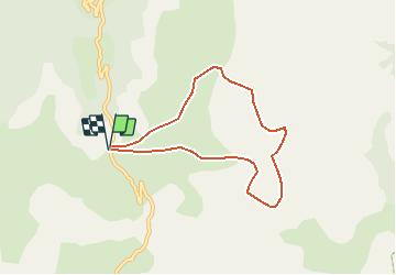
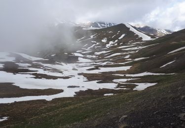
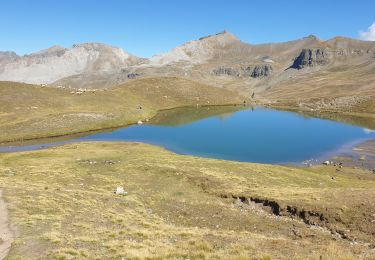
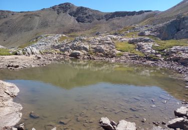
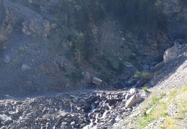
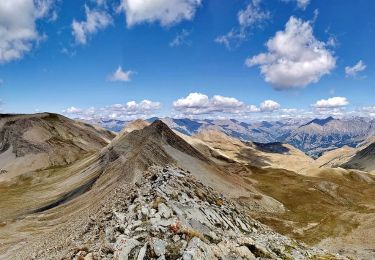
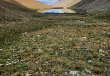
Trail Walking of 6.9 km to be discovered at Provence-Alpes-Côte d'Azur, Alpes-de-Haute-Provence, Jausiers. This trail is proposed by Gouze13.

Description

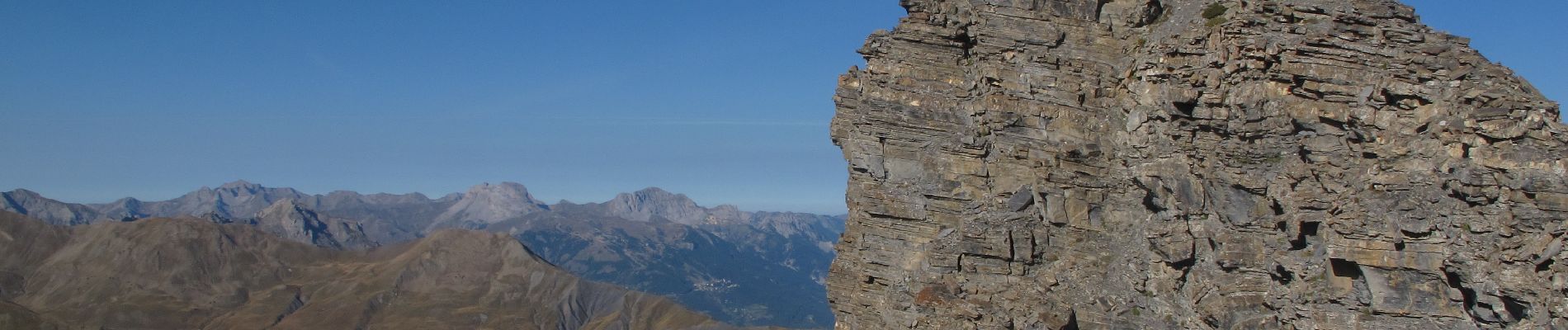
Itinéraire magnifique, trés sauvage, intégralement hors sentier. Jonction du Gerbier au collet 2660 m délicate (pas de désescalade en haut, terrain délité). Tracé indicatif: a faire au jugé avec lecture du terrain.

Elevation profile

Photos

Positioning

Country:
France
Region :
Provence-Alpes-Côte d'Azur
Department/Province :
Alpes-de-Haute-Provence
Municipality :
Jausiers
Location:
Unknown
Start:(UTM)
323295 ; 4915626 (32T) N.

Trails nearby

Trail Walking Jausiers - Cîme de Voga Via Jausier (lac de Sagne) - Photo
Walking
PapouBertrand

Walking

Very difficult
(1)
Jausiers, Provence-Alpes-Côte d'Azur, Alpes-de-Haute-Provence, France
14.9 km | 27 km-effort
6h 40min
Yes
Trail Walking Jausiers - Fontaine de la pissoun 15-08-12 - Photo
Walking
darktotor51

Walking

Medium
(1)
Jausiers, Provence-Alpes-Côte d'Azur, Alpes-de-Haute-Provence, France
9.5 km | 16.5 km-effort
3h 16min
Yes
Trail Walking Jausiers - cascadede pissoun 24 06 2024 - Photo
Walking
GUIDE
japy54

Walking

Medium
Jausiers, Provence-Alpes-Côte d'Azur, Alpes-de-Haute-Provence, France
7.2 km | 13.1 km-effort
2h 21min
Yes
Trail Walking Jausiers - Du col de Restefond, Mourre Haut - Photo
Walking
GrouGary

Walking

Easy
Jausiers, Provence-Alpes-Côte d'Azur, Alpes-de-Haute-Provence, France
3.6 km | 7.3 km-effort
1h 32min
Yes
Trail Walking Jausiers - Toureis Restefond - Photo
Walking
janussity

Walking

Medium
Jausiers, Provence-Alpes-Côte d'Azur, Alpes-de-Haute-Provence, France
6.3 km | 10.4 km-effort
2h 22min
Yes
Trail Walking Jausiers - Le Chevalier 2886m 13.5.22 - Photo
Walking
GUIDE
fredetpascale

Walking

Difficult
Jausiers, Provence-Alpes-Côte d'Azur, Alpes-de-Haute-Provence, France
8.9 km | 15.3 km-effort
3h 15min
Yes
Trail Walking Jausiers - Pissoun de Terres plaines - Photo
Walking
LittleAnne

Walking

Medium
Jausiers, Provence-Alpes-Côte d'Azur, Alpes-de-Haute-Provence, France
8.7 km | 14.7 km-effort
2h 57min
Yes
Trail Walking Jausiers - Lac des terres pleines et Arrête Rocher Tête de Clapouse - Photo
Walking
PapouBertrand

Walking

Difficult
Jausiers, Provence-Alpes-Côte d'Azur, Alpes-de-Haute-Provence, France
16.4 km | 28 km-effort
5h 22min
Yes
Trail Walking Jausiers - lac des terres pleines..tête du lac..tete de clapouse - Photo
Walking
gibello

Walking

Medium
Jausiers, Provence-Alpes-Côte d'Azur, Alpes-de-Haute-Provence, France
15.9 km | 28 km-effort
6h 54min
Yes


Close
My subscriptions