![](/images/other/stat-length.png)
![Trail Walking Sucé-sur-Erdre - Parc Botanique Ganuchaud - Photo](https://media.geolcdn.com/t/1900/400/ext.pjpeg?maxdim=2&url=https%3A%2F%2Fstatic1.geolcdn.com%2Fsiteimages%2Fupload%2Ffiles%2F1553511878bg_sport_marche.png)
Parc Botanique Ganuchaud
smu44
User
![Length](/images/other/stat-length.png)
![Max alt](https://static1.geolcdn.com/siteimages/upload/files/1508320355ic_sort_altitude_max_24dp.png)
![Uphill gradient](https://static1.geolcdn.com/siteimages/upload/files/1508320355ic_sort_den_pos_24dp.png)
![Km-Effort](/images/other/stat-length.png)
![Min alt](https://static1.geolcdn.com/siteimages/upload/files/1508320355ic_sort_altitude_min_24dp.png)
![Downhill gradient](https://static1.geolcdn.com/siteimages/upload/files/1508320355ic_sort_den_neg_24dp.png)
![Boucle](https://static1.geolcdn.com/siteimages/upload/files/16400158638029165_repeat_loop_refresh_sync_direction_icon.png)
![Walking](https://static1.geolcdn.com/sitytour/trail-icons/101.png)
18m
Difficulty : Very easy
![Scan this QR Code to open this trail in the SityTrail application](https://capi.geolives.com/qq0zvz2zws4bq2lad0pu/sitytour/trails/816385/qr.png?size=200)
FREE GPS app for hiking
About
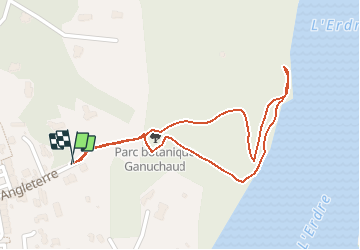
Trail Walking of 1.1 km to be discovered at Pays de la Loire, Loire-Atlantique, Sucé-sur-Erdre. This trail is proposed by smu44.
Description
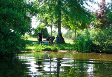
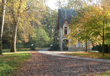
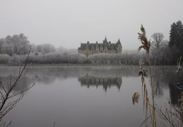
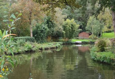
Parc botanique ouvert toute l'année.Il comporte plus de 55 espèces différentes d'arbres et de plantes de milieux divers. Ces espèces sont répertoriées sur 22 panneaux.Ce parc forestier permet une promenade au fil de l'Erdre .On peut y apercevoir la tour Saint-Georges (située sur une propriété privée). L'arboretum, plus récent, permet d'en savoir plus sur la flore des bords de l'Erdre.Point de départ187 Rue d'Angleterre44240 Suce-sur-erdreLat : 47.3418 Lng : -1.52341
Positioning
Comments
Trails nearby
![Trail Walking Sucé-sur-Erdre - Circuit de](https://media.geolcdn.com/t/375/260/ext.jpg?maxdim=2&url=https%3A%2F%2Fservices.sitytrail.com%2FGeolivesWS%2FDownloadMedia.ashx%3FTrailID%3D455795%26Media%3D797ca970-e83c-4cb0-a0f0-d31da8dcf767.jpg)
![Walking Walking](https://static1.geolcdn.com/sitytour/trail-icons/101.png)
Walking
![](/images/other/stat-length.png)
![](https://static1.geolcdn.com/siteimages/upload/files/16400158638029165_repeat_loop_refresh_sync_direction_icon.png)
![Trail On foot Carquefou - Entre Terres et Rivières - Photo](https://media.geolcdn.com/t/375/260/437a1c88-0c6a-4843-9806-3862e7c97877.jpeg&format=jpg&maxdim=2)
![On foot On foot](https://static1.geolcdn.com/sitytour/trail-icons/100.png)
On foot
![](/images/other/stat-length.png)
![](https://static1.geolcdn.com/siteimages/upload/files/16400158638029165_repeat_loop_refresh_sync_direction_icon.png)
![Trail Walking Carquefou - Carquefou les hauts - Photo](https://media.geolcdn.com/t/375/260/ext.jpg?maxdim=2&url=https%3A%2F%2Fstatic1.geolcdn.com%2Fsiteimages%2Fupload%2Ffiles%2F1553511878bg_sport_marche.png)
![Walking Walking](https://static1.geolcdn.com/sitytour/trail-icons/101.png)
Walking
![](/images/other/stat-length.png)
![](https://static1.geolcdn.com/siteimages/upload/files/16400158638029165_repeat_loop_refresh_sync_direction_icon.png)
![Trail Hybrid bike Sucé-sur-Erdre - Jour 3 - Photo](https://media.geolcdn.com/t/375/260/e4072160-a1ae-4190-a751-77fb38da9c46.jpg&format=jpg&maxdim=2)
![Hybrid bike Hybrid bike](https://static1.geolcdn.com/sitytour/trail-icons/203.png)
Hybrid bike
![](/images/other/stat-length.png)
![](https://static1.geolcdn.com/siteimages/upload/files/16400158638029165_repeat_loop_refresh_sync_direction_icon.png)
![Trail Hybrid bike Sucé-sur-Erdre - Jour 1 - Photo](https://media.geolcdn.com/t/375/260/a31fe038-81d5-4c8e-b7e1-d0d63ee8e81b.jpg&format=jpg&maxdim=2)
![Hybrid bike Hybrid bike](https://static1.geolcdn.com/sitytour/trail-icons/203.png)
Hybrid bike
![](/images/other/stat-length.png)
![](https://static1.geolcdn.com/siteimages/upload/files/16400158638029165_repeat_loop_refresh_sync_direction_icon.png)
![Trail On foot La Chapelle-sur-Erdre - La Source, Le Rupt, l'ancienne voie de chemin de fer - Photo](https://media.geolcdn.com/t/375/260/dd46a926-2019-47c5-9f72-3994a23fb768.jpeg&format=jpg&maxdim=2)
![On foot On foot](https://static1.geolcdn.com/sitytour/trail-icons/100.png)
On foot
![](/images/other/stat-length.png)
![](https://static1.geolcdn.com/siteimages/upload/files/16400158638029165_repeat_loop_refresh_sync_direction_icon.png)
![Trail On foot Carquefou - Les Bords de l'Erdre - Photo](https://media.geolcdn.com/t/375/260/c7417e76-e2f6-40cc-bd1f-087623dde044.jpeg&format=jpg&maxdim=2)
![On foot On foot](https://static1.geolcdn.com/sitytour/trail-icons/100.png)
On foot
![](/images/other/stat-length.png)
![](https://static1.geolcdn.com/siteimages/upload/files/16400158638029165_repeat_loop_refresh_sync_direction_icon.png)
![Trail Walking Sucé-sur-Erdre - Entre Erdre et marais - Photo](https://media.geolcdn.com/t/375/260/ext.jpg?maxdim=2&url=https%3A%2F%2Fservices.sitytrail.com%2FGeolivesWS%2FDownloadMedia.ashx%3FTrailID%3D226755%26Media%3De644a41d-758e-4354-96de-efbc9cef98be.jpg)
![Walking Walking](https://static1.geolcdn.com/sitytour/trail-icons/101.png)
Walking
![](/images/other/stat-length.png)
![](https://static1.geolcdn.com/siteimages/upload/files/16400158638029165_repeat_loop_refresh_sync_direction_icon.png)
![Trail Walking La Chapelle-sur-Erdre - La Chapelle Erdre Gascherie - Photo](https://media.geolcdn.com/t/375/260/6320ae57-0364-4b55-88d0-a7ec8f53670f.jpg&format=jpg&maxdim=2)
![Walking Walking](https://static1.geolcdn.com/sitytour/trail-icons/101.png)
Walking
![](/images/other/stat-length.png)
![](https://static1.geolcdn.com/siteimages/upload/files/16400158638029165_repeat_loop_refresh_sync_direction_icon.png)