![](/images/other/stat-length.png)
![Trail Walking Beaufort - MÜLLERTHAL ( Beaufort B7) - Photo](https://media.geolcdn.com/t/1900/400/ext.pjpeg?maxdim=2&url=https%3A%2F%2Fservices.sitytrail.com%2FGeolivesWS%2FDownloadMedia.ashx%3FTrailID%3D815735%26Media%3Dfix__20170823140629.jpg)
MÜLLERTHAL ( Beaufort B7)
GerardBouche
User
![Length](/images/other/stat-length.png)
Length
12.5 km
![Max alt](https://static1.geolcdn.com/siteimages/upload/files/1508320355ic_sort_altitude_max_24dp.png)
Max alt
420 m
![Uphill gradient](https://static1.geolcdn.com/siteimages/upload/files/1508320355ic_sort_den_pos_24dp.png)
Uphill gradient
234 m
![Km-Effort](/images/other/stat-length.png)
Km-Effort
15.6 km
![Min alt](https://static1.geolcdn.com/siteimages/upload/files/1508320355ic_sort_altitude_min_24dp.png)
Min alt
276 m
![Downhill gradient](https://static1.geolcdn.com/siteimages/upload/files/1508320355ic_sort_den_neg_24dp.png)
Downhill gradient
224 m
![Boucle](https://static1.geolcdn.com/siteimages/upload/files/16400158638029165_repeat_loop_refresh_sync_direction_icon.png)
Boucle
Yes
Creation date :
2017-08-25 00:00:00.0
Updated on :
2017-08-25 00:00:00.0
![Walking](https://static1.geolcdn.com/sitytour/trail-icons/101.png)
3h24
Difficulty : Easy
![Scan this QR Code to open this trail in the SityTrail application](https://capi.geolives.com/qq0zvz2zws4bq2lad0pu/sitytour/trails/815735/qr.png?size=200)
FREE GPS app for hiking
About
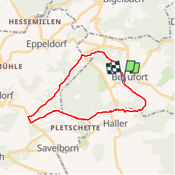
Trail Walking of 12.5 km to be discovered at Unknown, Canton Echternach, Beaufort. This trail is proposed by GerardBouche.
Description
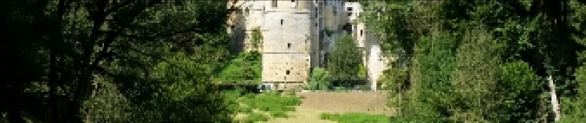
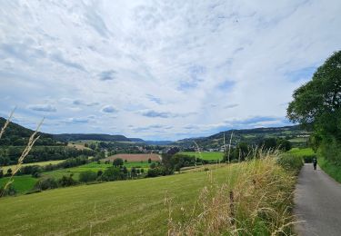
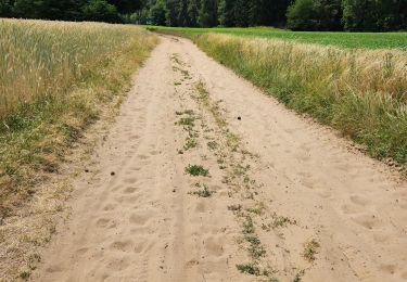
Belle randonnée forestière depuis le P du Château de Beaufort d'abord par un petit sentier ombragé puis un peu de bitume. Le retour, combiné avec un W 5 de toute beauté par les formations de grès dans la vallée de l'Haupeschbach ... un paradis pour le randonneur !
Positioning
Country:
Luxembourg
Region :
Unknown
Department/Province :
Canton Echternach
Municipality :
Beaufort
Location:
Unknown
Start:(Dec)
Start:(UTM)
304895 ; 5523615 (32U) N.
Comments
Trails nearby
![Trail Walking Waldbillig - 2024-08-10_15h10m00_Sentier_local_-_W4 - Photo](https://media.geolcdn.com/t/375/260/d315698e-faa8-4cbd-932a-8a7221249730.jpg&format=jpg&maxdim=2)
![Walking Walking](https://static1.geolcdn.com/sitytour/trail-icons/101.png)
2024-08-10_15h10m00_Sentier_local_-_W4
Walking
Medium
(1)
Waldbillig,
Unknown,
Canton Echternach,
Luxembourg
![](/images/other/stat-length.png)
6.2 km | 7.8 km-effort
1h 45min
![](https://static1.geolcdn.com/siteimages/upload/files/16400158638029165_repeat_loop_refresh_sync_direction_icon.png)
Yes
![Trail Walking Berdorf - Berdorf - B2 - Müllerthal - Photo](https://media.geolcdn.com/t/375/260/517daf86-eb8b-412e-9a7e-d0a346807e81.jpg&format=jpg&maxdim=2)
![Walking Walking](https://static1.geolcdn.com/sitytour/trail-icons/101.png)
Berdorf - B2 - Müllerthal
Walking
Medium
(2)
Berdorf,
Unknown,
Canton Echternach,
Luxembourg
![](/images/other/stat-length.png)
6.7 km | 8.5 km-effort
1h 35min
![](https://static1.geolcdn.com/siteimages/upload/files/16400158638029165_repeat_loop_refresh_sync_direction_icon.png)
Yes
![Trail Walking Bettendorf - 2022-09-22_13h06m23_t62862476_eislek pad bettendorf - Photo](https://media.geolcdn.com/t/375/260/ba8011a2-7a43-4fed-95b2-07279fc87c67.jpg&format=jpg&maxdim=2)
![Walking Walking](https://static1.geolcdn.com/sitytour/trail-icons/101.png)
2022-09-22_13h06m23_t62862476_eislek pad bettendorf
Walking
Medium
(1)
Bettendorf,
Unknown,
Canton Diekirch,
Luxembourg
![](/images/other/stat-length.png)
12.9 km | 17.1 km-effort
3h 52min
![](https://static1.geolcdn.com/siteimages/upload/files/16400158638029165_repeat_loop_refresh_sync_direction_icon.png)
Yes
![Trail Walking Beaufort - 2021-07-05_20h10m00_gpx-file (1) - Photo](https://media.geolcdn.com/t/375/260/9b40ebf8-55f0-408d-8504-76ef1490c879.jpg&format=jpg&maxdim=2)
![Walking Walking](https://static1.geolcdn.com/sitytour/trail-icons/101.png)
2021-07-05_20h10m00_gpx-file (1)
Walking
Medium
(1)
Beaufort,
Unknown,
Canton Echternach,
Luxembourg
![](/images/other/stat-length.png)
10.6 km | 13.6 km-effort
3h 5min
![](https://static1.geolcdn.com/siteimages/upload/files/16400158638029165_repeat_loop_refresh_sync_direction_icon.png)
Yes
![Trail Walking Beaufort - 2021-07-05_19h47m20_gpx-file - Photo](https://media.geolcdn.com/t/375/260/a4bdebcf-ad8b-4513-aa3a-a5e6b3892888.jpg&format=jpg&maxdim=2)
![Walking Walking](https://static1.geolcdn.com/sitytour/trail-icons/101.png)
2021-07-05_19h47m20_gpx-file
Walking
Medium
(2)
Beaufort,
Unknown,
Canton Echternach,
Luxembourg
![](/images/other/stat-length.png)
12.9 km | 16.8 km-effort
3h 48min
![](https://static1.geolcdn.com/siteimages/upload/files/16400158638029165_repeat_loop_refresh_sync_direction_icon.png)
Yes
![Trail Walking Waldbillig - Mullerthal randonnée magnifique - Photo](https://media.geolcdn.com/t/375/260/3f58fb00-23e0-4e5f-be44-94a05c44c601.jpg&format=jpg&maxdim=2)
![Walking Walking](https://static1.geolcdn.com/sitytour/trail-icons/101.png)
Mullerthal randonnée magnifique
Walking
Difficult
(4)
Waldbillig,
Unknown,
Canton Echternach,
Luxembourg
![](/images/other/stat-length.png)
9.3 km | 12.9 km-effort
4h 21min
![](https://static1.geolcdn.com/siteimages/upload/files/16400158638029165_repeat_loop_refresh_sync_direction_icon.png)
Yes
![Trail Walking Reisdorf - R2 - Photo](https://media.geolcdn.com/t/375/260/7552b052-379e-4866-b586-5f7ed6a8b465.jpeg&format=jpg&maxdim=2)
![Walking Walking](https://static1.geolcdn.com/sitytour/trail-icons/101.png)
![Trail Walking Berdorf - 2023-06-03_18h17m36_Sentier_local_-_B8 - Photo](https://media.geolcdn.com/t/375/260/7a8870ac-d558-4a39-b7c2-bdeb26e936c0.jpg&format=jpg&maxdim=2)
![Walking Walking](https://static1.geolcdn.com/sitytour/trail-icons/101.png)
2023-06-03_18h17m36_Sentier_local_-_B8
Walking
Medium
(2)
Berdorf,
Unknown,
Canton Echternach,
Luxembourg
![](/images/other/stat-length.png)
11.7 km | 15 km-effort
3h 24min
![](https://static1.geolcdn.com/siteimages/upload/files/16400158638029165_repeat_loop_refresh_sync_direction_icon.png)
Yes
![Trail Walking Waldbillig - MÜLLERTHAL (Cascades) - Photo](https://media.geolcdn.com/t/375/260/ext.jpg?maxdim=2&url=https%3A%2F%2Fservices.sitytrail.com%2FGeolivesWS%2FDownloadMedia.ashx%3FTrailID%3D815203%26Media%3Dfix__20170822135510.jpg)
![Walking Walking](https://static1.geolcdn.com/sitytour/trail-icons/101.png)
MÜLLERTHAL (Cascades)
Walking
Medium
(1)
Waldbillig,
Unknown,
Canton Echternach,
Luxembourg
![](/images/other/stat-length.png)
10.2 km | 13.7 km-effort
3h 1min
![](https://static1.geolcdn.com/siteimages/upload/files/16400158638029165_repeat_loop_refresh_sync_direction_icon.png)
Yes