![](/images/other/stat-length.png)
![Trail Walking Lannilis - Tour de la presqu’île de Sainte Marguerite - Photo](https://media.geolcdn.com/t/1900/400/ext.pjpeg?maxdim=2&url=https%3A%2F%2Fstatic1.geolcdn.com%2Fsiteimages%2Fupload%2Ffiles%2F1553511878bg_sport_marche.png)
Tour de la presqu’île de Sainte Marguerite
Balades en Finistère
Promenez-vous au bout du monde !
![Length](/images/other/stat-length.png)
![Max alt](https://static1.geolcdn.com/siteimages/upload/files/1508320355ic_sort_altitude_max_24dp.png)
![Uphill gradient](https://static1.geolcdn.com/siteimages/upload/files/1508320355ic_sort_den_pos_24dp.png)
![Km-Effort](/images/other/stat-length.png)
![Min alt](https://static1.geolcdn.com/siteimages/upload/files/1508320355ic_sort_altitude_min_24dp.png)
![Downhill gradient](https://static1.geolcdn.com/siteimages/upload/files/1508320355ic_sort_den_neg_24dp.png)
![Boucle](https://static1.geolcdn.com/siteimages/upload/files/16400158638029165_repeat_loop_refresh_sync_direction_icon.png)
![Walking](https://static1.geolcdn.com/sitytour/trail-icons/101.png)
8h03
Difficulty : Medium
![Scan this QR Code to open this trail in the SityTrail application](https://capi.geolives.com/qq0zvz2zws4bq2lad0pu/sitytour/trails/811583/qr.png?size=200)
FREE GPS app for hiking
About
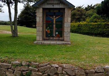
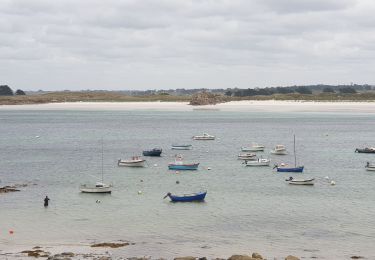
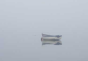
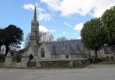
Trail Walking of 32 km to be discovered at Brittany, Finistère, Lannilis. This trail is proposed by Balades en Finistère.
Description
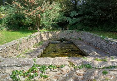
Le grand tour de la presqu'ile de Sainte Marguerite. Au départ de Lannilis, on longe la rive nord de l'aber Benoit pour retrouver la mer d'Iroise puis la rive sud de l'aber Wrac'h. Attention, à marée haute de coefficient supérieur à 80, certains passages côtiers sont impraticables.
Positioning
Comments
Trails nearby
![Trail Walking Plouvien - Autour de Plouvien - Photo](https://media.geolcdn.com/t/375/260/ext.jpg?maxdim=2&url=https%3A%2F%2Fservices.sitytrail.com%2FGeolivesWS%2FDownloadMedia.ashx%3FTrailID%3D109300%26Media%3D3529_1.jpg)
![Walking Walking](https://static1.geolcdn.com/sitytour/trail-icons/101.png)
Walking
![](/images/other/stat-length.png)
![](https://static1.geolcdn.com/siteimages/upload/files/16400158638029165_repeat_loop_refresh_sync_direction_icon.png)
![Trail Walking Landéda - 06.09.24 Landéda -- Treglonou (Touzilit) - Photo](https://media.geolcdn.com/t/375/260/ec11815a-c8fb-467a-9689-1ba3e69aa97c.jpg&format=jpg&maxdim=2)
![Walking Walking](https://static1.geolcdn.com/sitytour/trail-icons/101.png)
Walking
![](/images/other/stat-length.png)
![](https://static1.geolcdn.com/siteimages/upload/files/16400158638029165_repeat_loop_refresh_sync_direction_icon.png)
![Trail Walking Landéda - AberWrac'h - Traon Bizin - 4km - Photo](https://media.geolcdn.com/t/375/260/ext.jpg?maxdim=2&url=https%3A%2F%2Fstatic1.geolcdn.com%2Fsiteimages%2Fupload%2Ffiles%2F1553511878bg_sport_marche.png)
![Walking Walking](https://static1.geolcdn.com/sitytour/trail-icons/101.png)
Walking
![](/images/other/stat-length.png)
![](https://static1.geolcdn.com/siteimages/upload/files/16400158638029165_repeat_loop_refresh_sync_direction_icon.png)
![Trail Walking Landéda - Aberwac’h la dune (boucle) - Photo](https://media.geolcdn.com/t/375/260/e7189307-e1c4-4d36-a21c-92827b960ec1.jpg&format=jpg&maxdim=2)
![Walking Walking](https://static1.geolcdn.com/sitytour/trail-icons/101.png)
Walking
![](/images/other/stat-length.png)
![](https://static1.geolcdn.com/siteimages/upload/files/16400158638029165_repeat_loop_refresh_sync_direction_icon.png)
![Trail Walking Tréglonou - 07.09.23 Trouzilit -- Ploudalmézeau - Photo](https://media.geolcdn.com/t/375/260/4d914aa5-6c40-441a-82d6-52fface3f0bb.jpg&format=jpg&maxdim=2)
![Walking Walking](https://static1.geolcdn.com/sitytour/trail-icons/101.png)
Walking
![](/images/other/stat-length.png)
![](https://static1.geolcdn.com/siteimages/upload/files/16400158638029165_repeat_loop_refresh_sync_direction_icon.png)
![Trail Nordic walking Landéda - Abers vrac Aber Benoît - Photo](https://media.geolcdn.com/t/375/260/4710018b-ab0b-4599-9439-cb1eef86434c.jpg&format=jpg&maxdim=2)
![Nordic walking Nordic walking](https://static1.geolcdn.com/sitytour/trail-icons/102.png)
Nordic walking
![](/images/other/stat-length.png)
![](https://static1.geolcdn.com/siteimages/upload/files/16400158638029165_repeat_loop_refresh_sync_direction_icon.png)
![Trail Walking Tréglonou - Tréglonou - Portsall - Photo](https://media.geolcdn.com/t/375/260/c7d22bff-e37f-446d-a165-127937e8fd08.jpg&format=jpg&maxdim=2)
![Walking Walking](https://static1.geolcdn.com/sitytour/trail-icons/101.png)
Walking
![](/images/other/stat-length.png)
![](https://static1.geolcdn.com/siteimages/upload/files/16400158638029165_repeat_loop_refresh_sync_direction_icon.png)
![Trail Walking Landéda - Aber Wrac'h - Photo](https://media.geolcdn.com/t/375/260/7b637bde-55c1-41b8-9681-f16bd1ae981d.jpg&format=jpg&maxdim=2)
![Walking Walking](https://static1.geolcdn.com/sitytour/trail-icons/101.png)
![Trail On foot Plouvien - Rand'Abers 11 - Photo](https://media.geolcdn.com/t/375/260/00254f06-e1aa-4530-abb1-23bfa4f699b4.jpeg&format=jpg&maxdim=2)
![On foot On foot](https://static1.geolcdn.com/sitytour/trail-icons/100.png)
On foot
![](/images/other/stat-length.png)
![](https://static1.geolcdn.com/siteimages/upload/files/16400158638029165_repeat_loop_refresh_sync_direction_icon.png)