![](/images/other/stat-length.png)
![Trail Cycle Évreux - Cathédrale, St Michel, Gauville, voie verte. - Photo](https://media.geolcdn.com/t/1900/400/ext.pjpeg?maxdim=2&url=https%3A%2F%2Fstatic1.geolcdn.com%2Fsiteimages%2Fupload%2Ffiles%2F1524743154velo.jpg)
Cathédrale, St Michel, Gauville, voie verte.
librefredy
User
![Length](/images/other/stat-length.png)
Length
16.8 km
![Max alt](https://static1.geolcdn.com/siteimages/upload/files/1508320355ic_sort_altitude_max_24dp.png)
Max alt
143 m
![Uphill gradient](https://static1.geolcdn.com/siteimages/upload/files/1508320355ic_sort_den_pos_24dp.png)
Uphill gradient
170 m
![Km-Effort](/images/other/stat-length.png)
Km-Effort
19.1 km
![Min alt](https://static1.geolcdn.com/siteimages/upload/files/1508320355ic_sort_altitude_min_24dp.png)
Min alt
63 m
![Downhill gradient](https://static1.geolcdn.com/siteimages/upload/files/1508320355ic_sort_den_neg_24dp.png)
Downhill gradient
169 m
![Boucle](https://static1.geolcdn.com/siteimages/upload/files/16400158638029165_repeat_loop_refresh_sync_direction_icon.png)
Boucle
Yes
Creation date :
2017-08-16 00:00:00.0
Updated on :
2017-08-16 00:00:00.0
![Cycle](https://static1.geolcdn.com/sitytour/trail-icons/200.png)
1h06
Difficulty : Medium
![Scan this QR Code to open this trail in the SityTrail application](https://capi.geolives.com/qq0zvz2zws4bq2lad0pu/sitytour/trails/811080/qr.png?size=200)
FREE GPS app for hiking
About
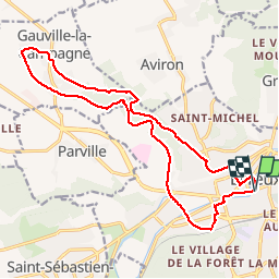
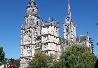
Trail Cycle of 16.8 km to be discovered at Normandy, Eure, Évreux. This trail is proposed by librefredy.
Description
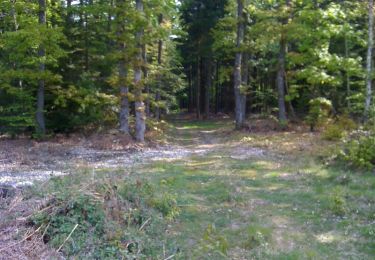
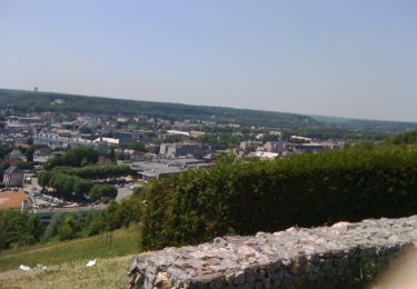
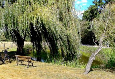
Au départ de la cathédrale d'Evreux, on grimpe la côte Henri Monduit vers St Michel. A travers bois et champs, on rejoint Gauville la Campagne. Retour par la voie verte.
Positioning
Country:
France
Region :
Normandy
Department/Province :
Eure
Municipality :
Évreux
Location:
Unknown
Start:(Dec)
Start:(UTM)
364818 ; 5431824 (31U) N.
Comments
Trails nearby
![Trail Mountain bike Arnières-sur-Iton - La balade des copains - Arnieres sur Iton - Photo](https://media.geolcdn.com/t/375/260/ext.jpg?maxdim=2&url=https%3A%2F%2Fservices.sitytrail.com%2FGeolivesWS%2FDownloadMedia.ashx%3FTrailID%3D103963%26Media%3D6851_2.jpg)
![Mountain bike Mountain bike](https://static1.geolcdn.com/sitytour/trail-icons/202.png)
La balade des copains - Arnieres sur Iton
Mountain bike
Difficult
(1)
Arnières-sur-Iton,
Normandy,
Eure,
France
![](/images/other/stat-length.png)
34 km | 41 km-effort
2h 19min
![](https://static1.geolcdn.com/siteimages/upload/files/16400158638029165_repeat_loop_refresh_sync_direction_icon.png)
Yes
![Trail Walking Huest - les trois etangs - Photo](https://media.geolcdn.com/t/375/260/ext.jpg?maxdim=2&url=https%3A%2F%2Fstatic1.geolcdn.com%2Fsiteimages%2Fupload%2Ffiles%2F1553511878bg_sport_marche.png)
![Walking Walking](https://static1.geolcdn.com/sitytour/trail-icons/101.png)
les trois etangs
Walking
Very difficult
(1)
Huest,
Normandy,
Eure,
France
![](/images/other/stat-length.png)
25 km | 28 km-effort
6h 25min
![](https://static1.geolcdn.com/siteimages/upload/files/16400158638029165_repeat_loop_refresh_sync_direction_icon.png)
Yes
![Trail Walking Évreux - Évreux PR1 - Photo](https://media.geolcdn.com/t/375/260/264dffb8-1158-4c64-8faa-da99acb4f66e.jpg&format=jpg&maxdim=2)
![Walking Walking](https://static1.geolcdn.com/sitytour/trail-icons/101.png)
![Trail Walking Gravigny - La Maladrerie (Gravigny) - Photo](https://media.geolcdn.com/t/375/260/ext.jpg?maxdim=2&url=https%3A%2F%2Fservices.sitytrail.com%2FGeolivesWS%2FDownloadMedia.ashx%3FTrailID%3D325516%26Media%3Dbb305735-0b2f-4c22-a378-39236568607d.jpg)
![Walking Walking](https://static1.geolcdn.com/sitytour/trail-icons/101.png)
La Maladrerie (Gravigny)
Walking
Easy
Gravigny,
Normandy,
Eure,
France
![](/images/other/stat-length.png)
5.5 km | 6.5 km-effort
1h 30min
![](https://static1.geolcdn.com/siteimages/upload/files/16400158638029165_repeat_loop_refresh_sync_direction_icon.png)
Yes
![Trail Mountain bike Gravigny - Balade dans la vallée d'iton - Photo](https://media.geolcdn.com/t/375/260/ext.jpg?maxdim=2&url=https%3A%2F%2Fservices.sitytrail.com%2FGeolivesWS%2FDownloadMedia.ashx%3FTrailID%3D105043%26Media%3D8613_5.jpg)
![Mountain bike Mountain bike](https://static1.geolcdn.com/sitytour/trail-icons/202.png)
Balade dans la vallée d'iton
Mountain bike
Very difficult
Gravigny,
Normandy,
Eure,
France
![](/images/other/stat-length.png)
63 km | 80 km-effort
3h 15min
![](https://static1.geolcdn.com/siteimages/upload/files/16400158638029165_repeat_loop_refresh_sync_direction_icon.png)
Yes
![Trail Mountain bike Gravigny - Chemins et collines entre les deux vallées - Gravigny - Photo](https://media.geolcdn.com/t/375/260/ext.jpg?maxdim=2&url=https%3A%2F%2Fservices.sitytrail.com%2FGeolivesWS%2FDownloadMedia.ashx%3FTrailID%3D103553%26Media%3D5800_4.jpg)
![Mountain bike Mountain bike](https://static1.geolcdn.com/sitytour/trail-icons/202.png)
Chemins et collines entre les deux vallées - Gravigny
Mountain bike
Difficult
Gravigny,
Normandy,
Eure,
France
![](/images/other/stat-length.png)
49 km | 58 km-effort
2h 40min
![](https://static1.geolcdn.com/siteimages/upload/files/16400158638029165_repeat_loop_refresh_sync_direction_icon.png)
Yes
![Trail Mountain bike Gravigny - Forêts et plaines autour de Gravigny - Photo](https://media.geolcdn.com/t/375/260/ext.jpg?maxdim=2&url=https%3A%2F%2Fservices.sitytrail.com%2FGeolivesWS%2FDownloadMedia.ashx%3FTrailID%3D103540%26Media%3D5757_6.jpg)
![Mountain bike Mountain bike](https://static1.geolcdn.com/sitytour/trail-icons/202.png)
Forêts et plaines autour de Gravigny
Mountain bike
Difficult
Gravigny,
Normandy,
Eure,
France
![](/images/other/stat-length.png)
42 km | 48 km-effort
2h 30min
![](https://static1.geolcdn.com/siteimages/upload/files/16400158638029165_repeat_loop_refresh_sync_direction_icon.png)
Yes
![Trail Cycle Évreux - Tourneville Autrebosc Aviron - Photo](https://media.geolcdn.com/t/375/260/ext.jpg?maxdim=2&url=https%3A%2F%2Fservices.sitytrail.com%2FGeolivesWS%2FDownloadMedia.ashx%3FTrailID%3D624042%26Media%3D7f1f9579-07fe-4acf-9a3e-3c60db9f6a3e.jpg)
![Cycle Cycle](https://static1.geolcdn.com/sitytour/trail-icons/200.png)
Tourneville Autrebosc Aviron
Cycle
Easy
Évreux,
Normandy,
Eure,
France
![](/images/other/stat-length.png)
23 km | 26 km-effort
1h 40min
![](https://static1.geolcdn.com/siteimages/upload/files/16400158638029165_repeat_loop_refresh_sync_direction_icon.png)
Yes
![Trail Cycle Évreux - gauville et forêt dEvreux - Photo](https://media.geolcdn.com/t/375/260/ext.jpg?maxdim=2&url=https%3A%2F%2Fservices.sitytrail.com%2FGeolivesWS%2FDownloadMedia.ashx%3FTrailID%3D619069%26Media%3D7d01f539-d3c6-4ebe-9e46-ade9ce394467.jpg)
![Cycle Cycle](https://static1.geolcdn.com/sitytour/trail-icons/200.png)
gauville et forêt dEvreux
Cycle
Very easy
Évreux,
Normandy,
Eure,
France
![](/images/other/stat-length.png)
22 km | 25 km-effort
1h 45min
![](https://static1.geolcdn.com/siteimages/upload/files/16400158638029165_repeat_loop_refresh_sync_direction_icon.png)
Yes