![](/images/other/stat-length.png)
![Trail Other activity Saint-Pierre-lès-Nemours - PREPA 170821-NemoursGréau-Sarrasin - Photo](https://media.geolcdn.com/t/1900/400/ext.pjpeg?maxdim=2&url=https%3A%2F%2Fservices.sitytrail.com%2FGeolivesWS%2FDownloadMedia.ashx%3FTrailID%3D808855%26Media%3Dfix__20170821133250.jpg)
PREPA 170821-NemoursGréau-Sarrasin
randodan
User
![Length](/images/other/stat-length.png)
Length
11.2 km
![Max alt](https://static1.geolcdn.com/siteimages/upload/files/1508320355ic_sort_altitude_max_24dp.png)
Max alt
116 m
![Uphill gradient](https://static1.geolcdn.com/siteimages/upload/files/1508320355ic_sort_den_pos_24dp.png)
Uphill gradient
228 m
![Km-Effort](/images/other/stat-length.png)
Km-Effort
14.3 km
![Min alt](https://static1.geolcdn.com/siteimages/upload/files/1508320355ic_sort_altitude_min_24dp.png)
Min alt
73 m
![Downhill gradient](https://static1.geolcdn.com/siteimages/upload/files/1508320355ic_sort_den_neg_24dp.png)
Downhill gradient
228 m
![Boucle](https://static1.geolcdn.com/siteimages/upload/files/16400158638029165_repeat_loop_refresh_sync_direction_icon.png)
Boucle
Yes
Creation date :
2018-04-18 00:00:00.0
Updated on :
2018-04-18 00:00:00.0
![Other activity](https://static1.geolcdn.com/sitytour/trail-icons/900.png)
2h41
Difficulty : Easy
![Scan this QR Code to open this trail in the SityTrail application](https://capi.geolives.com/qq0zvz2zws4bq2lad0pu/sitytour/trails/808855/qr.png?size=200)
FREE GPS app for hiking
About
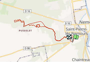
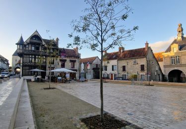
Trail Other activity of 11.2 km to be discovered at Ile-de-France, Seine-et-Marne, Saint-Pierre-lès-Nemours. This trail is proposed by randodan.
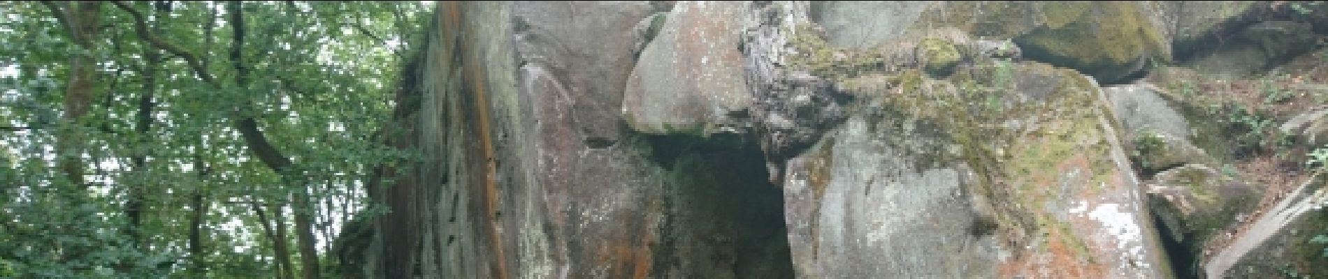
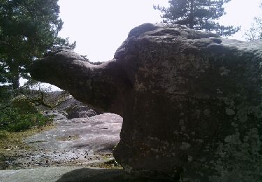
Description
d'après<br>
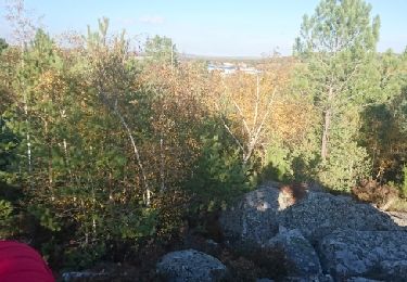
"Rochers Gréau et Puiselet"<br>
de philippepauleau
FAUDRA NOTER CE GUIDE !!!!
correction 1 : 23-08-17 (juste après rando du 21-08.<br>
correction 2 : 05-03-18 : reprise (modif) pour M&R du 27-03-18<br>
Positioning
Country:
France
Region :
Ile-de-France
Department/Province :
Seine-et-Marne
Municipality :
Saint-Pierre-lès-Nemours
Location:
Unknown
Start:(Dec)
Start:(UTM)
476575 ; 5345087 (31U) N.
Comments
Trails nearby
![Trail Walking Saint-Pierre-lès-Nemours - Rochers Gréau et Puiselet - Photo](https://media.geolcdn.com/t/375/260/ext.jpg?maxdim=2&url=https%3A%2F%2Fservices.sitytrail.com%2FGeolivesWS%2FDownloadMedia.ashx%3FTrailID%3D262438%26Media%3Dfix__20140401143751.jpg)
![Walking Walking](https://static1.geolcdn.com/sitytour/trail-icons/101.png)
Rochers Gréau et Puiselet
Walking
Medium
(1)
Saint-Pierre-lès-Nemours,
Ile-de-France,
Seine-et-Marne,
France
![](/images/other/stat-length.png)
10.8 km | 13.2 km-effort
2h 41min
![](https://static1.geolcdn.com/siteimages/upload/files/16400158638029165_repeat_loop_refresh_sync_direction_icon.png)
Yes
![Trail On foot Saint-Pierre-lès-Nemours - Le Mont Blanc de la Commanderie - Photo](https://media.geolcdn.com/t/375/260/44b5b534-5554-427f-a1ac-872604acda7f.jpg&format=jpg&maxdim=2)
![On foot On foot](https://static1.geolcdn.com/sitytour/trail-icons/100.png)
Le Mont Blanc de la Commanderie
On foot
Medium
Saint-Pierre-lès-Nemours,
Ile-de-France,
Seine-et-Marne,
France
![](/images/other/stat-length.png)
26 km | 30 km-effort
6h 50min
![](https://static1.geolcdn.com/siteimages/upload/files/16400158638029165_repeat_loop_refresh_sync_direction_icon.png)
No
![Trail Walking Saint-Pierre-lès-Nemours - De Nemours à Moret + halte resto Bourron Marlotte - Photo](https://media.geolcdn.com/t/375/260/270e70be-f83f-4bbe-bff6-c3c17d849c80.jpg&format=jpg&maxdim=2)
![Walking Walking](https://static1.geolcdn.com/sitytour/trail-icons/101.png)
De Nemours à Moret + halte resto Bourron Marlotte
Walking
Very easy
Saint-Pierre-lès-Nemours,
Ile-de-France,
Seine-et-Marne,
France
![](/images/other/stat-length.png)
33 km | 36 km-effort
6h 14min
![](https://static1.geolcdn.com/siteimages/upload/files/16400158638029165_repeat_loop_refresh_sync_direction_icon.png)
No
![Trail Walking Nemours - Forêt de Nemours Parking des crottes du loup route de Nemours à Poligny - Photo](https://media.geolcdn.com/t/375/260/ext.jpg?maxdim=2&url=https%3A%2F%2Fstatic1.geolcdn.com%2Fsiteimages%2Fupload%2Ffiles%2F1553511878bg_sport_marche.png)
![Walking Walking](https://static1.geolcdn.com/sitytour/trail-icons/101.png)
Forêt de Nemours Parking des crottes du loup route de Nemours à Poligny
Walking
Very difficult
(2)
Nemours,
Ile-de-France,
Seine-et-Marne,
France
![](/images/other/stat-length.png)
25 km | 30 km-effort
6h 50min
![](https://static1.geolcdn.com/siteimages/upload/files/16400158638029165_repeat_loop_refresh_sync_direction_icon.png)
Yes
![Trail Walking Poligny - polynoise 2017 - Photo](https://media.geolcdn.com/t/375/260/ext.jpg?maxdim=2&url=https%3A%2F%2Fstatic1.geolcdn.com%2Fsiteimages%2Fupload%2Ffiles%2F1553511878bg_sport_marche.png)
![Walking Walking](https://static1.geolcdn.com/sitytour/trail-icons/101.png)
polynoise 2017
Walking
Medium
(2)
Poligny,
Ile-de-France,
Seine-et-Marne,
France
![](/images/other/stat-length.png)
19.3 km | 23 km-effort
3h 44min
![](https://static1.geolcdn.com/siteimages/upload/files/16400158638029165_repeat_loop_refresh_sync_direction_icon.png)
Yes
![Trail Mountain bike Poligny - Poligny 55km - Photo](https://media.geolcdn.com/t/375/260/ext.jpg?maxdim=2&url=https%3A%2F%2Fstatic1.geolcdn.com%2Fsiteimages%2Fupload%2Ffiles%2F1524743154velo.jpg)
![Mountain bike Mountain bike](https://static1.geolcdn.com/sitytour/trail-icons/202.png)
Poligny 55km
Mountain bike
Difficult
(1)
Poligny,
Ile-de-France,
Seine-et-Marne,
France
![](/images/other/stat-length.png)
55 km | 64 km-effort
4h 9min
![](https://static1.geolcdn.com/siteimages/upload/files/16400158638029165_repeat_loop_refresh_sync_direction_icon.png)
No
![Trail Walking Saint-Pierre-lès-Nemours - Saint Pierre les Nemours - Photo](https://media.geolcdn.com/t/375/260/8cd46912-93f3-4274-87fe-49f7c41f32c6.jpg&format=jpg&maxdim=2)
![Walking Walking](https://static1.geolcdn.com/sitytour/trail-icons/101.png)
Saint Pierre les Nemours
Walking
Medium
Saint-Pierre-lès-Nemours,
Ile-de-France,
Seine-et-Marne,
France
![](/images/other/stat-length.png)
6.5 km | 7.9 km-effort
1h 39min
![](https://static1.geolcdn.com/siteimages/upload/files/16400158638029165_repeat_loop_refresh_sync_direction_icon.png)
No
![Trail Other activity Nemours - 181109 SVG - Photo](https://media.geolcdn.com/t/375/260/ext.jpg?maxdim=2&url=https%3A%2F%2Fservices.sitytrail.com%2FGeolivesWS%2FDownloadMedia.ashx%3FTrailID%3D1078205%26Media%3Dfix__20181109144100.jpg)
![Other activity Other activity](https://static1.geolcdn.com/sitytour/trail-icons/900.png)
181109 SVG
Other activity
Very easy
Nemours,
Ile-de-France,
Seine-et-Marne,
France
![](/images/other/stat-length.png)
12.7 km | 14.7 km-effort
5h 22min
![](https://static1.geolcdn.com/siteimages/upload/files/16400158638029165_repeat_loop_refresh_sync_direction_icon.png)
Yes
![Trail Other activity Nemours - 181109 EnCours - Photo](https://media.geolcdn.com/t/375/260/ext.jpg?maxdim=2&url=https%3A%2F%2Fservices.sitytrail.com%2FGeolivesWS%2FDownloadMedia.ashx%3FTrailID%3D1078201%26Media%3Dfix__20181109144100.jpg)
![Other activity Other activity](https://static1.geolcdn.com/sitytour/trail-icons/900.png)
181109 EnCours
Other activity
Very easy
Nemours,
Ile-de-France,
Seine-et-Marne,
France
![](/images/other/stat-length.png)
12.7 km | 14.7 km-effort
5h 22min
![](https://static1.geolcdn.com/siteimages/upload/files/16400158638029165_repeat_loop_refresh_sync_direction_icon.png)
Yes