Trail Walking Beaumont-du-Lac - Vasivière en Limousin - Photo
 fanthou
fanthou

User

© OpenStreetMap contributors
Length
Length
10 km
Max alt
Max alt
745 m
Uphill gradient
Uphill gradient
227 m
Km-Effort
Km-Effort  
13 km
Min alt
Min alt
603 m
Downhill gradient
Downhill gradient
222 m
Boucle
Boucle
Yes
Creation date :
2018-04-16 20:27:47.467
Updated on :
2018-04-16 20:27:47.467

(0 Reviews)

Walking
Walking
3h30
Difficulty : Medium

Scan this QR Code to open this trail in the SityTrail application

FREE GPS app for hiking

Logo SityTrail SityTrail

IGN / Geographical institutes

Download SityTrail from the App Store Download SityTrail from Google Play

Logo SityTrail SityTrail World

The world is yours!

Download SityTrail from the App Store Download SityTrail from Google Play Download SityTrail on Huawei AppGallery

About

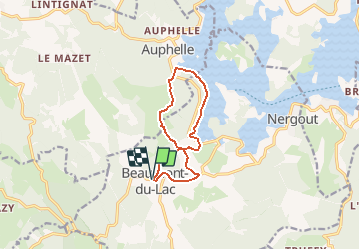
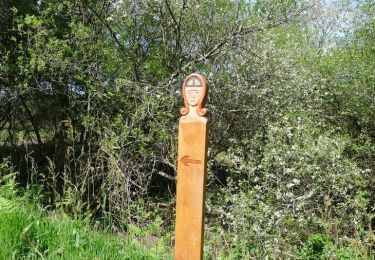
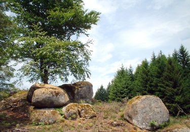
Trail Walking of 10 km to be discovered at New Aquitaine, Haute-Vienne, Beaumont-du-Lac. This trail is proposed by fanthou.

Description

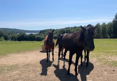
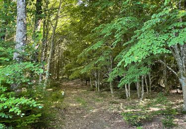
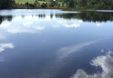
Jolie balade bien ombragée sur les bords du lac et dans la campagne limousine.

Elevation profile

Positioning

Country:
France
Region :
New Aquitaine
Department/Province :
Haute-Vienne
Municipality :
Beaumont-du-Lac
Location:
Unknown
Start:(UTM)
409383 ; 5069290 (31T) N.

Trails nearby

Trail Walking  - Circuit des Tourbières - Photo
Walking
tracegps

Walking

Difficult
(1)
, New Aquitaine, Creuse, France
13 km | 17.5 km-effort
4h 0min
No
Trail Walking Royère-de-Vassivière - variante Chataignoux  - Photo
Walking
JoelHerve

Walking

Easy
(1)
Royère-de-Vassivière, New Aquitaine, Creuse, France
6.9 km | 9.2 km-effort
2h 22min
Yes
Trail Walking Beaumont-du-Lac - Tour de l’ Île de Vassivière et presqu’île  - Photo
Walking
000843.e2af63ba812d4dc4a845c93df243350a.2104

Walking

Easy
Beaumont-du-Lac, New Aquitaine, Haute-Vienne, France
7.7 km | 9.6 km-effort
1h 31min
Yes
Trail Walking Peyrat-le-Château - lac de vassivière - Photo
Walking
christel28

Walking

Very difficult
(2)
Peyrat-le-Château, New Aquitaine, Haute-Vienne, France
38 km | 49 km-effort
10h 25min
Yes
Trail Walking Royère-de-Vassivière - digue d'Auphelle (Vassiviere) - Photo
Walking
zoe.vienne

Walking

Medium
Royère-de-Vassivière, New Aquitaine, Creuse, France
15 km | 19.3 km-effort
3h 45min
Yes
Trail Mountain bike Royère-de-Vassivière - Lac de Vassivière - Vauveix - Photo
Mountain bike
tracegps

Mountain bike

Difficult
Royère-de-Vassivière, New Aquitaine, Creuse, France
35 km | 44 km-effort
3h 30min
No
Trail Equestrian  - Circuit des Tourbières - Photo
Equestrian
tracegps

Equestrian

Difficult
(1)
, New Aquitaine, Creuse, France
13 km | 17.5 km-effort
3h 0min
No
Trail Mountain bike  - Circuit des Tourbières - Photo
Mountain bike
tracegps

Mountain bike

Difficult
, New Aquitaine, Creuse, France
13 km | 17.5 km-effort
1h 45min
No
Trail Walking Beaumont-du-Lac - Ile de Vassiviere - Photo
Walking
lfbocquet

Walking

Very easy
(1)
Beaumont-du-Lac, New Aquitaine, Haute-Vienne, France
9 km | 11.6 km-effort
2h 13min
Yes


Close
My subscriptions