


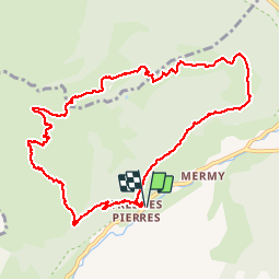

16.5 km | 30 km-effort


User


FREE GPS app for hiking
 SityTrail
IGN / Geographical institutes
SityTrail World
The world is yours!
Trail Walking of 10.8 km to be discovered at Auvergne-Rhône-Alpes, Upper Savoy, Châtel. This trail is proposed by jeffboss.
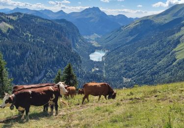
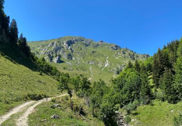
assez technique les 600 premiers mètres d'ascension sont "hard" sur le dénivelé . prévoir min 2litres d'eau par personne. super vue. bergerie au sommet avec eau potable (l'été )

Walking

Walking

Walking

Snowshoes

Snowshoes
Walking
Walking

Snowshoes

Walking