![](/images/other/stat-length.png)
![Trail Walking Herzele - Wijnhuize-Geraardsbergen en terug - Photo](https://media.geolcdn.com/t/1900/400/ext.pjpeg?maxdim=2&url=https%3A%2F%2Fservices.sitytrail.com%2FGeolivesWS%2FDownloadMedia.ashx%3FTrailID%3D795134%26Media%3D20170723155145.jpg)
Wijnhuize-Geraardsbergen en terug
mavbelgium
User
![Length](/images/other/stat-length.png)
Length
30 km
![Max alt](https://static1.geolcdn.com/siteimages/upload/files/1508320355ic_sort_altitude_max_24dp.png)
Max alt
93 m
![Uphill gradient](https://static1.geolcdn.com/siteimages/upload/files/1508320355ic_sort_den_pos_24dp.png)
Uphill gradient
294 m
![Km-Effort](/images/other/stat-length.png)
Km-Effort
34 km
![Min alt](https://static1.geolcdn.com/siteimages/upload/files/1508320355ic_sort_altitude_min_24dp.png)
Min alt
9 m
![Downhill gradient](https://static1.geolcdn.com/siteimages/upload/files/1508320355ic_sort_den_neg_24dp.png)
Downhill gradient
294 m
![Boucle](https://static1.geolcdn.com/siteimages/upload/files/16400158638029165_repeat_loop_refresh_sync_direction_icon.png)
Boucle
Yes
Creation date :
2017-07-24 00:00:00.0
Updated on :
2017-07-24 00:00:00.0
![Walking](https://static1.geolcdn.com/sitytour/trail-icons/101.png)
5h55
Difficulty : Difficult
![Scan this QR Code to open this trail in the SityTrail application](https://capi.geolives.com/qq0zvz2zws4bq2lad0pu/sitytour/trails/795134/qr.png?size=200)
FREE GPS app for hiking
About
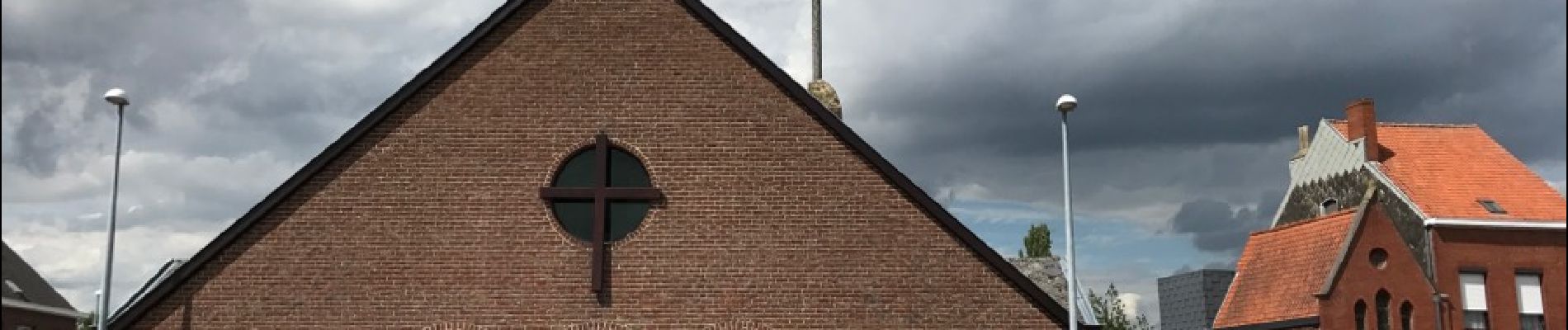
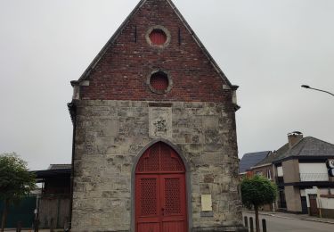
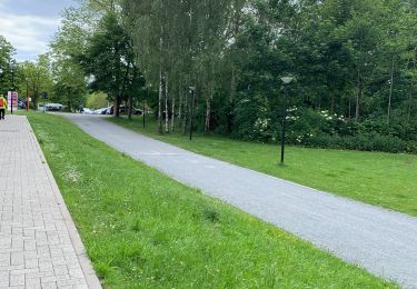
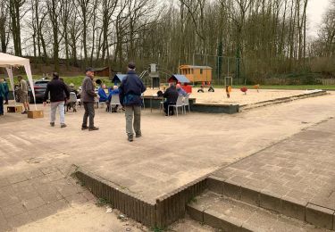
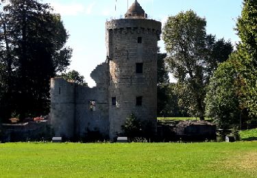
Trail Walking of 30 km to be discovered at Flanders, East Flanders, Herzele. This trail is proposed by mavbelgium.
Description
relatief lange wandeling start in Schipstraat Wijnhuize. Via Dender naar Geraardsbergen en terug langs Lierde naar Wijnhuize. Mix van verharde en onverharde landwegen
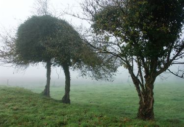
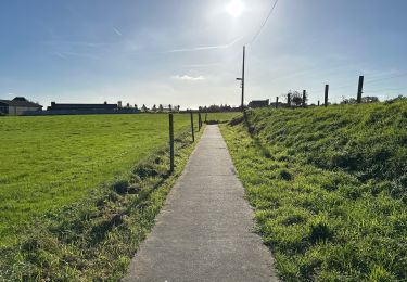
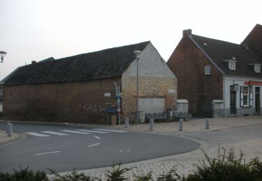
Positioning
Country:
Belgium
Region :
Flanders
Department/Province :
East Flanders
Municipality :
Herzele
Location:
Sint-Lievens-Esse
Start:(Dec)
Start:(UTM)
561002 ; 5633522 (31U) N.
Comments
Trails nearby
![Trail On foot Lierde - Uilenbroekpad - Photo](https://media.geolcdn.com/t/375/260/6bcd9e60-3c42-4545-8512-5c822fad23c2.jpeg&format=jpg&maxdim=2)
![On foot On foot](https://static1.geolcdn.com/sitytour/trail-icons/100.png)
Uilenbroekpad
On foot
Easy
Lierde,
Flanders,
East Flanders,
Belgium
![](/images/other/stat-length.png)
4.7 km | 5.8 km-effort
1h 18min
![](https://static1.geolcdn.com/siteimages/upload/files/16400158638029165_repeat_loop_refresh_sync_direction_icon.png)
Yes
![Trail Walking Herzele - Sint-Antelinks het Duivenbos Herzele - 10 km RT - Photo](https://media.geolcdn.com/t/375/260/ext.jpg?maxdim=2&url=https%3A%2F%2Fstatic1.geolcdn.com%2Fsiteimages%2Fupload%2Ffiles%2F1553511878bg_sport_marche.png)
![Walking Walking](https://static1.geolcdn.com/sitytour/trail-icons/101.png)
Sint-Antelinks het Duivenbos Herzele - 10 km RT
Walking
Very easy
(2)
Herzele,
Flanders,
East Flanders,
Belgium
![](/images/other/stat-length.png)
9.9 km | 11.3 km-effort
Unknown
![](https://static1.geolcdn.com/siteimages/upload/files/16400158638029165_repeat_loop_refresh_sync_direction_icon.png)
Yes
![Trail Walking Lierde - Sint-Maria-Lierde 22,1 km - Photo](https://media.geolcdn.com/t/375/260/a2be152f-8eb2-4f2d-918a-621eed7f210d.jpg&format=jpg&maxdim=2)
![Walking Walking](https://static1.geolcdn.com/sitytour/trail-icons/101.png)
Sint-Maria-Lierde 22,1 km
Walking
Medium
Lierde,
Flanders,
East Flanders,
Belgium
![](/images/other/stat-length.png)
22 km | 26 km-effort
6h 16min
![](https://static1.geolcdn.com/siteimages/upload/files/16400158638029165_repeat_loop_refresh_sync_direction_icon.png)
Yes
![Trail On foot Erpe-Mere - Den Dotter - Photo](https://media.geolcdn.com/t/375/260/9dcf633f-44ef-4719-92df-3cd1acfb1a7b.jpeg&format=jpg&maxdim=2)
![On foot On foot](https://static1.geolcdn.com/sitytour/trail-icons/100.png)
Den Dotter
On foot
Easy
Erpe-Mere,
Flanders,
East Flanders,
Belgium
![](/images/other/stat-length.png)
9.2 km | 10.7 km-effort
2h 25min
![](https://static1.geolcdn.com/siteimages/upload/files/16400158638029165_repeat_loop_refresh_sync_direction_icon.png)
Yes
![Trail Walking Herzele - Herzele - Photo](https://media.geolcdn.com/t/375/260/6ae3ac60-9229-43bb-9d4c-5a98bebc966f.jpg&format=jpg&maxdim=2)
![Walking Walking](https://static1.geolcdn.com/sitytour/trail-icons/101.png)
![Trail Walking Zottegem - WSV - Photo](https://media.geolcdn.com/t/375/260/02d5730a-be80-4dde-a24b-4bde9f8e7542.jpg&format=jpg&maxdim=2)
![Walking Walking](https://static1.geolcdn.com/sitytour/trail-icons/101.png)
![Trail Walking Zottegem - 20220316 WSV Egmont 7 km - Photo](https://media.geolcdn.com/t/375/260/cfd74bbd-61ac-42db-b8bc-7c47c558d7ec.jpg&format=jpg&maxdim=2)
![Walking Walking](https://static1.geolcdn.com/sitytour/trail-icons/101.png)
20220316 WSV Egmont 7 km
Walking
Very easy
Zottegem,
Flanders,
East Flanders,
Belgium
![](/images/other/stat-length.png)
7.7 km | 8.7 km-effort
20h 32min
![](https://static1.geolcdn.com/siteimages/upload/files/16400158638029165_repeat_loop_refresh_sync_direction_icon.png)
No
![Trail On foot Zottegem - Stationswandeling Terhagen - Zoutleeuw - Photo](https://media.geolcdn.com/t/375/260/5166128c-3515-4571-af76-fe9e5848277e.jpg&format=jpg&maxdim=2)
![On foot On foot](https://static1.geolcdn.com/sitytour/trail-icons/100.png)
Stationswandeling Terhagen - Zoutleeuw
On foot
Easy
Zottegem,
Flanders,
East Flanders,
Belgium
![](/images/other/stat-length.png)
14.9 km | 16.5 km-effort
3h 31min
![](https://static1.geolcdn.com/siteimages/upload/files/16400158638029165_repeat_loop_refresh_sync_direction_icon.png)
No
![Trail Horseback riding Geraardsbergen - RIDING ROUTE Green belt Voorde - Photo](https://media.geolcdn.com/t/375/260/ext.jpg?maxdim=2&url=https%3A%2F%2Fstatic1.geolcdn.com%2Fsiteimages%2Fupload%2Ffiles%2F1524743154cheval.jpg)
![Horseback riding Horseback riding](https://static1.geolcdn.com/sitytour/trail-icons/301.png)
RIDING ROUTE Green belt Voorde
Horseback riding
Easy
(1)
Geraardsbergen,
Flanders,
East Flanders,
Belgium
![](/images/other/stat-length.png)
11.6 km | 12.9 km-effort
1h 41min
![](https://static1.geolcdn.com/siteimages/upload/files/16400158638029165_repeat_loop_refresh_sync_direction_icon.png)
Yes