


10.6 km | 19.3 km-effort


User


FREE GPS app for hiking
 SityTrail
IGN / Geographical institutes
SityTrail World
The world is yours!
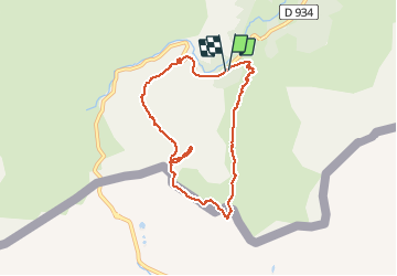
Trail Walking of 8.4 km to be discovered at New Aquitaine, Pyrénées-Atlantiques, Laruns. This trail is proposed by jysc238.
Départ du pont de Peyrelue. Onsuit le GR108 qui mène au col de Peyrelue. De là, on suit la crête frontière qui passe au-dessus du col du Pourtalet pour aboutir après une rude montée à un petit col sans nom. Puis on grimpe au sommet du Pic d'Estrémère où la vue est assez admirable. Descente technique par le couloir de l'Arrayet.

Walking

Walking

Walking

On foot
Walking

Walking

Walking

Walking
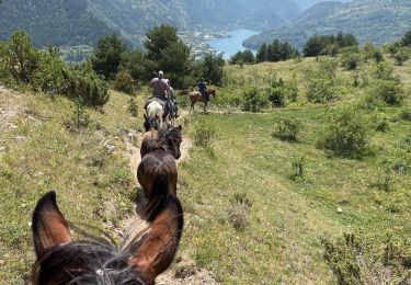
Horseback riding