Trail Other activity Sauze di Cesana - OR-7591379--Argentiera:It-Refuge Alpe plane-Bounous-RAG - Photo

OR-7591379--Argentiera:It-Refuge Alpe plane-Bounous-RAG

© OpenStreetMap contributors
Length
Length
13.9 km
Max alt
Max alt
2787 m
Uphill gradient
Uphill gradient
752 m
Km-Effort
Km-Effort  
26 km
Min alt
Min alt
1417 m
Downhill gradient
Downhill gradient
1369 m
Boucle
Boucle
No
Creation date :
2017-07-03 00:00:00.0
Updated on :
2017-07-03 00:00:00.0

(0 Reviews)

Other activity
Other activity
--
Difficulty : Unknown

Scan this QR Code to open this trail in the SityTrail application

FREE GPS app for hiking

Logo SityTrail SityTrail

IGN / Geographical institutes

Download SityTrail from the App Store Download SityTrail from Google Play

Logo SityTrail SityTrail World

The world is yours!

Download SityTrail from the App Store Download SityTrail from Google Play Download SityTrail on Huawei AppGallery

About

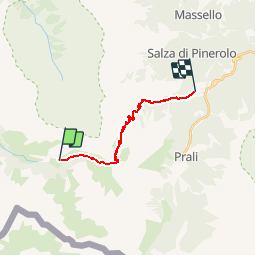
Trail Other activity of 13.9 km to be discovered at Piemont, Torino, Sauze di Cesana. This trail is proposed by 4426101738.

Elevation profile

Positioning

Country:
Italy
Region :
Piemont
Department/Province :
Torino
Municipality :
Sauze di Cesana
Location:
Unknown
Start:(Dec)
Start:(UTM)
338948 ; 4972496 (32T) N.

Trails nearby

Trail On foot Pragelato - IT-322 - Photo
On foot
GUIDE+

On foot

Easy
Pragelato, Piemont, Torino, Italy
3.5 km | 9.9 km-effort
2h 14min
No
Trail On foot Pragelato - IT-319 - Photo
On foot
GUIDE+

On foot

Easy
Pragelato, Piemont, Torino, Italy
4.2 km | 12.4 km-effort
2h 48min
No
Trail Walking Sauze di Cesana - DC19b - Photo
Walking

Walking

Very easy
Sauze di Cesana, Piemont, Torino, Italy
12.9 km | 18.7 km-effort
3h 14min
No
Trail Walking Sauze di Cesana - Bric Froid - Photo
Walking
Gouze13

Walking

Difficult
Sauze di Cesana, Piemont, Torino, Italy
3.9 km | 17.7 km-effort
5h 0min
No


Close
My subscriptions