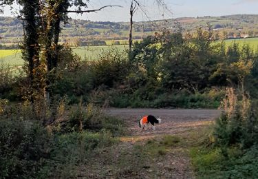
Trail Equestrian Penol - CAVAL07-4-ER2017 - Photo
© OpenStreetMap contributors
Length
Length
33 km
Max alt
Max alt
616 m
Uphill gradient
Uphill gradient
552 m
Km-Effort
Km-Effort  
41 km
Min alt
Min alt
339 m
Downhill gradient
Downhill gradient
542 m
Boucle
Boucle
No
Creation date :
2017-07-02 00:00:00.0
Updated on :
2017-07-02 00:00:00.0

(0 Reviews)

Equestrian
Equestrian
6h00
Difficulty : Unknown

Scan this QR Code to open this trail in the SityTrail application

FREE GPS app for hiking

Logo SityTrail SityTrail

IGN / Geographical institutes

Download SityTrail from the App Store Download SityTrail from Google Play

Logo SityTrail SityTrail World

The world is yours!

Download SityTrail from the App Store Download SityTrail from Google Play Download SityTrail on Huawei AppGallery

About

Trail Equestrian of 33 km to be discovered at Auvergne-Rhône-Alpes, Isère, Penol. This trail is proposed by jacquesdunogier.

Description

4° étape d'un voyage de 8 jours entre Glun(07) et Bourg en Bresse(01)EQUIRANDO 2017 par l'équipe de Caval'07

Elevation profile

Positioning

Country:
France
Region :
Auvergne-Rhône-Alpes
Department/Province :
Isère
Municipality :
Penol
Location:
Unknown
Start:(UTM)
670885 ; 5026421 (31T) N.

Trails nearby

Trail Walking Beaufort - Beaufort avec ses fontaines et sa plaine - Photo
Walking
raymondfn

Walking

Medium
(1)
Beaufort, Auvergne-Rhône-Alpes, Isère, France
7.7 km | 9.1 km-effort
2h 3min
Yes
Trail Walking Pajay - SityTrail - RD-Truchaud-Les Blaches - Photo
Walking
raymondfn

Walking

Medium
(1)
Pajay, Auvergne-Rhône-Alpes, Isère, France
8.1 km | 9.1 km-effort
2h 4min
Yes
Trail Walking Pajay - SityTrail - Truchaud-Les Blaches-variante - Photo
Walking
raymondfn

Walking

Medium
(1)
Pajay, Auvergne-Rhône-Alpes, Isère, France
8.8 km | 10.1 km-effort
2h 18min
Yes
Trail Horseback riding Pajay - bois de faramans  - Photo
Horseback riding
Ludivine Damotte

Horseback riding

Easy
Pajay, Auvergne-Rhône-Alpes, Isère, France
8.1 km | 9.7 km-effort
1h 44min
Yes
Trail Walking Viriville - viruville - Photo
Walking
lilloue

Walking

Medium
Viriville, Auvergne-Rhône-Alpes, Isère, France
6.3 km | 6.8 km-effort
2h 5min
Yes
Trail On foot Faramans - Faramans - 8,1 km - 165 m de dénivelé - 3h - Photo
On foot
Clubléorando

On foot

Easy
Faramans, Auvergne-Rhône-Alpes, Isère, France
8.1 km | 10.3 km-effort
3h 0min
Yes
Trail Walking Viriville - nivollon - Photo
Walking
lilloue

Walking

Very easy
Viriville, Auvergne-Rhône-Alpes, Isère, France
6 km | 6.5 km-effort
2h 3min
Yes
Trail Walking Penol - RS-Pajay-Penol-Gourras - Photo
Walking
raymondfn

Walking

Medium
Penol, Auvergne-Rhône-Alpes, Isère, France
6.7 km | 8.1 km-effort
1h 51min
Yes
Trail Walking Faramans - moulin Pion - Photo
Walking
lilloue

Walking

Easy
Faramans, Auvergne-Rhône-Alpes, Isère, France
11.1 km | 13.9 km-effort
3h 16min
Yes


Close
My subscriptions