Trail Mountain bike Val-d'Aigoual - mont Aigoual La Roque Ste Marguerite  - Photo

mont Aigoual La Roque Ste Marguerite

© OpenStreetMap contributors
Length
Length
74 km
Max alt
Max alt
1469 m
Uphill gradient
Uphill gradient
1400 m
Km-Effort
Km-Effort  
96 km
Min alt
Min alt
400 m
Downhill gradient
Downhill gradient
2456 m
Boucle
Boucle
No
Creation date :
2017-06-19 00:00:00.0
Updated on :
2017-06-19 00:00:00.0

(0 Reviews)

Mountain bike
Mountain bike
10h37
Difficulty : Medium

Scan this QR Code to open this trail in the SityTrail application

FREE GPS app for hiking

Logo SityTrail SityTrail

IGN / Geographical institutes

Download SityTrail from the App Store Download SityTrail from Google Play

Logo SityTrail SityTrail World

The world is yours!

Download SityTrail from the App Store Download SityTrail from Google Play Download SityTrail on Huawei AppGallery

About

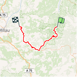
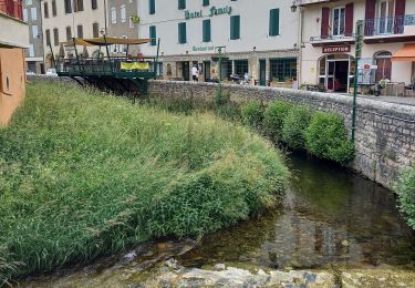
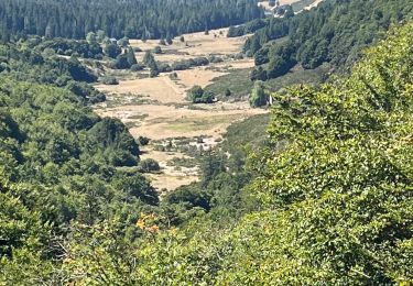
Trail Mountain bike of 74 km to be discovered at Occitania, Gard, Val-d'Aigoual. This trail is proposed by mathieu.causse.

Description

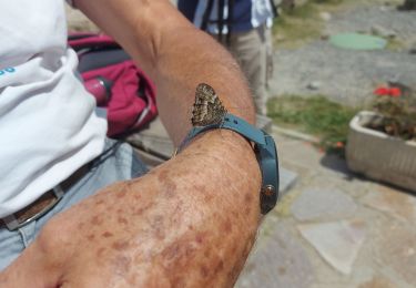
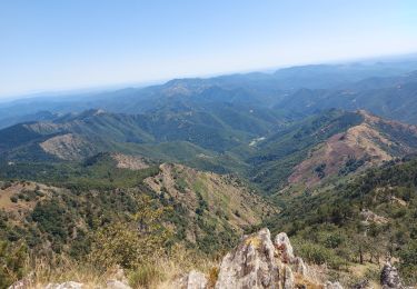
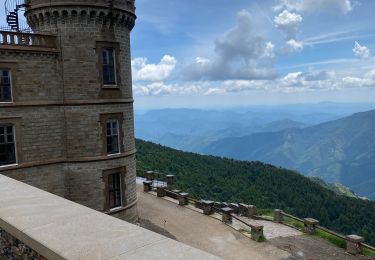
du Mont Aigoual à La roque ste Marguerite en passant par le lac des pises, saint guiral, sauclières, nant, les liquisses et descentes par pierrefiche du larzac moulin de corp.
   

Elevation profile

Points of interest

Point of interest Val-d'Aigoual - Point 1 - Photo
mathieu.causse
VAL-D'AIGOUAL 

Positioning

Country:
France
Region :
Occitania
Department/Province :
Gard
Municipality :
Val-d'Aigoual
Location:
Valleraugue
Start:(UTM)
545299 ; 4885441 (31T) N.

Trails nearby

Trail Walking Bassurels - Aigoual versant Lozérien - Photo
Walking
GUIDE
nadinebondoux

Walking

Difficult
Bassurels, Occitania, Lozère, France
15 km | 22 km-effort
4h 42min
No
Trail Walking Rousses - versant  nord Aigoual  - Photo
Walking
GUIDE
nadinebondoux

Walking

Difficult
Rousses, Occitania, Lozère, France
24 km | 34 km-effort
6h 26min
Yes
Trail Walking Meyrueis - Bois de la Dauphine - Photo
Walking
boudpn

Walking

Medium
Meyrueis, Occitania, Lozère, France
8 km | 9.8 km-effort
2h 52min
No
Trail Walking Val-d'Aigoual - les cascades de l'aigoual par seyrerede - Photo
Walking
labarone

Walking

Medium
Val-d'Aigoual, Occitania, Gard, France
19.7 km | 27 km-effort
6h 29min
Yes
Trail Walking Val-d'Aigoual - serreyrede à l aigoual par arboretum - Photo
Walking
labarone

Walking

Easy
Val-d'Aigoual, Occitania, Gard, France
20 km | 28 km-effort
7h 13min
Yes
Trail Walking Val-d'Aigoual - Serreyrede-caumette-Pra peyrot - Photo
Walking
gege30

Walking

Medium
Val-d'Aigoual, Occitania, Gard, France
7.7 km | 10.2 km-effort
2h 18min
Yes
Trail Walking Bassurels - Mont Aigoual Meyrues - Photo
Walking
GUIDE
Roger Philippe Wallez

Walking

Very difficult
Bassurels, Occitania, Lozère, France
37 km | 53 km-effort
11h 50min
Yes
Trail Walking Bassurels - Observatoire Mont Aigoual / Meyrueis - Photo
Walking
GUIDE
nadinebondoux

Walking

Medium
Bassurels, Occitania, Lozère, France
16.7 km | 22 km-effort
4h 44min
No
Trail Walking Val-d'Aigoual - PLO de VALBELLE  - Photo
Walking
boudpn

Walking

Difficult
Val-d'Aigoual, Occitania, Gard, France
13.9 km | 18.5 km-effort
5h 44min
Yes


Close
My subscriptions