![](/images/other/stat-length.png)
![Trail Cycle Antoing - Antoing Ville et eau - Photo](https://media.geolcdn.com/t/1900/400/ext.pjpeg?maxdim=2&url=https%3A%2F%2Fservices.sitytrail.com%2FGeolivesWS%2FDownloadMedia.ashx%3FTrailID%3D775040%26Media%3Dfix__20170618131155.jpg)
Antoing Ville et eau
bve9600
User
![Length](/images/other/stat-length.png)
Length
31 km
![Max alt](https://static1.geolcdn.com/siteimages/upload/files/1508320355ic_sort_altitude_max_24dp.png)
Max alt
42 m
![Uphill gradient](https://static1.geolcdn.com/siteimages/upload/files/1508320355ic_sort_den_pos_24dp.png)
Uphill gradient
208 m
![Km-Effort](/images/other/stat-length.png)
Km-Effort
33 km
![Min alt](https://static1.geolcdn.com/siteimages/upload/files/1508320355ic_sort_altitude_min_24dp.png)
Min alt
10 m
![Downhill gradient](https://static1.geolcdn.com/siteimages/upload/files/1508320355ic_sort_den_neg_24dp.png)
Downhill gradient
210 m
![Boucle](https://static1.geolcdn.com/siteimages/upload/files/16400158638029165_repeat_loop_refresh_sync_direction_icon.png)
Boucle
Yes
Creation date :
2017-06-18 00:00:00.0
Updated on :
2017-06-18 00:00:00.0
![Cycle](https://static1.geolcdn.com/sitytour/trail-icons/200.png)
3h12
Difficulty : Very easy
![Scan this QR Code to open this trail in the SityTrail application](https://capi.geolives.com/qq0zvz2zws4bq2lad0pu/sitytour/trails/775040/qr.png?size=200)
FREE GPS app for hiking
About
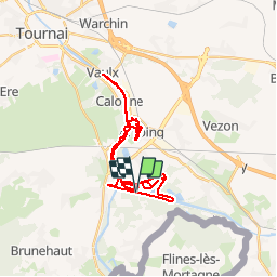
Trail Cycle of 31 km to be discovered at Wallonia, Hainaut, Antoing. This trail is proposed by bve9600.
Description
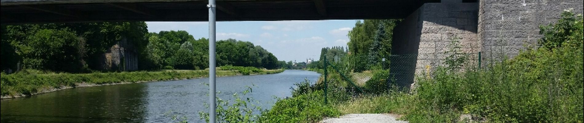
attention ne pas aller du côté industriel le chemin de halage est totalement barré
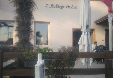
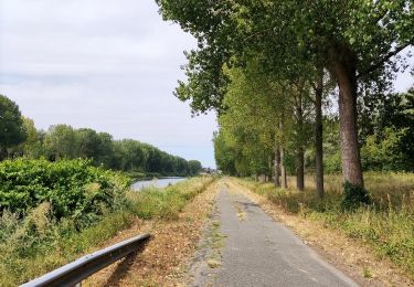
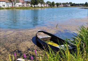
Positioning
Country:
Belgium
Region :
Wallonia
Department/Province :
Hainaut
Municipality :
Antoing
Location:
Péronnes
Start:(Dec)
Start:(UTM)
531781 ; 5598879 (31U) N.
Comments
Trails nearby
![Trail Walking Antoing - grand large- penonnes lez antoing - Photo](https://media.geolcdn.com/t/375/260/ext.jpg?maxdim=2&url=https%3A%2F%2Fservices.sitytrail.com%2FGeolivesWS%2FDownloadMedia.ashx%3FTrailID%3D653025%26Media%3Dfix__20161029165326.jpg)
![Walking Walking](https://static1.geolcdn.com/sitytour/trail-icons/101.png)
grand large- penonnes lez antoing
Walking
Easy
(3)
Antoing,
Wallonia,
Hainaut,
Belgium
![](/images/other/stat-length.png)
9.9 km | 10.7 km-effort
2h 12min
![](https://static1.geolcdn.com/siteimages/upload/files/16400158638029165_repeat_loop_refresh_sync_direction_icon.png)
Yes
![Trail Walking Brunehaut - Circuit de la coupure de Bléharies - Photo](https://media.geolcdn.com/t/375/260/c388fd6c-a6df-4e66-add0-50e55c75a52e.jpg&format=jpg&maxdim=2)
![Walking Walking](https://static1.geolcdn.com/sitytour/trail-icons/101.png)
Circuit de la coupure de Bléharies
Walking
Easy
Brunehaut,
Wallonia,
Hainaut,
Belgium
![](/images/other/stat-length.png)
3.7 km | 4 km-effort
54min
![](https://static1.geolcdn.com/siteimages/upload/files/16400158638029165_repeat_loop_refresh_sync_direction_icon.png)
Yes
![Trail Walking Antoing - Balade au coeur de Péronnes - Photo](https://media.geolcdn.com/t/375/260/d7561409-c7bf-436c-aa67-e1ca13223359.jpg&format=jpg&maxdim=2)
![Walking Walking](https://static1.geolcdn.com/sitytour/trail-icons/101.png)
Balade au coeur de Péronnes
Walking
Easy
(1)
Antoing,
Wallonia,
Hainaut,
Belgium
![](/images/other/stat-length.png)
4.5 km | 4.9 km-effort
1h 6min
![](https://static1.geolcdn.com/siteimages/upload/files/16400158638029165_repeat_loop_refresh_sync_direction_icon.png)
Yes
![Trail On foot Brunehaut - A tour of the plant and tree nurseries at Lesdain - Photo](https://media.geolcdn.com/t/375/260/ext.jpg?maxdim=2&url=https%3A%2F%2Fpivotmedia.tourismewallonie.be%2FANX-02-04JM-0024%2FANX-02-04JM-0024.jpg)
![On foot On foot](https://static1.geolcdn.com/sitytour/trail-icons/100.png)
A tour of the plant and tree nurseries at Lesdain
On foot
Easy
(1)
Brunehaut,
Wallonia,
Hainaut,
Belgium
![](/images/other/stat-length.png)
6.2 km | 6.6 km-effort
1h 29min
![](https://static1.geolcdn.com/siteimages/upload/files/16400158638029165_repeat_loop_refresh_sync_direction_icon.png)
Yes
![Trail On foot Antoing - 'Pays Blanc' circuit - Photo](https://media.geolcdn.com/t/375/260/ext.jpg?maxdim=2&url=https%3A%2F%2Fpivotmedia.tourismewallonie.be%2FANX-02-04JV-0001%2FANX-02-04JV-0001.jpg)
![On foot On foot](https://static1.geolcdn.com/sitytour/trail-icons/100.png)
'Pays Blanc' circuit
On foot
Easy
Antoing,
Wallonia,
Hainaut,
Belgium
![](/images/other/stat-length.png)
12.3 km | 14.3 km-effort
3h 14min
![](https://static1.geolcdn.com/siteimages/upload/files/16400158638029165_repeat_loop_refresh_sync_direction_icon.png)
Yes
![Trail On foot Brunehaut - Bléharies severed meander bird watching walking tour - 3,5km - Photo](https://media.geolcdn.com/t/375/260/ext.jpg?maxdim=2&url=https%3A%2F%2Fpivotmedia.tourismewallonie.be%2FANX-02-04JP-002T%2FANX-02-04JP-002T.jpg)
![On foot On foot](https://static1.geolcdn.com/sitytour/trail-icons/100.png)
Bléharies severed meander bird watching walking tour - 3,5km
On foot
Easy
Brunehaut,
Wallonia,
Hainaut,
Belgium
![](/images/other/stat-length.png)
3.7 km | 3.9 km-effort
53min
![](https://static1.geolcdn.com/siteimages/upload/files/16400158638029165_repeat_loop_refresh_sync_direction_icon.png)
Yes
![Trail Walking Mortagne-du-Nord - Mortagne-du-Nord 18,6 km - Photo](https://media.geolcdn.com/t/375/260/fd97f041-03e8-458c-b32d-9e5c0c535a41.jpg&format=jpg&maxdim=2)
![Walking Walking](https://static1.geolcdn.com/sitytour/trail-icons/101.png)
Mortagne-du-Nord 18,6 km
Walking
Mortagne-du-Nord,
Hauts-de-France,
Nord,
France
![](/images/other/stat-length.png)
18.6 km | 20 km-effort
4h 20min
![](https://static1.geolcdn.com/siteimages/upload/files/16400158638029165_repeat_loop_refresh_sync_direction_icon.png)
Yes
![Trail Road bike Tournai - Brau vélo Ravel Antoing - Photo](https://media.geolcdn.com/t/375/260/ext.jpg?maxdim=2&url=https%3A%2F%2Fstatic1.geolcdn.com%2Fsiteimages%2Fupload%2Ffiles%2F1524743154velo.jpg)
![Road bike Road bike](https://static1.geolcdn.com/sitytour/trail-icons/201.png)
Brau vélo Ravel Antoing
Road bike
Very easy
(1)
Tournai,
Wallonia,
Hainaut,
Belgium
![](/images/other/stat-length.png)
28 km | 31 km-effort
2h 22min
![](https://static1.geolcdn.com/siteimages/upload/files/16400158638029165_repeat_loop_refresh_sync_direction_icon.png)
Yes
![Trail Walking Brunehaut - RB - H - 15 Lesdain - Photo](https://media.geolcdn.com/t/375/260/ext.jpg?maxdim=2&url=https%3A%2F%2Fservices.sitytrail.com%2FGeolivesWS%2FDownloadMedia.ashx%3FTrailID%3D617918%26Media%3Dfix__20160820190940.jpg)
![Walking Walking](https://static1.geolcdn.com/sitytour/trail-icons/101.png)
RB - H - 15 Lesdain
Walking
Very easy
Brunehaut,
Wallonia,
Hainaut,
Belgium
![](/images/other/stat-length.png)
17.7 km | 18.9 km-effort
3h 55min
![](https://static1.geolcdn.com/siteimages/upload/files/16400158638029165_repeat_loop_refresh_sync_direction_icon.png)
Yes