![](/images/other/stat-length.png)
![Trail Running La Tour - La Verticale du Môle - Photo](https://media.geolcdn.com/t/1900/400/ext.pjpeg?maxdim=2&url=https%3A%2F%2Fstatic1.geolcdn.com%2Fsiteimages%2Fupload%2Ffiles%2F1524743154running.jpg)
La Verticale du Môle
sim1491
User
![Length](/images/other/stat-length.png)
![Max alt](https://static1.geolcdn.com/siteimages/upload/files/1508320355ic_sort_altitude_max_24dp.png)
![Uphill gradient](https://static1.geolcdn.com/siteimages/upload/files/1508320355ic_sort_den_pos_24dp.png)
![Km-Effort](/images/other/stat-length.png)
![Min alt](https://static1.geolcdn.com/siteimages/upload/files/1508320355ic_sort_altitude_min_24dp.png)
![Downhill gradient](https://static1.geolcdn.com/siteimages/upload/files/1508320355ic_sort_den_neg_24dp.png)
![Boucle](https://static1.geolcdn.com/siteimages/upload/files/16400158638029165_repeat_loop_refresh_sync_direction_icon.png)
![Running](https://static1.geolcdn.com/sitytour/trail-icons/103.png)
32m
Difficulty : Easy
![Scan this QR Code to open this trail in the SityTrail application](https://capi.geolives.com/qq0zvz2zws4bq2lad0pu/sitytour/trails/768376/qr.png?size=200)
FREE GPS app for hiking
About
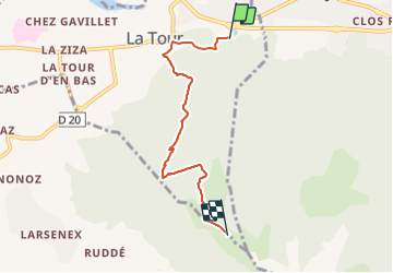
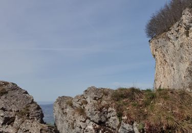
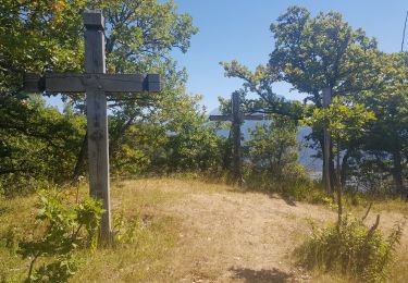
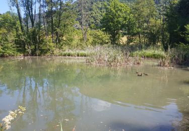
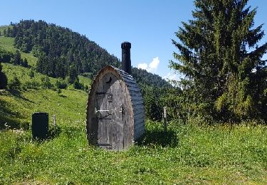
Trail Running of 4.8 km to be discovered at Auvergne-Rhône-Alpes, Upper Savoy, La Tour. This trail is proposed by sim1491.
Description
Départ toutes les 30" à partir de 8h30
Pointage obligatoire au départ fictif de l'Oasis (Base vie), annonce du départ fictif par le speaker.
Le chronométrage est lancé après un arrêt au cimetière (SAS de départ).
Échauffement dans la zone prévue entre l'oasis et le cimetière.
Votre sac coureur vous attendra à l'arbre mort (Ravitaillement de l'arrivée)
Dossards 1 à 20 : Départ à 8h30
Dossards 21 à 40 : Départ 8h40
Dossards 41 à 60 : Départ 8h50
Equipes : Départ à 9h00
Dossards 61 à 80 : Départ 9h20
Dossards 81 à 100 : Départ 9h30
Dossards 101 à 120 : Départ 9h40
Dossards 121 à 140 : Départ 9h50
Dossards 141 à 160 : Départ 10h00
Dossards 161 à 180 : Départ 10h10
Dossards 181 à 200 : Départ 10h20
Positioning
Comments
Trails nearby
![Trail Walking La Tour - 17-04-2022 Le tour de Saint Jean de Tholomé - Photo](https://media.geolcdn.com/t/375/260/afe0a2c8-09a9-438d-add3-0f8a286a78fb.jpg&format=jpg&maxdim=2)
![Walking Walking](https://static1.geolcdn.com/sitytour/trail-icons/101.png)
Walking
![](/images/other/stat-length.png)
![](https://static1.geolcdn.com/siteimages/upload/files/16400158638029165_repeat_loop_refresh_sync_direction_icon.png)
![Trail Walking Viuz-en-Sallaz - Viuz-Les Brasses-Vernant-Viuz - Photo](https://media.geolcdn.com/t/375/260/34dcd57e-15ca-4ca3-ab02-fc2bad27ee19.jpg&format=jpg&maxdim=2)
![Walking Walking](https://static1.geolcdn.com/sitytour/trail-icons/101.png)
Walking
![](/images/other/stat-length.png)
![](https://static1.geolcdn.com/siteimages/upload/files/16400158638029165_repeat_loop_refresh_sync_direction_icon.png)
![Trail Walking Bonneville - Tour du Reyret - Photo](https://media.geolcdn.com/t/375/260/3a92c894-f22c-4988-83b1-a50c7d0d14a4.jpg&format=jpg&maxdim=2)
![Walking Walking](https://static1.geolcdn.com/sitytour/trail-icons/101.png)
Walking
![](/images/other/stat-length.png)
![](https://static1.geolcdn.com/siteimages/upload/files/16400158638029165_repeat_loop_refresh_sync_direction_icon.png)
![Trail Walking Ayse - Les Gallinons - Crêtes du Rocher de l'aigle - Les Gallinons - Photo](https://media.geolcdn.com/t/375/260/a639a28d-0ec8-43bc-b5eb-0bc044c3bd96.jpg&format=jpg&maxdim=2)
![Walking Walking](https://static1.geolcdn.com/sitytour/trail-icons/101.png)
Walking
![](/images/other/stat-length.png)
![](https://static1.geolcdn.com/siteimages/upload/files/16400158638029165_repeat_loop_refresh_sync_direction_icon.png)
![Trail Walking Bonneville - Chemin de Croix d'Orgevat par Le Reyret - Photo](https://media.geolcdn.com/t/375/260/e982347c-b249-4c2e-8b5c-da3bb77412db.jpg&format=jpg&maxdim=2)
![Walking Walking](https://static1.geolcdn.com/sitytour/trail-icons/101.png)
Walking
![](/images/other/stat-length.png)
![](https://static1.geolcdn.com/siteimages/upload/files/16400158638029165_repeat_loop_refresh_sync_direction_icon.png)
![Trail Walking Ville-en-Sallaz - 2020-07 Lac du Môle - Saint Jeoire - Photo](https://media.geolcdn.com/t/375/260/4ade7828-b272-4802-b721-df9a5ba1cac5.jpg&format=jpg&maxdim=2)
![Walking Walking](https://static1.geolcdn.com/sitytour/trail-icons/101.png)
Walking
![](/images/other/stat-length.png)
![](https://static1.geolcdn.com/siteimages/upload/files/16400158638029165_repeat_loop_refresh_sync_direction_icon.png)
![Trail Walking Marignier - Le Môle par l'arrête Nord. - Photo](https://media.geolcdn.com/t/375/260/ext.jpg?maxdim=2&url=https%3A%2F%2Fservices.sitytrail.com%2FGeolivesWS%2FDownloadMedia.ashx%3FTrailID%3D774253%26Media%3Dfix__20170615160659.jpg)
![Walking Walking](https://static1.geolcdn.com/sitytour/trail-icons/101.png)
Walking
![](/images/other/stat-length.png)
![](https://static1.geolcdn.com/siteimages/upload/files/16400158638029165_repeat_loop_refresh_sync_direction_icon.png)
![Trail Walking Marignier - Le Môle par l'arrête Nord. - Photo](https://media.geolcdn.com/t/375/260/ext.jpg?maxdim=2&url=https%3A%2F%2Fservices.sitytrail.com%2FGeolivesWS%2FDownloadMedia.ashx%3FTrailID%3D773609%26Media%3Dfix__20170615160659.jpg)
![Walking Walking](https://static1.geolcdn.com/sitytour/trail-icons/101.png)
Walking
![](/images/other/stat-length.png)
![](https://static1.geolcdn.com/siteimages/upload/files/16400158638029165_repeat_loop_refresh_sync_direction_icon.png)
![Trail Running Saint-Jean-de-Tholome - Sortie Longue GR1 - 17/04 - Photo](https://media.geolcdn.com/t/375/260/ext.jpg?maxdim=2&url=https%3A%2F%2Fstatic1.geolcdn.com%2Fsiteimages%2Fupload%2Ffiles%2F1524743154running.jpg)
![Running Running](https://static1.geolcdn.com/sitytour/trail-icons/103.png)
Running
![](/images/other/stat-length.png)
![](https://static1.geolcdn.com/siteimages/upload/files/16400158638029165_repeat_loop_refresh_sync_direction_icon.png)