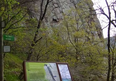
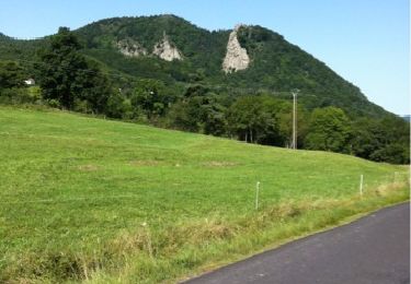
Trail Walking Vorey - StJ-J12-Vorey/Arzon-Puy en Velay - Photo

StJ-J12-Vorey/Arzon-Puy en Velay

 Bonsaicd
Bonsaicd

User

© OpenStreetMap contributors
Length
Length
27 km
Max alt
Max alt
857 m
Uphill gradient
Uphill gradient
836 m
Km-Effort
Km-Effort  
38 km
Min alt
Min alt
539 m
Downhill gradient
Downhill gradient
689 m
Boucle
Boucle
No
Creation date :
2018-06-26 00:00:00.0
Updated on :
2018-06-26 00:00:00.0

(0 Reviews)

Walking
Walking
8h11
Difficulty : Very difficult

Scan this QR Code to open this trail in the SityTrail application

FREE GPS app for hiking

Logo SityTrail SityTrail

IGN / Geographical institutes

Download SityTrail from the App Store Download SityTrail from Google Play

Logo SityTrail SityTrail World

The world is yours!

Download SityTrail from the App Store Download SityTrail from Google Play Download SityTrail on Huawei AppGallery

About

Trail Walking of 27 km to be discovered at Auvergne-Rhône-Alpes, Haute-Loire, Vorey. This trail is proposed by Bonsaicd.

Description

Vorey/Arzon > Puy en Velay

Elevation profile

Points of interest

Point of interest Brives-Charensac - Camping - Photo
Bonsaicd
BRIVES-CHARENSAC 
Point of interest Aiguilhe - Camping - Photo
Bonsaicd
AIGUILHE 
Point of interest Le Puy-en-Velay - Decathlon - Photo
Bonsaicd
LE PUY-EN-VELAY 
Point of interest Lavoûte-sur-Loire - Boulangerie - Photo
Bonsaicd
LAVOÛTE-SUR-LOIRE 
Point of interest Le Puy-en-Velay - Hospitalier - Photo
Bonsaicd
LE PUY-EN-VELAY 
Point of interest Le Puy-en-Velay - Hospitalier - Photo
Bonsaicd
LE PUY-EN-VELAY 
Point of interest Le Puy-en-Velay - Hospitalier - Photo
Bonsaicd
LE PUY-EN-VELAY 

Positioning

Country:
France
Region :
Auvergne-Rhône-Alpes
Department/Province :
Haute-Loire
Municipality :
Vorey
Location:
Unknown
Start:(UTM)
571212 ; 5004054 (31T) N.

Trails nearby

Trail Walking Chamalières-sur-Loire - Suc de Bartou - Rocher de Costaros - Photo
Walking
Jackoyo

Walking

Medium
Chamalières-sur-Loire, Auvergne-Rhône-Alpes, Haute-Loire, France
4.5 km | 7 km-effort
1h 20min
Yes
Trail Walking Chamalières-sur-Loire - Le rocher de Costaros - Photo
Walking
Jean-MarieFaux

Walking

Medium
Chamalières-sur-Loire, Auvergne-Rhône-Alpes, Haute-Loire, France
7.8 km | 11.4 km-effort
2h 21min
Yes
Trail Cycle Vorey - autour de Corey - Photo
Cycle
francisbouhot

Cycle

Medium
Vorey, Auvergne-Rhône-Alpes, Haute-Loire, France
21 km | 28 km-effort
1h 24min
Yes
Trail sport Vorey - Vorey - Photo
sport
Banaszak

sport

Very easy
Vorey, Auvergne-Rhône-Alpes, Haute-Loire, France
7.5 km | 9.6 km-effort
Unknown
Yes
Trail Walking Vorey - GR 40_8 - Photo
Walking
Laverret

Walking

Difficult
Vorey, Auvergne-Rhône-Alpes, Haute-Loire, France
23 km | 31 km-effort
8h 41min
No
Trail Walking Chamalières-sur-Loire - Suc de Bartou - Photo
Walking
Iahns

Walking

Medium
Chamalières-sur-Loire, Auvergne-Rhône-Alpes, Haute-Loire, France
3.9 km | 6.2 km-effort
1h 24min
Yes
Trail Walking Vorey - GR40 - Photo
Walking
collot

Walking

Medium
Vorey, Auvergne-Rhône-Alpes, Haute-Loire, France
174 km | 237 km-effort
Unknown
Yes
Trail Mountain bike Vorey - VOREY ROCHE EN REGNIER 2012-01-29 - 13h42m05 - Photo
Mountain bike
alph13

Mountain bike

Difficult
Vorey, Auvergne-Rhône-Alpes, Haute-Loire, France
32 km | 47 km-effort
4h 29min
Yes
Trail Hybrid bike Vorey - Vorey to vourze - Photo
Hybrid bike
philloup43

Hybrid bike

Difficult
Vorey, Auvergne-Rhône-Alpes, Haute-Loire, France
32 km | 39 km-effort
1h 29min
No


Close
My subscriptions