Trail Walking Larchant - M&R-170303 - MtBlanc-DameJouanne - Photo

M&R-170303 - MtBlanc-DameJouanne

© OpenStreetMap contributors
Length
Length
11.8 km
Max alt
Max alt
120 m
Uphill gradient
Uphill gradient
219 m
Km-Effort
Km-Effort  
14.7 km
Min alt
Min alt
69 m
Downhill gradient
Downhill gradient
219 m
Boucle
Boucle
Yes
Creation date :
2017-05-26 00:00:00.0
Updated on :
2017-05-26 00:00:00.0

(0 Reviews)

Walking
Walking
5h00
Difficulty : Medium

Scan this QR Code to open this trail in the SityTrail application

FREE GPS app for hiking

Logo SityTrail SityTrail

IGN / Geographical institutes

Download SityTrail from the App Store Download SityTrail from Google Play

Logo SityTrail SityTrail World
The world is yours!

Download SityTrail from the App Store Download SityTrail from Google Play Download SityTrail on Huawei AppGallery

About

Trail Walking of 11.8 km to be discovered at Ile-de-France, Seine-et-Marne, Larchant. This trail is proposed by MarcheEtReve.

Description

=== Copie de randodan ===<br>
Rando Mont Blanc et Dame Jouanne avec Marche et Rêve<br>
- 3 mars 2017 -<br>
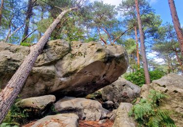
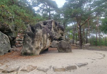
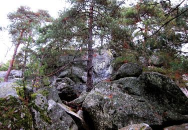
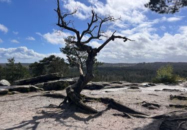
Départ 9h35 du parking de l'auberge et nous attaquons le Denecourt n°19, nommé aussi "Tour du Golfe de Larchant" . Quelques bonnes grimpettes sur le Mont Simonet et le Rocher de la Justice, ça nous fait apprécier, à 10h45, la pause biberon à l'Éléphant.<br>
La Fontaine St-Mathurin, encore une grimpette au passage du Auvent, puis c'est l'ascension du Mont Blanc, 4810 m... heu non, seulement 112 m.<br>
3/4h de marche dans cette belle Forêt Domaniale de la Commanderie, et tout d'un coup, Francine s'exclame : "Tiens, y a d'l'eau !" Et toc ! C'est la fameuse Fontaine St-Bernard qu'il était prévu rechercher . Bravo Francine.<br>
Une heure moins dix, arrivons à l'Auberge de la Dame Jouanne pour le saumon à la plancha.<br>
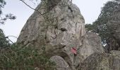
15h, nous repartons pour le tour de la Dame Jouanne . Vue de dessus de la Dame . Puis descendons par la diaclase et repassons au pied de la grande Dame par un petit hors piste.<br>
16h45, de retour aux voitures.<br>
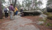
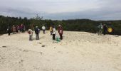
Nous étions 27 grimpeurs sur le Mont Blanc.

Elevation profile

Photos

Points of interest

Point of interest Larchant - 01 - A l'assaut du Mont Simonet - Photo
MarcheEtReve
Point of interest Larchant - 02 - Le Mont Simonet et le Mont Louis, y a comme une certaine ressemblance... - Photo
MarcheEtReve
Point of interest Larchant - 03 - L'Arche de la Justice - Photo
MarcheEtReve
Point of interest Larchant - 04 - Point de vue de la Justice - Photo
MarcheEtReve
Point of interest Larchant - 05 - La Marmite du Diable - Photo
MarcheEtReve
Point of interest Larchant - 06 - La grimpette à la Roche au Diable - Photo
MarcheEtReve
Point of interest Larchant - 07 - Presqu'au sommet de la Roche au Diable - Photo
MarcheEtReve
Point of interest Larchant - 08 - La grimpette à l'Auvent - Photo
MarcheEtReve
Point of interest Larchant - 09 - Les vainqueurs du Mont Blanc, 112 m - Photo
MarcheEtReve
Point of interest Larchant - 10 - La Fontaine Saint Bernard (ou Sainte Francine ;o) - Photo
MarcheEtReve
Point of interest Larchant - 11 - A table, à l'apéro... Tchin ! - Photo
MarcheEtReve
Point of interest Larchant - 12 - L'escalier... - Photo
MarcheEtReve
Point of interest Larchant - 13 - L'Arche (H) - Photo
MarcheEtReve
Point of interest Larchant - 14 - Un passage un peu délicat - Photo
MarcheEtReve
Point of interest Larchant - 15 - La Dame Jouanne - Photo
MarcheEtReve

Positioning

Country:
France
Region :
Ile-de-France
Department/Province :
Seine-et-Marne
Municipality :
Larchant
Location:
Unknown
Start:(UTM)
470304 ; 5350074 (31U) N.

Trails nearby

Trail Walking Recloses - Boucle recloses Nemours Grez/loing - Photo
Walking
GUIDE
chessyca

Walking

Medium
(1)
Recloses, Ile-de-France, Seine-et-Marne, France
30 km | 34 km-effort
6h 20min
Yes
Trail Walking Larchant - Larchant la Féérique  - Photo
Walking
GUIDE
chessyca

Walking

Medium
Larchant, Ile-de-France, Seine-et-Marne, France
19.6 km | 24 km-effort
5h 14min
Yes
Trail On foot Larchant - Sentier Denecourt-Colinet 19 - Photo
On foot
GUIDE+

On foot

Easy
Larchant, Ile-de-France, Seine-et-Marne, France
9.7 km | 12.3 km-effort
2h 47min
Yes
Trail Walking Amponville - Amponville - Dolmen dit la Pierre Larmoire - Photo
Walking
guydu41

Walking

Very easy
Amponville, Ile-de-France, Seine-et-Marne, France
7.8 km | 8.3 km-effort
1h 53min
Yes
Trail Walking Villiers-sous-Grez - Villiers sous grez / Larchant - Photo
Walking
becor94

Walking

Very difficult
Villiers-sous-Grez, Ile-de-France, Seine-et-Marne, France
24 km | 29 km-effort
5h 31min
Yes
Trail Walking Recloses - Recloses Ve120124 pm - Photo
Walking
fmg

Walking

Medium
(1)
Recloses, Ile-de-France, Seine-et-Marne, France
8.9 km | 10.5 km-effort
2h 23min
Yes
Trail Walking Recloses - Recloses ve 120124 am - Photo
Walking
fmg

Walking

Medium
(1)
Recloses, Ile-de-France, Seine-et-Marne, France
10.8 km | 12.6 km-effort
2h 52min
Yes
Trail Walking Recloses - Recloses Ve 280423 SR30042323 PM10km - Photo
Walking
fmg

Walking

Medium
(1)
Recloses, Ile-de-France, Seine-et-Marne, France
9.9 km | 11.9 km-effort
2h 42min
Yes
Trail Nordic walking Larchant - Dame Juane - Photo
Nordic walking
pierre_mack

Nordic walking

Larchant, Ile-de-France, Seine-et-Marne, France
22 km | 26 km-effort
3h 6min
No


Close
My subscriptions