Trail Mountain bike Rustrel - Rustrel 2017 2 - Photo
© OpenStreetMap contributors
Length
Length
36 km
Max alt
Max alt
579 m
Uphill gradient
Uphill gradient
813 m
Km-Effort
Km-Effort  
47 km
Min alt
Min alt
219 m
Downhill gradient
Downhill gradient
813 m
Boucle
Boucle
No
Creation date :
2017-05-18 00:00:00.0
Updated on :
2017-05-18 00:00:00.0

(0 Reviews)

Mountain bike
Mountain bike
7h34
Difficulty : Difficult

Scan this QR Code to open this trail in the SityTrail application

FREE GPS app for hiking

Logo SityTrail SityTrail

IGN / Geographical institutes

Download SityTrail from the App Store Download SityTrail from Google Play

Logo SityTrail SityTrail World

The world is yours!

Download SityTrail from the App Store Download SityTrail from Google Play Download SityTrail on Huawei AppGallery

About

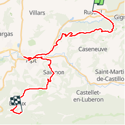
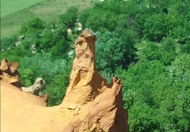
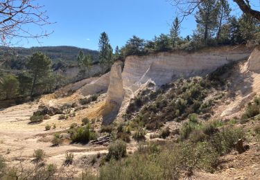
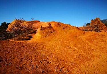
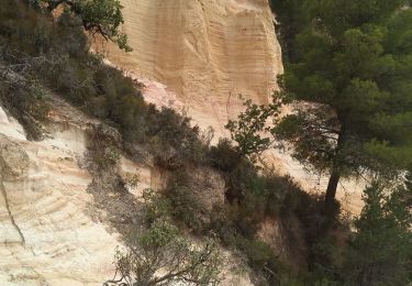
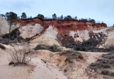
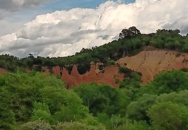
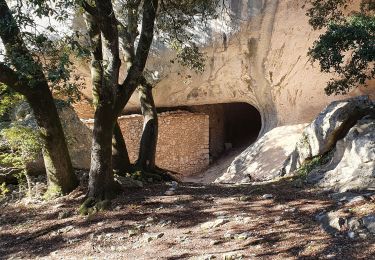
Trail Mountain bike of 36 km to be discovered at Provence-Alpes-Côte d'Azur, Vaucluse, Rustrel. This trail is proposed by pates_au_chaud.

Description

11-05-2017 - Raid VTT Lubéron étape 4 - avec Bertrand, Philou, Nico, Ronan et Tanguy

Elevation profile

Positioning

Country:
France
Region :
Provence-Alpes-Côte d'Azur
Department/Province :
Vaucluse
Municipality :
Rustrel
Location:
Unknown
Start:(UTM)
699410 ; 4866531 (31T) N.

Trails nearby

Trail Walking Rustrel - Colorado provensal Rustrel - Photo
Walking
Cricounet84

Walking

Easy
(5)
Rustrel, Provence-Alpes-Côte d'Azur, Vaucluse, France
7.2 km | 8.9 km-effort
4h 25min
Yes
Trail Walking Rustrel - Colorado provençal - Photo
Walking
ezola

Walking

Easy
(2)
Rustrel, Provence-Alpes-Côte d'Azur, Vaucluse, France
4.4 km | 5.6 km-effort
1h 16min
Yes
Trail Walking Caseneuve - Le Colorado provençal de Gignac - Photo
Walking
PITOUSSAINT

Walking

Very easy
(1)
Caseneuve, Provence-Alpes-Côte d'Azur, Vaucluse, France
12.4 km | 16.3 km-effort
4h 37min
Yes
Trail Walking Rustrel - Colorado de Rustrel - Photo
Walking
counoise

Walking

Easy
(1)
Rustrel, Provence-Alpes-Côte d'Azur, Vaucluse, France
6.5 km | 8.4 km-effort
2h 17min
Yes
Trail Walking Villars - Chapelle st Pierre Aiguiers d' Auribeau - Photo
Walking
pieven

Walking

Easy
(1)
Villars, Provence-Alpes-Côte d'Azur, Vaucluse, France
10.9 km | 17.8 km-effort
4h 43min
Yes
Trail Walking Rustrel - rustrel. Le tour du Colorado  et le Colorado  - Photo
Walking
Roger

Walking

Difficult
Rustrel, Provence-Alpes-Côte d'Azur, Vaucluse, France
11.3 km | 15.2 km-effort
4h 32min
Yes
Trail Walking Rustrel - tour du Colorado Provencal-10-05-23 - Photo
Walking
Christiancordin

Walking

Medium
(1)
Rustrel, Provence-Alpes-Côte d'Azur, Vaucluse, France
17.2 km | 23 km-effort
4h 38min
Yes
Trail Walking Rustrel - visite et tour du Colorado Provençal  - Photo
Walking
GUIDE
stef789

Walking

Medium
Rustrel, Provence-Alpes-Côte d'Azur, Vaucluse, France
14.2 km | 19 km-effort
4h 51min
Yes
Trail Walking Villars - Les Aiguiers du Villars par Cabrone - Photo
Walking
MarcLEBARON

Walking

Difficult
(1)
Villars, Provence-Alpes-Côte d'Azur, Vaucluse, France
17.7 km | 27 km-effort
4h 36min
Yes


Close
My subscriptions