Trail Walking Saint-Vallier-de-Thiey - Climb from the river Siagne to Escragolles - Photo

Climb from the river Siagne to Escragolles

© OpenStreetMap contributors
Length
Length
9.7 km
Max alt
Max alt
1094 m
Uphill gradient
Uphill gradient
510 m
Km-Effort
Km-Effort  
16.6 km
Min alt
Min alt
589 m
Downhill gradient
Downhill gradient
513 m
Boucle
Boucle
Yes
Creation date :
2018-08-05 15:27:37.325
Updated on :
2018-08-05 15:27:37.411

(0 Reviews)

Walking
Walking
2h43
Difficulty : Medium

Scan this QR Code to open this trail in the SityTrail application

FREE GPS app for hiking

Logo SityTrail SityTrail

IGN / Geographical institutes

Download SityTrail from the App Store Download SityTrail from Google Play

Logo SityTrail SityTrail World

The world is yours!

Download SityTrail from the App Store Download SityTrail from Google Play Download SityTrail on Huawei AppGallery

About

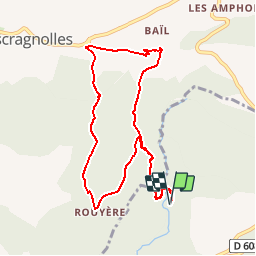
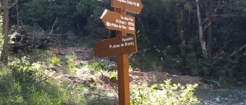
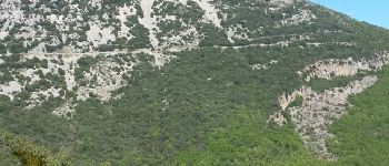
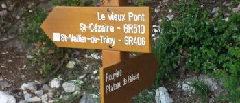
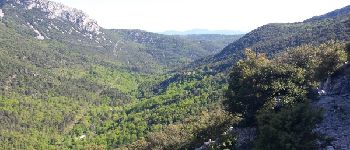
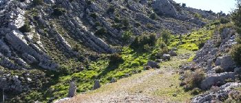
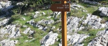
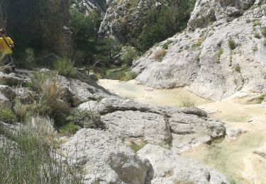
Trail Walking of 9.7 km to be discovered at Provence-Alpes-Côte d'Azur, Maritime Alps, Saint-Vallier-de-Thiey. This trail is proposed by Palimpseste.

Description

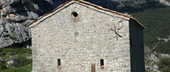
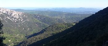
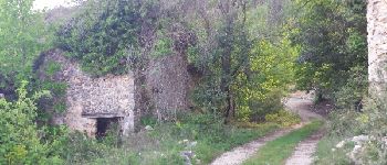
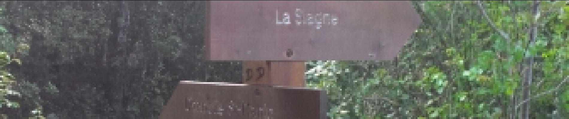
Beautiful loop allowing to leave from the Siagne to the chapel saint Jean at Escragnolles and return with superb points of view

Elevation profile

Photos

Points of interest

Point of interest Saint-Vallier-de-Thiey - Point 1 - Photo
Palimpseste
SAINT-VALLIER-DE-THIEY 
Point of interest Saint-Vallier-de-Thiey - La Siagne vers l amont - Photo
Palimpseste
SAINT-VALLIER-DE-THIEY 
Point of interest Saint-Vallier-de-Thiey - Le pont sur la Siagne - Photo
Palimpseste
SAINT-VALLIER-DE-THIEY 
Point of interest Saint-Vallier-de-Thiey - Un debut de montee facile - Photo
Palimpseste
SAINT-VALLIER-DE-THIEY 
Point of interest Saint-Vallier-de-Thiey - Commune d Escragnolles - Photo
Palimpseste
SAINT-VALLIER-DE-THIEY 
Point of interest Escragnolles - Point 7 - Photo
Palimpseste
ESCRAGNOLLES 
Point of interest Escragnolles - Du cailloux !!! - Photo
Palimpseste
ESCRAGNOLLES 
Point of interest Escragnolles - Point 9 - Photo
Palimpseste
ESCRAGNOLLES 
Point of interest Escragnolles - La RN  dans le lointain - Photo
Palimpseste
Point of interest Escragnolles - Point 11 - Photo
Palimpseste
ESCRAGNOLLES 
Point of interest Escragnolles - Point 12 - Photo
Palimpseste
ESCRAGNOLLES 
Point of interest Escragnolles - L Estérel - Photo
Palimpseste
ESCRAGNOLLES 
Point of interest Escragnolles - Un chemin plus carrossable - Photo
Palimpseste
Point of interest Escragnolles - Bientot le sommet - Photo
Palimpseste
ESCRAGNOLLES 
Point of interest Escragnolles - La chapelle saint Jean - Photo
Palimpseste
Point of interest Escragnolles - Arivee au sommet - Photo
Palimpseste
ESCRAGNOLLES 
Point of interest Escragnolles - Point 21 - Photo
Palimpseste
ESCRAGNOLLES 
Point of interest Escragnolles - Point 22 - Photo
Palimpseste
ESCRAGNOLLES 
Point of interest Escragnolles - la mer - Photo
Palimpseste
ESCRAGNOLLES 
Point of interest Escragnolles - Panneau - Photo
Palimpseste
ESCRAGNOLLES 
Point of interest Escragnolles - le raccourci - Photo
Palimpseste
ESCRAGNOLLES 
Point of interest Escragnolles - Point 26 - Photo
Palimpseste
ESCRAGNOLLES 
Point of interest Escragnolles - ruines - Photo
Palimpseste
ESCRAGNOLLES 
Point of interest Escragnolles - La bifurcation a ne pas rater - Photo
Palimpseste

Positioning

Country:
France
Region :
Provence-Alpes-Côte d'Azur
Department/Province :
Maritime Alps
Municipality :
Saint-Vallier-de-Thiey
Location:
Unknown
Start:(UTM)
323344 ; 4841981 (32T) N.

Comments

Please log in to post a review or rate the element


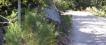
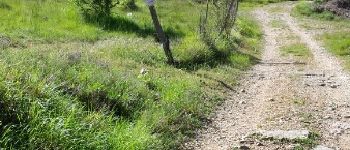
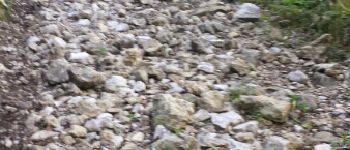
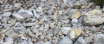
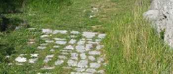
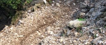
Belle balade, même si la montée est parfois un peu raide avec les pierres


Trails nearby

Trail Walking Escragnolles - Casade du Ray (Clars) depuis les Gallants - Photo
Walking
Reich

Walking

Very easy
(1)
Escragnolles, Provence-Alpes-Côte d'Azur, Maritime Alps, France
938 m | 1.3 km-effort
20min
No
Trail Walking Saint-Vallier-de-Thiey - Arche de Ponadieu Source de la Pare Baou Mourine Vieux Pont  - Photo
Walking
GUIDE
jouans

Walking

Very difficult
Saint-Vallier-de-Thiey, Provence-Alpes-Côte d'Azur, Maritime Alps, France
19.2 km | 32 km-effort
7h 20min
Yes
Trail On foot Escragnolles - Plateau de Briasq - Photo
On foot
PRO

On foot

Medium
Escragnolles, Provence-Alpes-Côte d'Azur, Maritime Alps, France
14.1 km | 22 km-effort
4h 56min
Yes
Trail Walking Saint-Vallier-de-Thiey - Grasse - Montagne de Thiey - Photo
Walking
GUIDE
Orcal37

Walking

Medium
Saint-Vallier-de-Thiey, Provence-Alpes-Côte d'Azur, Maritime Alps, France
14.9 km | 25 km-effort
4h 54min
Yes
Trail Walking Saint-Vallier-de-Thiey - St Vallier : Colle du  maçon doublier  - Photo
Walking
ETMU5496

Walking

Difficult
Saint-Vallier-de-Thiey, Provence-Alpes-Côte d'Azur, Maritime Alps, France
18.2 km | 29 km-effort
6h 35min
Yes
Trail Walking Saint-Vallier-de-Thiey - St Vallier de Thiey - Col de la Lèque - Chapelle St Jean - Arche Ponadieu - Photo
Walking
LtZIP

Walking

Medium
Saint-Vallier-de-Thiey, Provence-Alpes-Côte d'Azur, Maritime Alps, France
14.1 km | 21 km-effort
4h 44min
Yes
Trail Walking Saint-Vallier-de-Thiey - St Vallier : Pare2 - Photo
Walking
ETMU5496

Walking

Difficult
Saint-Vallier-de-Thiey, Provence-Alpes-Côte d'Azur, Maritime Alps, France
17.7 km | 29 km-effort
6h 35min
Yes
Trail Walking Saint-Vallier-de-Thiey - St Vallier de Thiey - Col du Ferrier - Castellaras de la Malle - Col du Pilon - Pierre Druidique - Photo
Walking
LtZIP

Walking

Medium
Saint-Vallier-de-Thiey, Provence-Alpes-Côte d'Azur, Maritime Alps, France
18.9 km | 28 km-effort
6h 18min
Yes
Trail Walking Saint-Vallier-de-Thiey - Montagne de Thiey 2 - Photo
Walking
ETMU5496

Walking

Medium
Saint-Vallier-de-Thiey, Provence-Alpes-Côte d'Azur, Maritime Alps, France
19.3 km | 31 km-effort
6h 57min
Yes


Close
My subscriptions