![](/images/other/stat-length.png)
![Trail Walking L'Abbaye - circuit Le Pont - Dent de Vaulion 24.04.17 - Photo](https://media.geolcdn.com/t/1900/400/ext.pjpeg?maxdim=2&url=https%3A%2F%2Fservices.sitytrail.com%2FGeolivesWS%2FDownloadMedia.ashx%3FTrailID%3D739025%26Media%3D9da1c2cb-4844-49e3-9106-c39e10d00101.jpg)
circuit Le Pont - Dent de Vaulion 24.04.17
duamerg
User
![Length](/images/other/stat-length.png)
![Max alt](https://static1.geolcdn.com/siteimages/upload/files/1508320355ic_sort_altitude_max_24dp.png)
![Uphill gradient](https://static1.geolcdn.com/siteimages/upload/files/1508320355ic_sort_den_pos_24dp.png)
![Km-Effort](/images/other/stat-length.png)
![Min alt](https://static1.geolcdn.com/siteimages/upload/files/1508320355ic_sort_altitude_min_24dp.png)
![Downhill gradient](https://static1.geolcdn.com/siteimages/upload/files/1508320355ic_sort_den_neg_24dp.png)
![Boucle](https://static1.geolcdn.com/siteimages/upload/files/16400158638029165_repeat_loop_refresh_sync_direction_icon.png)
![Walking](https://static1.geolcdn.com/sitytour/trail-icons/101.png)
3h23
Difficulty : Easy
![Scan this QR Code to open this trail in the SityTrail application](https://capi.geolives.com/qq0zvz2zws4bq2lad0pu/sitytour/trails/739025/qr.png?size=200)
FREE GPS app for hiking
About
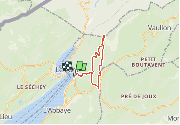
Trail Walking of 9.7 km to be discovered at Vaud, District du Jura-Nord vaudois, L'Abbaye. This trail is proposed by duamerg.
Description
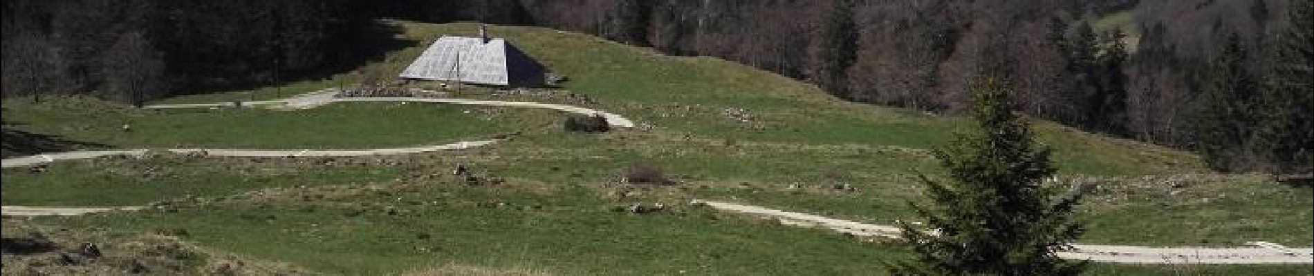
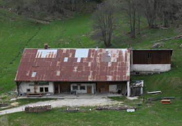
En train ajoutez 15m. pour rejoindre le début de la ballade. Nombreuses places de parc.
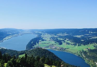
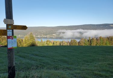
Suivre les indicateurs 'Dent de Vaulion' pour la montée et Pétra Félix pour la descente.
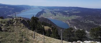
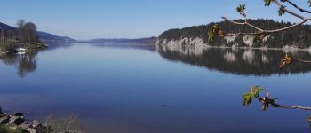
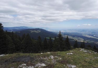
La vue depuis la dent est magnifique.
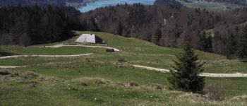
Aucune difficulté pour cette ballade. On y monte en voiture, ça casse le charme....
Positioning
Comments
Trails nearby
![Trail On foot Vallorbe - Mont d'Orzeires - Le Pont Gare - Photo](https://media.geolcdn.com/t/375/260/7e9156be-5722-477c-ab77-407a4f623ffb.jpeg&format=jpg&maxdim=2)
![On foot On foot](https://static1.geolcdn.com/sitytour/trail-icons/100.png)
On foot
![](/images/other/stat-length.png)
![](https://static1.geolcdn.com/siteimages/upload/files/16400158638029165_repeat_loop_refresh_sync_direction_icon.png)
![Trail On foot L'Abbaye - Pétra Félix-Dent du Vaulion - Photo](https://media.geolcdn.com/t/375/260/791319e2-c645-47ad-9892-4c78de70e46d.jpeg&format=jpg&maxdim=2)
![On foot On foot](https://static1.geolcdn.com/sitytour/trail-icons/100.png)
On foot
![](/images/other/stat-length.png)
![](https://static1.geolcdn.com/siteimages/upload/files/16400158638029165_repeat_loop_refresh_sync_direction_icon.png)
![Trail On foot Vallorbe - Saigne Geret-Les Revines - Photo](https://media.geolcdn.com/t/375/260/7e9156be-5722-477c-ab77-407a4f623ffb.jpeg&format=jpg&maxdim=2)
![On foot On foot](https://static1.geolcdn.com/sitytour/trail-icons/100.png)
On foot
![](/images/other/stat-length.png)
![](https://static1.geolcdn.com/siteimages/upload/files/16400158638029165_repeat_loop_refresh_sync_direction_icon.png)
![Trail Walking L'Abbaye - La Dent de Vaulion - Photo](https://media.geolcdn.com/t/375/260/d5e685b7-4a94-4c58-8eef-781dbd85a043.jpg&format=jpg&maxdim=2)
![Walking Walking](https://static1.geolcdn.com/sitytour/trail-icons/101.png)
Walking
![](/images/other/stat-length.png)
![](https://static1.geolcdn.com/siteimages/upload/files/16400158638029165_repeat_loop_refresh_sync_direction_icon.png)
![Trail Snowshoes L'Abbaye - Le Pont dent de Vaulion Suisse - Photo](https://media.geolcdn.com/t/375/260/9e2200ad-9d42-4562-b83d-ca6468e63af4.jpg&format=jpg&maxdim=2)
![Snowshoes Snowshoes](https://static1.geolcdn.com/sitytour/trail-icons/504.png)
Snowshoes
![](/images/other/stat-length.png)
![](https://static1.geolcdn.com/siteimages/upload/files/16400158638029165_repeat_loop_refresh_sync_direction_icon.png)
![Trail Walking Mont-la-Ville - Col du Mollendruz- Châtel12.08.16 - Photo](https://media.geolcdn.com/t/375/260/ext.jpg?maxdim=2&url=https%3A%2F%2Fservices.sitytrail.com%2FGeolivesWS%2FDownloadMedia.ashx%3FTrailID%3D613380%26Media%3D43a7cf82-b29c-47b6-b70e-4ce03287cc7c.jpg)
![Walking Walking](https://static1.geolcdn.com/sitytour/trail-icons/101.png)
Walking
![](/images/other/stat-length.png)
![](https://static1.geolcdn.com/siteimages/upload/files/16400158638029165_repeat_loop_refresh_sync_direction_icon.png)
![Trail Walking L'Abbaye - Suisse Le Mont tendre - Photo](https://media.geolcdn.com/t/375/260/adf6acd7-5983-4bcb-a340-72f8a96d6de5.jpg&format=jpg&maxdim=2)
![Walking Walking](https://static1.geolcdn.com/sitytour/trail-icons/101.png)
Walking
![](/images/other/stat-length.png)
![](https://static1.geolcdn.com/siteimages/upload/files/16400158638029165_repeat_loop_refresh_sync_direction_icon.png)
![Trail Walking Mont-la-Ville - Jura Club Grand Tour belle vue lac leman - Photo](https://media.geolcdn.com/t/375/260/ef457377-2225-4112-a04a-847f4d6a388b.jpg&format=jpg&maxdim=2)
![Walking Walking](https://static1.geolcdn.com/sitytour/trail-icons/101.png)
Walking
![](/images/other/stat-length.png)
![](https://static1.geolcdn.com/siteimages/upload/files/16400158638029165_repeat_loop_refresh_sync_direction_icon.png)
![Trail On foot Vaulion - Sur le Voué- - Photo](https://media.geolcdn.com/t/375/260/ext.jpg?maxdim=2&url=https%3A%2F%2Fstatic1.geolcdn.com%2Fsiteimages%2Fupload%2Ffiles%2F1545311037marcheuse_200dpi.jpg)
![On foot On foot](https://static1.geolcdn.com/sitytour/trail-icons/100.png)
On foot
![](/images/other/stat-length.png)
![](https://static1.geolcdn.com/siteimages/upload/files/16400158638029165_repeat_loop_refresh_sync_direction_icon.png)