Trail Walking Bléneau - Rando des étangs (2017) - Photo

Rando des étangs (2017)

© OpenStreetMap contributors
Length
Length
15.8 km
Max alt
Max alt
203 m
Uphill gradient
Uphill gradient
117 m
Km-Effort
Km-Effort  
17.3 km
Min alt
Min alt
173 m
Downhill gradient
Downhill gradient
115 m
Boucle
Boucle
Yes
Creation date :
2019-05-03 09:14:51.589
Updated on :
2019-05-03 09:14:51.664

(0 Reviews)

Walking
Walking
3h16
Difficulty : Easy

Scan this QR Code to open this trail in the SityTrail application

FREE GPS app for hiking

Logo SityTrail SityTrail

IGN / Geographical institutes

Download SityTrail from the App Store Download SityTrail from Google Play

Logo SityTrail SityTrail World

The world is yours!

Download SityTrail from the App Store Download SityTrail from Google Play Download SityTrail on Huawei AppGallery

About

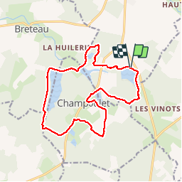
Trail Walking of 15.8 km to be discovered at Bourgogne-Franche-Comté, Yonne, Bléneau. This trail is proposed by Ordijamo45.

Description

Départ étang des Blondeaux dit étang des Beaurois (Bléneau 89)
De Bléneau prendre la direction de Briare a la sortie de la ville prendre la D64 et direction domaine de Beaurois
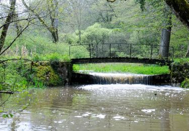
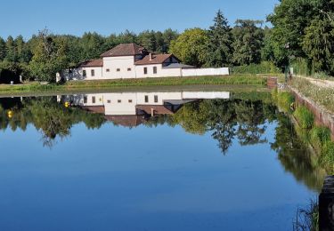
Belle randonnée par journée ensoleillée

Elevation profile

Positioning

Country:
France
Region :
Bourgogne-Franche-Comté
Department/Province :
Yonne
Municipality :
Bléneau
Location:
Unknown
Start:(UTM)
495646 ; 5279598 (31T) N.

Trails nearby

Trail Walking Breteau - tour de la Garenne de Reuilly en Puisaye - Photo
Walking
Jean-MarieFaux

Walking

Very easy
Breteau, Centre-Loire Valley, Loiret, France
5.3 km | 5.9 km-effort
1h 32min
Yes
Trail Walking Bléneau - Rando des étangs  - Photo
Walking
Ordijamo45

Walking

Easy
Bléneau, Bourgogne-Franche-Comté, Yonne, France
16 km | 17.6 km-effort
3h 0min
Yes
Trail Walking Bléneau - Bleneaux 89 - Photo
Walking
picouleau220345

Walking

Easy
Bléneau, Bourgogne-Franche-Comté, Yonne, France
9.6 km | 10.6 km-effort
3h 15min
Yes
Trail Walking Champoulet - Champoulet (les étangs) - Photo
Walking
Ordijamo45

Walking

Very easy
Champoulet, Centre-Loire Valley, Loiret, France
9.4 km | 10.3 km-effort
2h 20min
Yes
Trail Walking Champoulet - Champoulet - Photo
Walking
Ordijamo45

Walking

Medium
Champoulet, Centre-Loire Valley, Loiret, France
9.8 km | 10.8 km-effort
2h 42min
Yes
Trail Walking Champoulet - Autour des étangs de Champoulet - Photo
Walking
Ordijamo45

Walking

Very easy
Champoulet, Centre-Loire Valley, Loiret, France
10.7 km | 11.9 km-effort
2h 38min
Yes
Trail Equestrian Saint-Privé - Géro.Etape5 - Photo
Equestrian
aucamus

Equestrian

Very easy
Saint-Privé, Bourgogne-Franche-Comté, Yonne, France
34 km | 37 km-effort
5h 0min
No
Trail Walking Saint-Privé - Saint Privé  - Photo
Walking
Ordijamo45

Walking

Easy
Saint-Privé, Bourgogne-Franche-Comté, Yonne, France
14.5 km | 16.5 km-effort
3h 37min
Yes
Trail Walking Breteau - De digues en digues à Champoulet - Photo
Walking
Ordijamo45

Walking

Easy
Breteau, Centre-Loire Valley, Loiret, France
15.5 km | 17.1 km-effort
3h 46min
Yes


Close
My subscriptions