Trail Mountain bike Sainte-Maxime - La nartelle - les saquedes - Photo
© OpenStreetMap contributors
Length
Length
27 km
Max alt
Max alt
321 m
Uphill gradient
Uphill gradient
538 m
Km-Effort
Km-Effort  
35 km
Min alt
Min alt
2 m
Downhill gradient
Downhill gradient
533 m
Boucle
Boucle
No
Creation date :
2017-04-16 00:00:00.0
Updated on :
2017-04-16 00:00:00.0

(0 Reviews)

Mountain bike
Mountain bike
2h35
Difficulty : Medium

Scan this QR Code to open this trail in the SityTrail application

FREE GPS app for hiking

Logo SityTrail SityTrail

IGN / Geographical institutes

Download SityTrail from the App Store Download SityTrail from Google Play

Logo SityTrail SityTrail World

The world is yours!

Download SityTrail from the App Store Download SityTrail from Google Play Download SityTrail on Huawei AppGallery

About

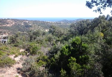
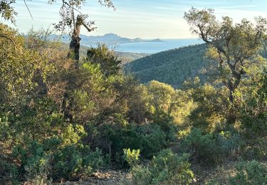
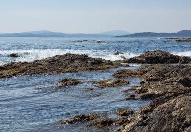
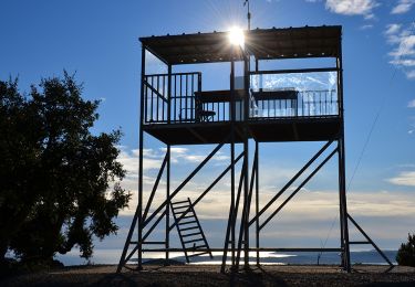
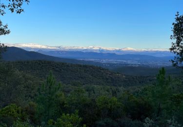
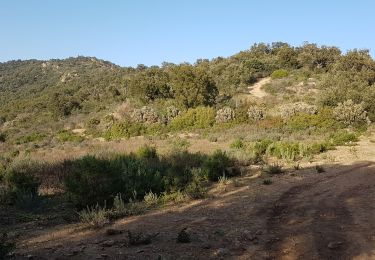
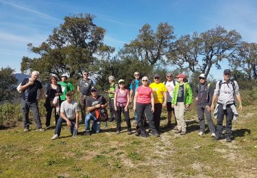
Trail Mountain bike of 27 km to be discovered at Provence-Alpes-Côte d'Azur, Var, Sainte-Maxime. This trail is proposed by jm.lemore.

Description

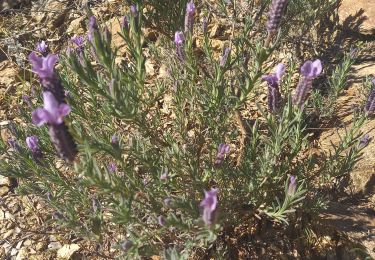
niveau moyen. très jolie balade et variée.  Les débutants peuvent poser le pied à terre 2 ou 3 fois, mais ça passe.

Elevation profile

Positioning

Country:
France
Region :
Provence-Alpes-Côte d'Azur
Department/Province :
Var
Municipality :
Sainte-Maxime
Location:
Unknown
Start:(UTM)
310647 ; 4799002 (32T) N.

Trails nearby

Trail Walking Sainte-Maxime - la baumette - Photo
Walking
perrucheone

Walking

Easy
(1)
Sainte-Maxime, Provence-Alpes-Côte d'Azur, Var, France
8.1 km | 10.6 km-effort
2h 25min
Yes
Trail Walking Roquebrune-sur-Argens - Col du Bougnon : la Garonnette - Photo
Walking
ETMU5496

Walking

Medium
Roquebrune-sur-Argens, Provence-Alpes-Côte d'Azur, Var, France
17.6 km | 28 km-effort
6h 16min
Yes
Trail Walking Sainte-Maxime - Circuit du Deffend 12.3.23 - Photo
Walking
GUIDE
fredetpascale

Walking

Easy
Sainte-Maxime, Provence-Alpes-Côte d'Azur, Var, France
8.4 km | 12.4 km-effort
2h 15min
Yes
Trail Walking Roquebrune-sur-Argens - LES ISSAMBRES - BOUCLE PAR SAN PEIRE - Photo
Walking
jean-marie.parachini

Walking

Easy
Roquebrune-sur-Argens, Provence-Alpes-Côte d'Azur, Var, France
8.8 km | 11.5 km-effort
5h 6min
Yes
Trail Walking Roquebrune-sur-Argens - les petites maures Roquebrume s Argens - Photo
Walking
Matamimi

Walking

Medium
Roquebrune-sur-Argens, Provence-Alpes-Côte d'Azur, Var, France
7.6 km | 11.1 km-effort
2h 7min
Yes
Trail Walking Roquebrune-sur-Argens - Col du Bougnon - Peigros - Photo
Walking
LtZIP

Walking

Very difficult
(2)
Roquebrune-sur-Argens, Provence-Alpes-Côte d'Azur, Var, France
15.9 km | 24 km-effort
4h 4min
No
Trail Walking Roquebrune-sur-Argens - Le Peigros depuis le Bougnon - Photo
Walking
ETMU5496

Walking

Medium
Roquebrune-sur-Argens, Provence-Alpes-Côte d'Azur, Var, France
16.2 km | 25 km-effort
3h 58min
Yes
Trail Walking Sainte-Maxime - SAINTE-MAXIME - LE DEFFEND - Photo
Walking
jean-marie.parachini

Walking

Easy
Sainte-Maxime, Provence-Alpes-Côte d'Azur, Var, France
7.5 km | 11.2 km-effort
3h 5min
Yes
Trail Walking Roquebrune-sur-Argens - Issambres - Photo
Walking
Benteux

Walking

Very easy
Roquebrune-sur-Argens, Provence-Alpes-Côte d'Azur, Var, France
3.4 km | 5.2 km-effort
2h 12min
Yes


Close
My subscriptions