Trail Walking Méjannes-le-Clap - Cyclemeter-Hike-20170413-0841.gpx - Photo

Cyclemeter-Hike-20170413-0841.gpx

© OpenStreetMap contributors
Length
Length
16.3 km
Max alt
Max alt
306 m
Uphill gradient
Uphill gradient
311 m
Km-Effort
Km-Effort  
20 km
Min alt
Min alt
98 m
Downhill gradient
Downhill gradient
309 m
Boucle
Boucle
Yes
Creation date :
2017-04-13 00:00:00.0
Updated on :
2017-04-13 00:00:00.0

(0 Reviews)

Walking
Walking
--
Difficulty : Difficult

Scan this QR Code to open this trail in the SityTrail application

FREE GPS app for hiking

Logo SityTrail SityTrail

IGN / Geographical institutes

Download SityTrail from the App Store Download SityTrail from Google Play

Logo SityTrail SityTrail World

The world is yours!

Download SityTrail from the App Store Download SityTrail from Google Play Download SityTrail on Huawei AppGallery

About

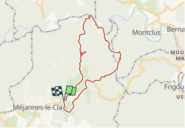
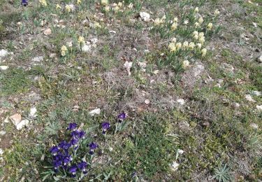
Trail Walking of 16.3 km to be discovered at Occitania, Gard, Méjannes-le-Clap. This trail is proposed by boudatadec.

Description

Cyclemeter Randonnée 13 avr. 2017 à 08:41:39

Elevation profile

Positioning

Country:
France
Region :
Occitania
Department/Province :
Gard
Municipality :
Méjannes-le-Clap
Location:
Unknown
Start:(UTM)
609043 ; 4898052 (31T) N.

Trails nearby

Trail Walking Lussan - Concluses de Lussan - Photo
Walking
GUIDE
nadinebondoux

Walking

Difficult
Lussan, Occitania, Gard, France
26 km | 0 m-effort
5h 46min
No
Trail Walking Tharaux - Tharaux - Photo
Walking
GUIDE
Roger Philippe Wallez

Walking

Very difficult
Tharaux, Occitania, Gard, France
17.8 km | 23 km-effort
7h 10min
Yes
Trail Walking Montclus - Montclus - Photo
Walking
PhilippeetEvelyne

Walking

Medium
(1)
Montclus, Occitania, Gard, France
6.3 km | 9.6 km-effort
1h 36min
Yes
Trail Walking Montclus - montclus - Photo
Walking
toinou30

Walking

Medium
Montclus, Occitania, Gard, France
17.8 km | 26 km-effort
6h 13min
Yes
Trail Walking Tharaux - Tharaux la Cèze  - Photo
Walking
GUIDE
nadinebondoux

Walking

Medium
Tharaux, Occitania, Gard, France
18.8 km | 25 km-effort
6h 11min
Yes
Trail Walking Méjannes-le-Clap - mejannes le clap  - Photo
Walking
Vero7684

Walking

Medium
Méjannes-le-Clap, Occitania, Gard, France
14.4 km | 19.3 km-effort
5h 19min
Yes
Trail Walking Méjannes-le-Clap - Mejannes le clap par Rocher de l'Aigle - Photo
Walking
GUIDE
nadinebondoux

Walking

Difficult
Méjannes-le-Clap, Occitania, Gard, France
15.3 km | 21 km-effort
5h 14min
Yes
Trail Walking Méjannes-le-Clap - grotte Aven de Peyre haute - Photo
Walking
GUIDE
amiral13

Walking

Very easy
(1)
Méjannes-le-Clap, Occitania, Gard, France
3.6 km | 4.6 km-effort
1h 13min
Yes
Trail Walking Montclus - Montclus petite boucle.  - Photo
Walking
aitkhedache

Walking

Easy
Montclus, Occitania, Gard, France
9.7 km | 14.1 km-effort
5h 56min
Yes


Close
My subscriptions