Trail Walking Sost - Boucle au départ de Sost - Photo

Boucle au départ de Sost

 Rouzier
Rouzier

User

© OpenStreetMap contributors
Length
Length
12.4 km
Max alt
Max alt
1742 m
Uphill gradient
Uphill gradient
1023 m
Km-Effort
Km-Effort  
26 km
Min alt
Min alt
753 m
Downhill gradient
Downhill gradient
1027 m
Boucle
Boucle
Yes
Creation date :
2017-04-09 00:00:00.0
Updated on :
2017-04-09 00:00:00.0

(0 Reviews)

Walking
Walking
5h27
Difficulty : Medium

Scan this QR Code to open this trail in the SityTrail application

FREE GPS app for hiking

Logo SityTrail SityTrail

IGN / Geographical institutes

Download SityTrail from the App Store Download SityTrail from Google Play

Logo SityTrail SityTrail World

The world is yours!

Download SityTrail from the App Store Download SityTrail from Google Play Download SityTrail on Huawei AppGallery

About

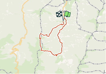
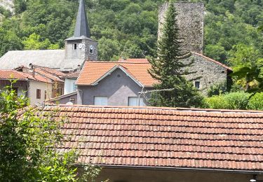
Trail Walking of 12.4 km to be discovered at Occitania, Hautespyrenees, Sost. This trail is proposed by Rouzier.

Description

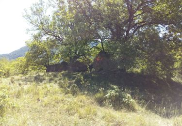
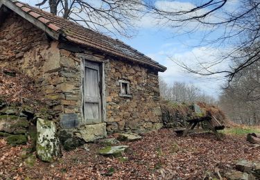
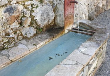
Cap de la Lane,début du chemin des Poupets,bois de la Coste Doradé,fontaine de l'Arrait,col à 1652m,PIC de POUY USCLAT(1755m),pic du Mail de Compiens,passage de la Courbe,cabane de la Courbe,cabane de Bourgelas,piste rive droite de l'Ourse(long:1h environ) ,retour Cap de la Lane.

Elevation profile

Positioning

Country:
France
Region :
Occitania
Department/Province :
Hautespyrenees
Municipality :
Sost
Location:
Unknown
Start:(UTM)
300675 ; 4754798 (31T) N.

Trails nearby

Trail Walking Mauléon-Barousse - MAULEON-BAROUSSE la boucle des 2 ourses G3 2703781 - Photo
Walking
GUIDE
marmotte65

Walking

Easy
Mauléon-Barousse, Occitania, Hautespyrenees, France
9.5 km | 14.9 km-effort
2h 50min
Yes
Trail Walking Mauléon-Barousse - MAULEON BAROUSSE la rando de Payremilla (G3) faite le 23/10/2020 - Photo
Walking
GUIDE
marmotte65

Walking

Medium
Mauléon-Barousse, Occitania, Hautespyrenees, France
11.6 km | 16.9 km-effort
5h 3min
Yes
Trail Walking Mauléon-Barousse - MAULEON BAROUSSE Circuit des amis du Lac
Walking
GUIDE
marmotte65

Walking

Difficult
Mauléon-Barousse, Occitania, Hautespyrenees, France
11.5 km | 19.1 km-effort
3h 45min
Yes
Trail Walking Ferrère - pic de Douly en boucle depuis Ferrère  - Photo
Walking
GUIDE
lhomme.ph

Walking

Medium
Ferrère, Occitania, Hautespyrenees, France
12.4 km | 25 km-effort
5h 56min
Yes
Trail On foot Mauléon-Barousse - Mauleon Barousse-Esbareich-Ourde - Photo
On foot
mitch1952

On foot

Very easy
(1)
Mauléon-Barousse, Occitania, Hautespyrenees, France
7.2 km | 11.3 km-effort
3h 0min
Yes
Trail Walking Mauléon-Barousse - Mauléon Esbareich Boucle  - Photo
Walking
GUIDE
lhomme.ph

Walking

Medium
Mauléon-Barousse, Occitania, Hautespyrenees, France
7.5 km | 11.3 km-effort
2h 45min
Yes
Trail Walking Ferrère - départ Ferrere , Ourde sortie du bois Douly redescende normale rando perso avec Michelle - Photo
Walking
Jeanne Pene

Walking

Medium
Ferrère, Occitania, Hautespyrenees, France
13.9 km | 27 km-effort
6h 43min
Yes
Trail Walking Mauléon-Barousse - Mauleon bar rousse - Photo
Walking
papounet32

Walking

Difficult
Mauléon-Barousse, Occitania, Hautespyrenees, France
12.3 km | 17.7 km-effort
3h 19min
Yes
Trail Walking Ferrère - Marrougne en boucle depuis Ferrère  - Photo
Walking
GUIDE
lhomme.ph

Walking

Very difficult
Ferrère, Occitania, Hautespyrenees, France
9.9 km | 20 km-effort
5h 59min
Yes


Close
My subscriptions