![](/images/other/stat-length.png)
![Trail Mountain bike Pont-Noyelles - Le passage aux loups - Pont-Noyelles - Photo](https://media.geolcdn.com/t/1900/400/ext.pjpeg?maxdim=2&url=https%3A%2F%2Fstatic1.geolcdn.com%2Fsiteimages%2Fupload%2Ffiles%2F1524743154velo.jpg)
Le passage aux loups - Pont-Noyelles
Baltykatt
User
![Length](/images/other/stat-length.png)
Length
13.8 km
![Max alt](https://static1.geolcdn.com/siteimages/upload/files/1508320355ic_sort_altitude_max_24dp.png)
Max alt
96 m
![Uphill gradient](https://static1.geolcdn.com/siteimages/upload/files/1508320355ic_sort_den_pos_24dp.png)
Uphill gradient
146 m
![Km-Effort](/images/other/stat-length.png)
Km-Effort
15.8 km
![Min alt](https://static1.geolcdn.com/siteimages/upload/files/1508320355ic_sort_altitude_min_24dp.png)
Min alt
26 m
![Downhill gradient](https://static1.geolcdn.com/siteimages/upload/files/1508320355ic_sort_den_neg_24dp.png)
Downhill gradient
147 m
![Boucle](https://static1.geolcdn.com/siteimages/upload/files/16400158638029165_repeat_loop_refresh_sync_direction_icon.png)
Boucle
Yes
Creation date :
2014-12-10 00:00:00.0
Updated on :
2014-12-10 00:00:00.0
![Mountain bike](https://static1.geolcdn.com/sitytour/trail-icons/202.png)
1h15
Difficulty : Medium
![Scan this QR Code to open this trail in the SityTrail application](https://capi.geolives.com/qq0zvz2zws4bq2lad0pu/sitytour/trails/728784/qr.png?size=200)
FREE GPS app for hiking
About
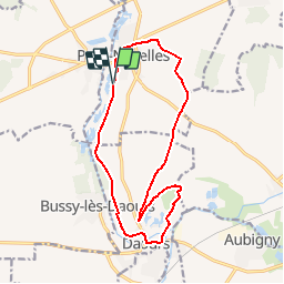
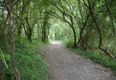
Trail Mountain bike of 13.8 km to be discovered at Hauts-de-France, Somme, Pont-Noyelles. This trail is proposed by Baltykatt.
Description
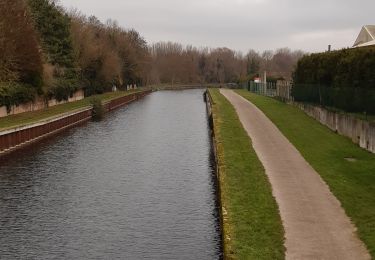
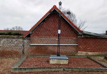
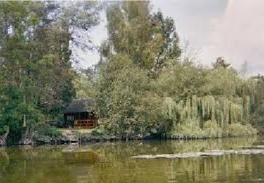
Entre points de vue d’exception, monuments historiques et sites naturels tous vos sens seront mis en éveil lors de cette balade. Départ de la route du camping de Pont-Noyelles. Téléchargez la fiche du circuit.
Positioning
Country:
France
Region :
Hauts-de-France
Department/Province :
Somme
Municipality :
Pont-Noyelles
Location:
Unknown
Start:(Dec)
Start:(UTM)
459660 ; 5531451 (31U) N.
Comments
Trails nearby
![Trail Walking Corbie - Les rives de Somme de Corbie à Amiens - Photo](https://media.geolcdn.com/t/375/260/b950c723-196c-4705-b4c8-c7caaabdf39d.jpg&format=jpg&maxdim=2)
![Walking Walking](https://static1.geolcdn.com/sitytour/trail-icons/101.png)
Les rives de Somme de Corbie à Amiens
Walking
Medium
Corbie,
Hauts-de-France,
Somme,
France
![](/images/other/stat-length.png)
21 km | 22 km-effort
4h 31min
![](https://static1.geolcdn.com/siteimages/upload/files/16400158638029165_repeat_loop_refresh_sync_direction_icon.png)
No
![Trail On foot Daours - Le Passage aux Loups - Photo](https://media.geolcdn.com/t/375/260/c0a6c8f5-02d2-4dbd-8744-0550644a54a7.jpeg&format=jpg&maxdim=2)
![On foot On foot](https://static1.geolcdn.com/sitytour/trail-icons/100.png)
Le Passage aux Loups
On foot
Easy
Daours,
Hauts-de-France,
Somme,
France
![](/images/other/stat-length.png)
13.9 km | 15.9 km-effort
3h 36min
![](https://static1.geolcdn.com/siteimages/upload/files/16400158638029165_repeat_loop_refresh_sync_direction_icon.png)
Yes
![Trail Quad Fouilloy - 30 juil. 2019 14:04:21 - Photo](https://media.geolcdn.com/t/375/260/2fe84f10-c8aa-4a4e-9c7d-13d62879c110.jpg&format=jpg&maxdim=2)
![Quad Quad](https://static1.geolcdn.com/sitytour/trail-icons/404.png)
30 juil. 2019 14:04:21
Quad
Medium
(1)
Fouilloy,
Hauts-de-France,
Somme,
France
![](/images/other/stat-length.png)
103 km | 122 km-effort
Unknown
![](https://static1.geolcdn.com/siteimages/upload/files/16400158638029165_repeat_loop_refresh_sync_direction_icon.png)
No
![Trail Mountain bike Pont-Noyelles - Le passage aux loups - Pont-Noyelles - Photo](https://media.geolcdn.com/t/375/260/ext.jpg?maxdim=2&url=https%3A%2F%2Fservices.sitytrail.com%2FGeolivesWS%2FDownloadMedia.ashx%3FTrailID%3D215211%26Media%3D15824_5.jpg)
![Mountain bike Mountain bike](https://static1.geolcdn.com/sitytour/trail-icons/202.png)
Le passage aux loups - Pont-Noyelles
Mountain bike
Medium
Pont-Noyelles,
Hauts-de-France,
Somme,
France
![](/images/other/stat-length.png)
13.8 km | 15.7 km-effort
1h 15min
![](https://static1.geolcdn.com/siteimages/upload/files/16400158638029165_repeat_loop_refresh_sync_direction_icon.png)
Yes
![Trail Walking Pont-Noyelles - Le passage aux loups - Pont-Noyelles - Photo](https://media.geolcdn.com/t/375/260/ext.jpg?maxdim=2&url=https%3A%2F%2Fservices.sitytrail.com%2FGeolivesWS%2FDownloadMedia.ashx%3FTrailID%3D215210%26Media%3D15824_5.jpg)
![Walking Walking](https://static1.geolcdn.com/sitytour/trail-icons/101.png)
Le passage aux loups - Pont-Noyelles
Walking
Difficult
(1)
Pont-Noyelles,
Hauts-de-France,
Somme,
France
![](/images/other/stat-length.png)
13.8 km | 15.7 km-effort
4h 40min
![](https://static1.geolcdn.com/siteimages/upload/files/16400158638029165_repeat_loop_refresh_sync_direction_icon.png)
Yes
![Trail Quad Fouilloy - 2022-05-08_16h40m10_SityTrail - 2795546 - rando-fouilloy - Photo](https://media.geolcdn.com/t/375/260/ext.jpg?maxdim=2&url=https%3A%2F%2Fstatic1.geolcdn.com%2Fsiteimages%2Fupload%2Ffiles%2F15247431544x4.jpg)
![Quad Quad](https://static1.geolcdn.com/sitytour/trail-icons/404.png)
2022-05-08_16h40m10_SityTrail - 2795546 - rando-fouilloy
Quad
Easy
Fouilloy,
Hauts-de-France,
Somme,
France
![](/images/other/stat-length.png)
73 km | 84 km-effort
Unknown
![](https://static1.geolcdn.com/siteimages/upload/files/16400158638029165_repeat_loop_refresh_sync_direction_icon.png)
No
![Trail Walking Béhencourt - Le circuit des monts - Photo](https://media.geolcdn.com/t/375/260/ext.jpg?maxdim=2&url=https%3A%2F%2Fstatic1.geolcdn.com%2Fsiteimages%2Fupload%2Ffiles%2F1553511878bg_sport_marche.png)
![Walking Walking](https://static1.geolcdn.com/sitytour/trail-icons/101.png)
Le circuit des monts
Walking
Medium
Béhencourt,
Hauts-de-France,
Somme,
France
![](/images/other/stat-length.png)
16.4 km | 18.6 km-effort
Unknown
![](https://static1.geolcdn.com/siteimages/upload/files/16400158638029165_repeat_loop_refresh_sync_direction_icon.png)
Yes
![Trail Walking Fréchencourt - frechencourt - Photo](https://media.geolcdn.com/t/375/260/ext.jpg?maxdim=2&url=https%3A%2F%2Fstatic1.geolcdn.com%2Fsiteimages%2Fupload%2Ffiles%2F1553511878bg_sport_marche.png)
![Walking Walking](https://static1.geolcdn.com/sitytour/trail-icons/101.png)
frechencourt
Walking
Medium
Fréchencourt,
Hauts-de-France,
Somme,
France
![](/images/other/stat-length.png)
20 km | 24 km-effort
4h 5min
![](https://static1.geolcdn.com/siteimages/upload/files/16400158638029165_repeat_loop_refresh_sync_direction_icon.png)
Yes
![Trail Horseback riding Pont-Noyelles - Jour 1 equirando - Photo](https://media.geolcdn.com/t/375/260/ext.jpg?maxdim=2&url=https%3A%2F%2Fstatic1.geolcdn.com%2Fsiteimages%2Fupload%2Ffiles%2F1524743154cheval.jpg)
![Horseback riding Horseback riding](https://static1.geolcdn.com/sitytour/trail-icons/301.png)
Jour 1 equirando
Horseback riding
Medium
Pont-Noyelles,
Hauts-de-France,
Somme,
France
![](/images/other/stat-length.png)
26 km | 29 km-effort
5h 29min
![](https://static1.geolcdn.com/siteimages/upload/files/16400158638029165_repeat_loop_refresh_sync_direction_icon.png)
No