


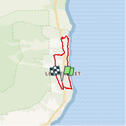

3.8 km | 10.1 km-effort


User


FREE GPS app for hiking
 SityTrail
IGN / Geographical institutes
SityTrail World
The world is yours!
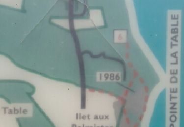
Trail Walking of 11.9 km to be discovered at Réunion, Unknown, Saint-Philippe. This trail is proposed by Fdum.
Belle balade, avec le littoral pour finir. Eviter les journées pluvieuses, car ça glisse. En avril les herbes sont hautes, sur certains secteurs !!!

Walking
Walking

Walking

Walking

Other activity


sport

Road bike
Walking