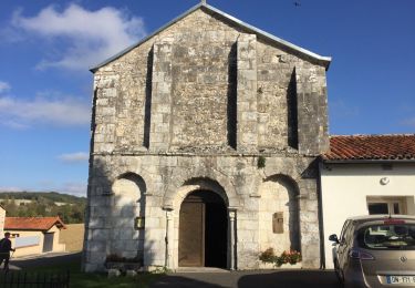
7.4 km | 9.4 km-effort
Pereuil
dorcier
User
Length
9.9 km
Max alt
131 m
Uphill gradient
161 m
Km-Effort
12 km
Min alt
55 m
Downhill gradient
160 m
Boucle
Yes
Creation date :
2017-03-27 00:00:00.0
Updated on :
2017-03-27 00:00:00.0
2h37
Difficulty : Easy
FREE GPS app for hiking
About
Trail Walking of 9.9 km to be discovered at New Aquitaine, Charente, Val-des-Vignes. This trail is proposed by dorcier.
Description
départ place de la mairie.
Positioning
Country:
France
Region :
New Aquitaine
Department/Province :
Charente
Municipality :
Val-des-Vignes
Location:
Péreuil
Start:(Dec)
Start:(UTM)
732647 ; 5040704 (30T) N.
Comments
Trails nearby
SAINT AULAIS pour AJM
Walking
Difficult
Saint-Aulais-la-Chapelle,
New Aquitaine,
Charente,
France
11.1 km | 12.9 km-effort
2h 49min
Yes
Maine Giraud, Champagne-Vigny
Walking
Easy
Champagne-Vigny,
New Aquitaine,
Charente,
France
12.2 km | 14.8 km-effort
3h 13min
Yes
chemin des moulins-Pereuil - 31-08-2014
Walking
Medium
Val-des-Vignes,
New Aquitaine,
Charente,
France
17.3 km | 21 km-effort
3h 48min
Yes
Blanzac-Pereuil
Walking
Easy
Val-des-Vignes,
New Aquitaine,
Charente,
France
12.1 km | 14.4 km-effort
2h 33min
Yes
champagne vigny
Other activity
Very easy
Champagne-Vigny,
New Aquitaine,
Charente,
France
15.1 km | 18.5 km-effort
Unknown
Yes
Charente 2eme partie
4x4
Very easy
Champagne-Vigny,
New Aquitaine,
Charente,
France
56 km | 68 km-effort
2h 6min
No
Blanzac
Walking
Medium
Coteaux-du-Blanzacais,
New Aquitaine,
Charente,
France
8.7 km | 10.3 km-effort
2h 15min
Yes
Pereuil
Walking
Difficult
Val-des-Vignes,
New Aquitaine,
Charente,
France
10.4 km | 12.8 km-effort
2h 39min
Yes