Trail Walking Baren - Grande boucle Baren - Photo

Grande boucle Baren

 Rouzier
Rouzier

User

© OpenStreetMap contributors
Length
Length
13.4 km
Max alt
Max alt
2141 m
Uphill gradient
Uphill gradient
1350 m
Km-Effort
Km-Effort  
31 km
Min alt
Min alt
857 m
Downhill gradient
Downhill gradient
1347 m
Boucle
Boucle
Yes
Creation date :
2017-03-14 00:00:00.0
Updated on :
2017-03-14 00:00:00.0

(0 Reviews)

Walking
Walking
6h17
Difficulty : Difficult

Scan this QR Code to open this trail in the SityTrail application

FREE GPS app for hiking

Logo SityTrail SityTrail

IGN / Geographical institutes

Download SityTrail from the App Store Download SityTrail from Google Play

Logo SityTrail SityTrail World

The world is yours!

Download SityTrail from the App Store Download SityTrail from Google Play Download SityTrail on Huawei AppGallery

About

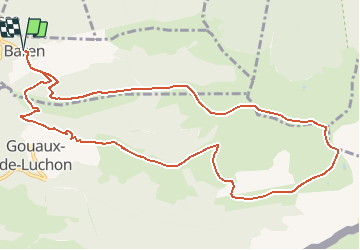
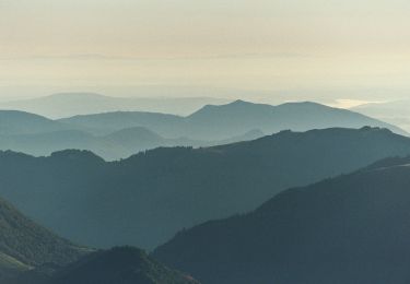
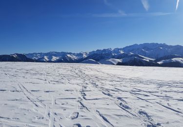
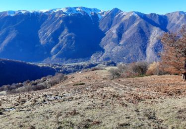
Trail Walking of 13.4 km to be discovered at Occitania, Haute-Garonne, Baren. This trail is proposed by Rouzier.

Description

Baren,Crête de Sarrat Médan,Maillot des Clots,Pic de Burat,Pic de Bassioues,Cabane du Mouscadé,Cabane de Salode,Granges d'Echart,Gouaux,Baren.

Elevation profile

Positioning

Country:
France
Region :
Occitania
Department/Province :
Haute-Garonne
Municipality :
Baren
Location:
Unknown
Start:(UTM)
305506 ; 4749004 (31T) N.

Trails nearby

Trail Walking Baren - mail de la Pique 01 2018 - Photo
Walking
chrisgps

Walking

Very easy
(1)
Baren, Occitania, Haute-Garonne, France
7.6 km | 19.1 km-effort
4h 55min
Yes
Trail Walking Artigue - ARTIGUE - Gouaux de Luchon - chemin forestier - Photo
Walking
josy31

Walking

Medium
(1)
Artigue, Occitania, Haute-Garonne, France
13.7 km | 23 km-effort
3h 21min
Yes
Trail Walking Artigue - Artigue par la cabane du plan Bosc et la cabane de Saunères - Photo
Walking
swp648

Walking

Difficult
Artigue, Occitania, Haute-Garonne, France
10.5 km | 18.3 km-effort
4h 10min
Yes
Trail Walking Baren - Mail de la Pique depuis Baren - Photo
Walking
GUIDE
lhomme.ph

Walking

Difficult
Baren, Occitania, Haute-Garonne, France
9.8 km | 23 km-effort
6h 43min
Yes
Trail Walking Artigue - 2022-02-26 Artigue - cabane de peyrehitte - mont Majou -  luchonais - Photo
Walking
jacq58

Walking

Difficult
Artigue, Occitania, Haute-Garonne, France
12 km | 22 km-effort
3h 33min
Yes
Trail On foot Artigue - Pic de Bacanère - Photo
On foot
GUIDE+

On foot

Easy
Artigue, Occitania, Haute-Garonne, France
8.3 km | 18.3 km-effort
4h 9min
No
Trail Walking Artigue - Le Montmajou en boucle depuis Artigue - Photo
Walking
GUIDE
lhomme.ph

Walking

Medium
Artigue, Occitania, Haute-Garonne, France
11.1 km | 23 km-effort
6h 7min
Yes
Trail Walking Gouaux-de-Luchon - cabane de Salode en boucle depuis Gouaux de Luchon - Photo
Walking
GUIDE
lhomme.ph

Walking

Easy
Gouaux-de-Luchon, Occitania, Haute-Garonne, France
8.2 km | 16.9 km-effort
5h 20min
Yes
Trail Walking Antignac - cap de Salieres en boucle depuis Antignac - Photo
Walking
chrisgps

Walking

Difficult
Antignac, Occitania, Haute-Garonne, France
12.7 km | 28 km-effort
8h 8min
Yes


Close
My subscriptions