Trail Walking Meinisberg - L'ancien cours de l'Aar 03.17 - Photo
 duamerg
duamerg

User

© OpenStreetMap contributors
Length
Length
14.5 km
Max alt
Max alt
441 m
Uphill gradient
Uphill gradient
77 m
Km-Effort
Km-Effort  
15.6 km
Min alt
Min alt
424 m
Downhill gradient
Downhill gradient
77 m
Boucle
Boucle
Yes
Creation date :
2017-03-15 00:00:00.0
Updated on :
2020-01-30 13:56:18.469

(0 Reviews)

Walking
Walking
3h26
Difficulty : Very easy

Scan this QR Code to open this trail in the SityTrail application

FREE GPS app for hiking

Logo SityTrail SityTrail

IGN / Geographical institutes

Download SityTrail from the App Store Download SityTrail from Google Play

Logo SityTrail SityTrail World

The world is yours!

Download SityTrail from the App Store Download SityTrail from Google Play Download SityTrail on Huawei AppGallery

About

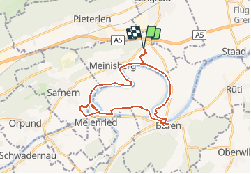
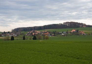
Trail Walking of 14.5 km to be discovered at Bern, Biel/Bienne administrative district, Meinisberg. This trail is proposed by duamerg.

Description

Laisser la voiture au cimetière de Meinisberg ou alors venir en train et commencer la ballade à Büren. Rejoindre l'ancien cours d'eau pour trouver le chemin pédestre que l'on suit de bout en bout.
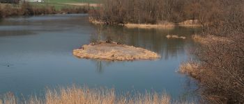
Tout cet ancien cours de l'Aar est maintenant d'importance nationale pour la faune aquatique.
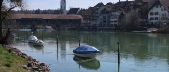
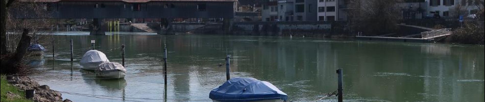
Vous visiterez l'intéressant ancien bourg de Büren an der Aare avec son pont en bois couvert. Vous aurez l'occasion de monter sur un observatoire, n'oubliez pas les jumelles.
Tout le parcours est agrémenté de bancs chaque fois que l'on a une vue sur le cours d'eau.
Jolis chemins de bout en bout.
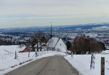
Ballade à faire au printemps comme bonne mise en jambe ou alors en arrière saison.

Elevation profile

Photos

Points of interest

Point of interest Büren an der Aare - pont en bois et petit bourg de Büren an der aare - Photo
duamerg
BÜREN AN DER AARE 
Point of interest Büren an der Aare - Büren an der Aare - Photo
duamerg
BÜREN AN DER AARE 
Point of interest Meinisberg - station météo - Photo
duamerg
MEINISBERG 
Point of interest Büren an der Aare - ancien cours de l'Aar - Photo
duamerg
BÜREN AN DER AARE 

Positioning

Country:
Switzerland
Region :
Bern
Department/Province :
Biel/Bienne administrative district
Municipality :
Meinisberg
Location:
Unknown
Start:(UTM)
375836 ; 5224804 (32T) N.

Trails nearby

Trail On foot Lengnau (BE) - Wurzelweg - Photo
On foot
GUIDE+

On foot

Easy
Lengnau (BE), Bern, Biel/Bienne administrative district, Switzerland
4.2 km | 6.1 km-effort
1h 23min
Yes
Trail On foot Pieterlen - Bözingenberg - fixme - Photo
On foot
GUIDE+

On foot

Easy
Pieterlen, Bern, Biel/Bienne administrative district, Switzerland
5.5 km | 9.8 km-effort
2h 14min
No
Trail On foot Oberwil bei Büren - Oberwil - Photo
On foot
GUIDE+

On foot

Easy
Oberwil bei Büren, Bern, Seeland administrative district, Switzerland
3.2 km | 4.7 km-effort
1h 3min
No
Trail On foot Oberwil bei Büren - Büren a.A.- Oberwil - Photo
On foot
GUIDE+

On foot

Easy
Oberwil bei Büren, Bern, Seeland administrative district, Switzerland
3.4 km | 4.5 km-effort
1h 1min
No
Trail On foot Oberwil bei Büren - Oberwil - Forsthaus Biezwil - Photo
On foot
GUIDE+

On foot

Easy
Oberwil bei Büren, Bern, Seeland administrative district, Switzerland
5.4 km | 7.7 km-effort
1h 44min
No
Trail On foot Romont (BE) - Romont - La Bergerie - Photo
On foot
GUIDE+

On foot

Easy
Romont (BE), Bern, Bernese Jura administrative district, Switzerland
3.3 km | 5.6 km-effort
1h 16min
No
Trail On foot Sauge - Montagne de Romont-Plagne - Photo
On foot
GUIDE+

On foot

Easy
Sauge, Bern, Bernese Jura administrative district, Switzerland
4.6 km | 8.6 km-effort
1h 57min
No
Trail On foot Romont (BE) - Montagne de Romont-Plagne - Photo
On foot
GUIDE+

On foot

Easy
Romont (BE), Bern, Bernese Jura administrative district, Switzerland
3.7 km | 4.7 km-effort
1h 4min
No
Trail Walking Grenchen - bike_grenchenberg_2008 - Photo
Walking
GUIDE+

Walking

Very easy
Grenchen, Solothurn, Bezirk Lebern, Switzerland
43 km | 66 km-effort
12h 29min
No


Close
My subscriptions