24 km | 29 km-effort
bourgueil montserau chinon savigny
maxbabine
User
Length
44 km
Max alt
47 m
Uphill gradient
274 m
Km-Effort
47 km
Min alt
24 m
Downhill gradient
289 m
Boucle
No
Creation date :
2014-12-10 00:00:00.0
Updated on :
2014-12-10 00:00:00.0
3h51
Difficulty : Easy
FREE GPS app for hiking
About
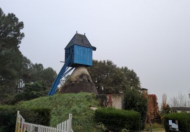
Trail Cycle of 44 km to be discovered at Centre-Loire Valley, Indre-et-Loire, Bourgueil. This trail is proposed by maxbabine.
Positioning
Country:
France
Region :
Centre-Loire Valley
Department/Province :
Indre-et-Loire
Municipality :
Bourgueil
Location:
Unknown
Start:(Dec)
Start:(UTM)
285531 ; 5240916 (31T) N.
Comments
Trails nearby
Bourgueil le Picard - GRP Coteaux de Bourgueil - 24.3km 325m 5h25 (45mn) - 20...
Walking
Medium
Bourgueil,
Centre-Loire Valley,
Indre-et-Loire,
France
5h 25min
Yes
Restigné - GRP Coteaux de Bourgueil Benais Ingrandes-de-Touraine - 24.3km 220...
Walking
Easy
Restigné,
Centre-Loire Valley,
Indre-et-Loire,
France
24 km | 27 km-effort
5h 30min
Yes
Bourgueil la Grande Prairie - GRP Coteaux de Bourgueil - 26.7km 150m 5h55 (45...
Walking
Very difficult
Bourgueil,
Centre-Loire Valley,
Indre-et-Loire,
France
27 km | 29 km-effort
6h 30min
Yes
La Chapelle-sur-Loire - GRP Coteaux de Bourgueil - 26.6km 105m 6h00 (40mn) - ...
Walking
Easy
La Chapelle-sur-Loire,
Centre-Loire Valley,
Indre-et-Loire,
France
27 km | 28 km-effort
6h 0min
Yes
Saint Nicolas de Bourgueil : La forêt et les vignes
Walking
Medium
(1)
Saint-Nicolas-de-Bourgueil,
Centre-Loire Valley,
Indre-et-Loire,
France
14.8 km | 17.7 km-effort
4h 0min
Yes
LA BUTTE A CHÉRON
Mountain bike
Medium
(1)
Bourgueil,
Centre-Loire Valley,
Indre-et-Loire,
France
23 km | 27 km-effort
1h 47min
Yes
BENAIS
Walking
Easy
Benais,
Centre-Loire Valley,
Indre-et-Loire,
France
13 km | 15.3 km-effort
2h 48min
Yes
Bourgueil C
Walking
Easy
Bourgueil,
Centre-Loire Valley,
Indre-et-Loire,
France
8.9 km | 10.5 km-effort
1h 41min
Yes
bourgueil 18
Walking
Easy
Bourgueil,
Centre-Loire Valley,
Indre-et-Loire,
France
39 km | 43 km-effort
5h 54min
No