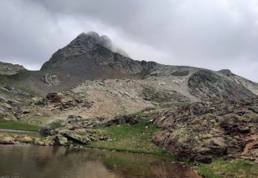
6.4 km | 9.2 km-effort
2011-08-03 15h51m06
tchab
User
Length
6.8 km
Max alt
1009 m
Uphill gradient
222 m
Km-Effort
9.8 km
Min alt
814 m
Downhill gradient
222 m
Boucle
Yes
Creation date :
2014-12-10 00:00:00.0
Updated on :
2014-12-10 00:00:00.0
--
Difficulty : Very easy
FREE GPS app for hiking
About
Trail Walking of 6.8 km to be discovered at Occitania, Hautespyrenees, Saint-Lary-Soulan. This trail is proposed by tchab.
Positioning
Country:
France
Region :
Occitania
Department/Province :
Hautespyrenees
Municipality :
Saint-Lary-Soulan
Location:
Unknown
Start:(Dec)
Start:(UTM)
280990 ; 4743699 (31T) N.
Comments
Trails nearby
lacs de Consaterre
Walking
Difficult
(1)
Ens,
Occitania,
Hautespyrenees,
France
16.5 km | 34 km-effort
6h 56min
Yes
Au col d'Azet
Walking
Medium
(1)
Azet,
Occitania,
Hautespyrenees,
France
7.3 km | 10.5 km-effort
2h 19min
Yes
J4 Néouvelle 2024 : Col d’Azet
Walking
Medium
Azet,
Occitania,
Hautespyrenees,
France
13.7 km | 21 km-effort
4h 40min
Yes
2023-09-10 Azet-Col d'Azet crète de la Serre
Walking
Very difficult
Azet,
Occitania,
Hautespyrenees,
France
11.8 km | 19.4 km-effort
4h 24min
Yes
Au dessus de tramezaigues
sport
Very easy
Tramezaïgues,
Occitania,
Hautespyrenees,
France
3 km | 5.8 km-effort
Unknown
Yes
AZET : Pla d’Ourtigué en boucle
Walking
Medium
Saint-Lary-Soulan,
Occitania,
Hautespyrenees,
France
16.9 km | 25 km-effort
4h 22min
No
Vieille Aure-Trachère
Walking
Medium
Saint-Lary-Soulan,
Occitania,
Hautespyrenees,
France
14.4 km | 20 km-effort
3h 46min
Yes
lacs des Miares depuis le col d'Azet
Walking
Medium
Azet,
Occitania,
Hautespyrenees,
France
10.4 km | 24 km-effort
7h 13min
Yes
Très bien fait
Sympa on peut y croiser des vtt, pensez à vous protéger des moustiques pour les passages en forêt