


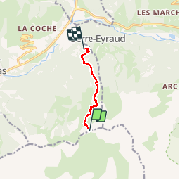

7.4 km | 12.1 km-effort


User


FREE GPS app for hiking
 SityTrail
IGN / Geographical institutes
SityTrail World
The world is yours!
Trail Snowshoes of 5.2 km to be discovered at Provence-Alpes-Côte d'Azur, Hautes-Alpes, Saint-Jean-Saint-Nicolas. This trail is proposed by motardes04.
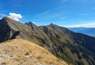
Ski de randonnée.
Facile sauf sur les conditions et qualité de neige ...
En haut, trafol et quelques passages entre poudreux / neige de printemps, milieu façon piste de ski damée, forêt insuffisamment enneigée, et chemins en neige dure traffolée ramollie / regelée.
On a fini skis sur le dos à partir de 1450 m environ (piste impraticable en ski).

Walking

Running

Walking
Walking

Walking

Walking

Walking

Walking
Walking