Trail Walking Castañar de Ibor - J4-Castanar-Fresnedoso-par-Avellaneda - Photo

J4-Castanar-Fresnedoso-par-Avellaneda

 PatRando
PatRando

User

© OpenStreetMap contributors
Length
Length
19.2 km
Max alt
Max alt
667 m
Uphill gradient
Uphill gradient
378 m
Km-Effort
Km-Effort  
25 km
Min alt
Min alt
412 m
Downhill gradient
Downhill gradient
521 m
Boucle
Boucle
No
Creation date :
2017-02-24 00:00:00.0
Updated on :
2017-02-24 00:00:00.0

(0 Reviews)

Walking
Walking
5h11
Difficulty : Unknown

Scan this QR Code to open this trail in the SityTrail application

FREE GPS app for hiking

Logo SityTrail SityTrail

IGN / Geographical institutes

Download SityTrail from the App Store Download SityTrail from Google Play

Logo SityTrail SityTrail World

The world is yours!

Download SityTrail from the App Store Download SityTrail from Google Play Download SityTrail on Huawei AppGallery

About

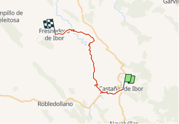
Trail Walking of 19.2 km to be discovered at Extremadura, Cáceres, Castañar de Ibor. This trail is proposed by PatRando.

Description

12 Avril 2017

Elevation profile

Positioning

Country:
Spain
Region :
Extremadura
Department/Province :
Cáceres
Municipality :
Castañar de Ibor
Location:
Unknown
Start:(UTM)
292814 ; 4388875 (30S) N.

Trails nearby

Trail Walking Castañar de Ibor - J4-Castanar-Fresnedoso-par-Ibor - Photo
Walking
PatRando

Walking

Very easy
Castañar de Ibor, Extremadura, Cáceres, Spain
16.3 km | 20 km-effort
4h 19min
No
Trail Walking Castañar de Ibor - J3-Castanar-Navalvillar-Castanar - Photo
Walking
PatRando

Walking

Very easy
Castañar de Ibor, Extremadura, Cáceres, Spain
22 km | 31 km-effort
6h 30min
Yes
Trail Walking Castañar de Ibor - J1-Castanar-Ghorrera-Camorro-Castanar - Photo
Walking
PatRando

Walking

Very easy
Castañar de Ibor, Extremadura, Cáceres, Spain
20 km | 33 km-effort
6h 38min
Yes


Close
My subscriptions