Vecoux -Dommartin
jeanclaude12
User
Length
9.4 km
Max alt
708 m
Uphill gradient
340 m
Km-Effort
14.1 km
Min alt
403 m
Downhill gradient
386 m
Boucle
No
Creation date :
2017-02-14 00:00:00.0
Updated on :
2017-02-14 00:00:00.0
2h35
Difficulty : Medium
FREE GPS app for hiking
About
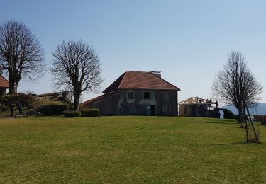
Trail Walking of 9.4 km to be discovered at Grand Est, Vosges, Vecoux. This trail is proposed by jeanclaude12.
Description
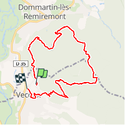
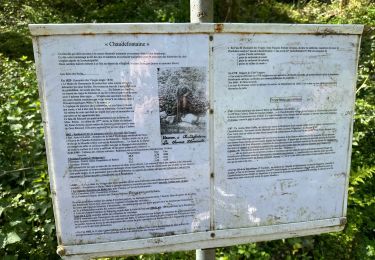
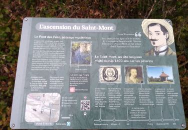
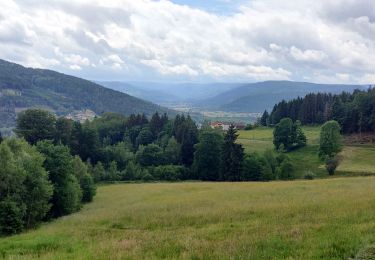
Du parking de Semoflex, montée vers la Vierge de Mai, Grande Goutte, la Roche des Hats, l'ancien Etang Sauveget, et retour par le Pré de la Grange (ou Grande mange) et le très agréable Sentier du Tulipier.
Positioning
Country:
France
Region :
Grand Est
Department/Province :
Vosges
Municipality :
Vecoux
Location:
Unknown
Start:(Dec)
Start:(UTM)
323942 ; 5317105 (32T) N.
Comments
Trails nearby
carrière de Saint Amé
Walking
Medium
(1)
Saint-Amé,
Grand Est,
Vosges,
France
8.6 km | 12.6 km-effort
2h 13min
Yes
Balcon du Solem
Walking
Medium
(1)
Le Syndicat,
Grand Est,
Vosges,
France
4.3 km | 7.4 km-effort
2h 0min
Yes
Remiremont (Girmont-Val-d'Ajol) 22 880m +729m
Walking
Very difficult
(1)
Remiremont,
Grand Est,
Vosges,
France
23 km | 33 km-effort
7h 24min
Yes
Chaudefontaine -grand lac- Chaudefontaine
Walking
Difficult
Vecoux,
Grand Est,
Vosges,
France
8.6 km | 13.4 km-effort
3h 2min
Yes
rando chanoinesses 2024
Walking
Medium
Saint-Étienne-lès-Remiremont,
Grand Est,
Vosges,
France
12.5 km | 18 km-effort
2h 32min
No
GIRMONT VAL D'AJOL
Walking
Difficult
(1)
Girmont-Val-d'Ajol,
Grand Est,
Vosges,
France
9.3 km | 12.9 km-effort
2h 55min
Yes
Chalet avuxon / La Vrille / Col de Xiard variante
Walking
Difficult
(1)
Vecoux,
Grand Est,
Vosges,
France
12.3 km | 19.1 km-effort
4h 20min
Yes
2022-06-06 Rando CVA Dommartin Les Remiremont Le Tholy
Horseback riding
Medium
Dommartin-lès-Remiremont,
Grand Est,
Vosges,
France
22 km | 31 km-effort
3h 56min
No
20220324_projet_rando_ST-ETIENNE-LES-REMIREMONT_N_Sur_les_pas_de_St_Romary
Walking
Very difficult
Saint-Étienne-lès-Remiremont,
Grand Est,
Vosges,
France
15.8 km | 25 km-effort
5h 36min
Yes