


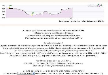
9.1 km | 11.9 km-effort

User


FREE GPS app for hiking
 SityTrail
IGN / Geographical institutes
SityTrail World
The world is yours!
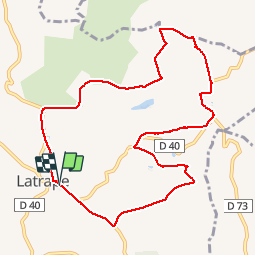
Trail Walking of 10.7 km to be discovered at Occitania, Haute-Garonne, Latrape. This trail is proposed by pidjam.
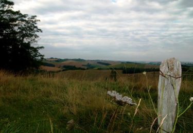
Marche dans la campagne
le chemin suit en partie le parcours éducatif du "balcon des étoiles" (du côté de Marqueflous/le cap del Bosc,etc...vers la fin)


Equestrian
Walking

Walking

Walking
Walking
Walking
Walking

Walking

On foot