![](/images/other/stat-length.png)
![Trail Snowshoes Railleu - Petit tour en raquette au dessus de Sensa - Photo](https://media.geolcdn.com/t/1900/400/ext.pjpeg?maxdim=2&url=https%3A%2F%2Fservices.sitytrail.com%2FGeolivesWS%2FDownloadMedia.ashx%3FTrailID%3D692444%26Media%3Dfix__20170201123445.jpg)
Petit tour en raquette au dessus de Sensa
jpipacific
User
![Length](/images/other/stat-length.png)
Length
3.1 km
![Max alt](https://static1.geolcdn.com/siteimages/upload/files/1508320355ic_sort_altitude_max_24dp.png)
Max alt
1582 m
![Uphill gradient](https://static1.geolcdn.com/siteimages/upload/files/1508320355ic_sort_den_pos_24dp.png)
Uphill gradient
72 m
![Km-Effort](/images/other/stat-length.png)
Km-Effort
4.1 km
![Min alt](https://static1.geolcdn.com/siteimages/upload/files/1508320355ic_sort_altitude_min_24dp.png)
Min alt
1538 m
![Downhill gradient](https://static1.geolcdn.com/siteimages/upload/files/1508320355ic_sort_den_neg_24dp.png)
Downhill gradient
73 m
![Boucle](https://static1.geolcdn.com/siteimages/upload/files/16400158638029165_repeat_loop_refresh_sync_direction_icon.png)
Boucle
Yes
Creation date :
2017-02-02 00:00:00.0
Updated on :
2017-02-02 00:00:00.0
![Snowshoes](https://static1.geolcdn.com/sitytour/trail-icons/504.png)
1h38
Difficulty : Very easy
![Scan this QR Code to open this trail in the SityTrail application](https://capi.geolives.com/qq0zvz2zws4bq2lad0pu/sitytour/trails/692444/qr.png?size=200)
FREE GPS app for hiking
About
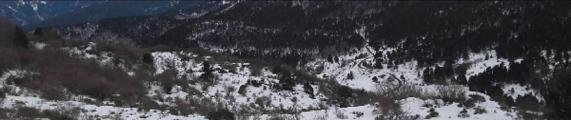
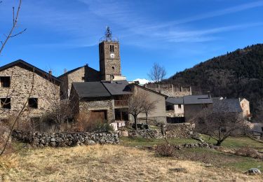
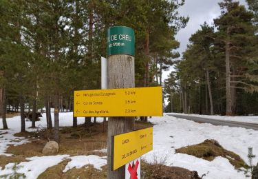
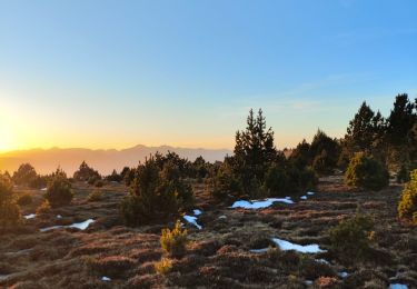
Trail Snowshoes of 3.1 km to be discovered at Occitania, Pyrénées-Orientales, Railleu. This trail is proposed by jpipacific.
Description
neige vierge. Nous avons perdu le marcage du chemin dans les bois. Impossible de passer dans les branchages. Nous avons fait un demi tour puis un petit tour hors chemin avant de rentrer.
Positioning
Country:
France
Region :
Occitania
Department/Province :
Pyrénées-Orientales
Municipality :
Railleu
Location:
Unknown
Start:(Dec)
Start:(UTM)
431046 ; 4716517 (31T) N.
Comments
Trails nearby
![Trail Walking Railleu - 20230312 Boucle depuis Railleu - Photo](https://media.geolcdn.com/t/375/260/6ec33acc-251f-45d6-baf5-f5b7fe74b26f.jpg&format=jpg&maxdim=2)
![Walking Walking](https://static1.geolcdn.com/sitytour/trail-icons/101.png)
20230312 Boucle depuis Railleu
Walking
Medium
Railleu,
Occitania,
Pyrénées-Orientales,
France
![](/images/other/stat-length.png)
15.8 km | 25 km-effort
4h 27min
![](https://static1.geolcdn.com/siteimages/upload/files/16400158638029165_repeat_loop_refresh_sync_direction_icon.png)
Yes
![Trail Walking Formiguères - 20210710 pla del bosc - Foumigueres - Photo](https://media.geolcdn.com/t/375/260/1179261a-6605-4660-a8d9-78a9473ad380.jpg&format=jpg&maxdim=2)
![Walking Walking](https://static1.geolcdn.com/sitytour/trail-icons/101.png)
20210710 pla del bosc - Foumigueres
Walking
Easy
Formiguères,
Occitania,
Pyrénées-Orientales,
France
![](/images/other/stat-length.png)
12.5 km | 18.3 km-effort
2h 47min
![](https://static1.geolcdn.com/siteimages/upload/files/16400158638029165_repeat_loop_refresh_sync_direction_icon.png)
Yes
![Trail Snowshoes Formiguères - Formigueres el collet - Photo](https://media.geolcdn.com/t/375/260/fd8d553e-fbbc-4eac-9bcd-8fe4718e94f2.jpg&format=jpg&maxdim=2)
![Snowshoes Snowshoes](https://static1.geolcdn.com/sitytour/trail-icons/504.png)
Formigueres el collet
Snowshoes
Very easy
Formiguères,
Occitania,
Pyrénées-Orientales,
France
![](/images/other/stat-length.png)
6.4 km | 8.7 km-effort
2h 47min
![](https://static1.geolcdn.com/siteimages/upload/files/16400158638029165_repeat_loop_refresh_sync_direction_icon.png)
Yes
![Trail Snowshoes Matemale - Tour lac mattemale neige - Photo](https://media.geolcdn.com/t/375/260/46aed13f-af74-4409-96af-d8ee48a8d1a0.jpg&format=jpg&maxdim=2)
![Snowshoes Snowshoes](https://static1.geolcdn.com/sitytour/trail-icons/504.png)
Tour lac mattemale neige
Snowshoes
Very easy
Matemale,
Occitania,
Pyrénées-Orientales,
France
![](/images/other/stat-length.png)
9.1 km | 10.4 km-effort
3h 5min
![](https://static1.geolcdn.com/siteimages/upload/files/16400158638029165_repeat_loop_refresh_sync_direction_icon.png)
Yes
![Trail Snowshoes Railleu - Maximale Col de Creu - Photo](https://media.geolcdn.com/t/375/260/ext.jpg?maxdim=2&url=https%3A%2F%2Fservices.sitytrail.com%2FGeolivesWS%2FDownloadMedia.ashx%3FTrailID%3D922253%26Media%3Dfix__20180313153146.jpg)
![Snowshoes Snowshoes](https://static1.geolcdn.com/sitytour/trail-icons/504.png)
Maximale Col de Creu
Snowshoes
Medium
Railleu,
Occitania,
Pyrénées-Orientales,
France
![](/images/other/stat-length.png)
16.7 km | 26 km-effort
4h 55min
![](https://static1.geolcdn.com/siteimages/upload/files/16400158638029165_repeat_loop_refresh_sync_direction_icon.png)
No
![Trail Mountain bike Railleu - la couillue - Photo](https://media.geolcdn.com/t/375/260/ext.jpg?maxdim=2&url=https%3A%2F%2Fservices.sitytrail.com%2FGeolivesWS%2FDownloadMedia.ashx%3FTrailID%3D330610%26Media%3Dfix__20140803145941.jpg)
![Mountain bike Mountain bike](https://static1.geolcdn.com/sitytour/trail-icons/202.png)
la couillue
Mountain bike
Very difficult
(1)
Railleu,
Occitania,
Pyrénées-Orientales,
France
![](/images/other/stat-length.png)
34 km | 50 km-effort
5h 31min
![](https://static1.geolcdn.com/siteimages/upload/files/16400158638029165_repeat_loop_refresh_sync_direction_icon.png)
No
![Trail Walking Railleu - refuge de la perdrix - Photo](https://media.geolcdn.com/t/375/260/accebc35-7569-48a9-9d1a-c6f2c0c31945.jpg&format=jpg&maxdim=2)
![Walking Walking](https://static1.geolcdn.com/sitytour/trail-icons/101.png)
refuge de la perdrix
Walking
Very difficult
Railleu,
Occitania,
Pyrénées-Orientales,
France
![](/images/other/stat-length.png)
18.1 km | 31 km-effort
5h 29min
![](https://static1.geolcdn.com/siteimages/upload/files/16400158638029165_repeat_loop_refresh_sync_direction_icon.png)
No
![Trail Walking Railleu - 20230325 autre parcours sympa depuis Railleu - Photo](https://media.geolcdn.com/t/375/260/eff59e5d-1ddd-49c4-9fc4-244521da53aa.jpg&format=jpg&maxdim=2)
![Walking Walking](https://static1.geolcdn.com/sitytour/trail-icons/101.png)
20230325 autre parcours sympa depuis Railleu
Walking
Medium
Railleu,
Occitania,
Pyrénées-Orientales,
France
![](/images/other/stat-length.png)
17.8 km | 30 km-effort
5h 4min
![](https://static1.geolcdn.com/siteimages/upload/files/16400158638029165_repeat_loop_refresh_sync_direction_icon.png)
Yes
![Trail Walking Railleu - railleu sansa - Photo](https://media.geolcdn.com/t/375/260/3ff29442-3449-4525-a6a7-a29e1ce36aba.jpg&format=jpg&maxdim=2)
![Walking Walking](https://static1.geolcdn.com/sitytour/trail-icons/101.png)
railleu sansa
Walking
Very difficult
Railleu,
Occitania,
Pyrénées-Orientales,
France
![](/images/other/stat-length.png)
17.2 km | 29 km-effort
5h 2min
![](https://static1.geolcdn.com/siteimages/upload/files/16400158638029165_repeat_loop_refresh_sync_direction_icon.png)
Yes