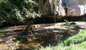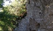

Charlas: gorges de la Save

patricklecetre
User

Length
16.7 km

Max alt
436 m

Uphill gradient
312 m

Km-Effort
21 km

Min alt
279 m

Downhill gradient
308 m
Boucle
Yes
Creation date :
2017-04-02 00:00:00.0
Updated on :
2017-04-02 00:00:00.0
4h33
Difficulty : Easy

FREE GPS app for hiking
About
Trail Walking of 16.7 km to be discovered at Occitania, Haute-Garonne, Charlas. This trail is proposed by patricklecetre.
Description
Belle promenade dans la campagne qui s'achève sur les gorges de la Save (à l'ombre et au frais). La route des gorges est fermée à la circulation; elle est bordée de nombreux abris sous roches préhistoriques.
(pique nique possible à La Coume près de Montmaurin)
Positioning
Country:
France
Region :
Occitania
Department/Province :
Haute-Garonne
Municipality :
Charlas
Location:
Unknown
Start:(Dec)
Start:(UTM)
312062 ; 4789965 (31T) N.
Comments
Trails nearby
Charlas: gorges de la Save


Walking
Easy
Charlas,
Occitania,
Haute-Garonne,
France

16.7 km | 21 km-effort
4h 33min
Yes
2021-03-13 Saint Marcet boucle avec tour du chateau


Walking
Difficult
Saint-Marcet,
Occitania,
Haute-Garonne,
France

9.3 km | 12.5 km-effort
2h 50min
Yes
Gorges de la Save - Montmaurin


Walking
Medium
(2)
Montmaurin,
Occitania,
Haute-Garonne,
France

10.7 km | 13.7 km-effort
2h 43min
No

Gorges Save


Walking
Easy
Cardeilhac,
Occitania,
Haute-Garonne,
France

21 km | 0 m-effort
5h 16min
No

31_Montmaurin


Walking
Medium
Sarremezan,
Occitania,
Haute-Garonne,
France

18.7 km | 24 km-effort
4h 33min
No

Montmaurin


Walking
Very easy
Montmaurin,
Occitania,
Haute-Garonne,
France

16.6 km | 21 km-effort
5h 8min
Yes

31_Ciadoux long


Walking
Medium
Ciadoux,
Occitania,
Haute-Garonne,
France

17.4 km | 22 km-effort
5h 29min
Yes

31_Ciadoux court


Walking
Very easy
Ciadoux,
Occitania,
Haute-Garonne,
France

14.8 km | 18.3 km-effort
3h 1min
Yes

31_Ciadoux_2circuits


Walking
Medium
Ciadoux,
Occitania,
Haute-Garonne,
France

32 km | 40 km-effort
9h 0min
Yes


 SityTrail


