


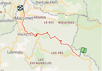

14.2 km | 23 km-effort


User


FREE GPS app for hiking
 SityTrail
IGN / Geographical institutes
SityTrail World
The world is yours!
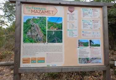
Trail Walking of 11.6 km to be discovered at Occitania, Tarn, Mazamet. This trail is proposed by richard21220.
Gîte d'Etape communal : Castaunouze 81200 MAZAMET Tél 05 63 61 27 07
Gîte d'Etape : Laviale 11160 CASTANS Tél 04 68 72 03 62
Gîte d'Etape La Maison Forestière : 16 route du Pic de Nore 11380 PRADELLES CABARDES Tél 04 68 77 82 52

Walking
Walking
Walking
Walking

Walking

Cycle
Mountain bike
