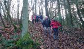
Trail Walking Thoury-Férottes - GG-170105 - Montagne-Forteresse - Photo

GG-170105 - Montagne-Forteresse

 randodan
randodan

User

© OpenStreetMap contributors
Length
Length
6.6 km
Max alt
Max alt
163 m
Uphill gradient
Uphill gradient
144 m
Km-Effort
Km-Effort  
8.6 km
Min alt
Min alt
85 m
Downhill gradient
Downhill gradient
143 m
Boucle
Boucle
Yes
Creation date :
2017-02-10 00:00:00.0
Updated on :
2017-02-10 00:00:00.0

(0 Reviews)

Walking
Walking
2h00
Difficulty : Easy

Scan this QR Code to open this trail in the SityTrail application

FREE GPS app for hiking

Logo SityTrail SityTrail

IGN / Geographical institutes

Download SityTrail from the App Store Download SityTrail from Google Play

Logo SityTrail SityTrail World

The world is yours!

Download SityTrail from the App Store Download SityTrail from Google Play Download SityTrail on Huawei AppGallery

About

Trail Walking of 6.6 km to be discovered at Ile-de-France, Seine-et-Marne, Thoury-Férottes. This trail is proposed by randodan.

Description

Montagne et Golf de la Forteresse<br>
- Jeudi 5 janvier 2017 -<br>
Pour les 70 balais du Gégé, on commence par une petite rando matinale.<br>
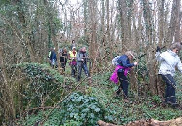
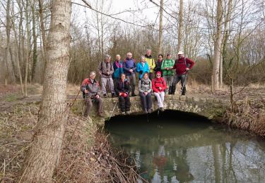
10h10, départ de la Forteresse . Tout droit dans la pente à l'assaut de la Montagne . Descente douce pour remonter gentiment au point culminant de la Montagne : 153 m.<br>
La descente de retour est un peu plus sauvage, faudra écraser un peu de ronces pour rejoindre le chemin en bordure qui nous ramène au parking où on retrouve Jean-Claude.<br>
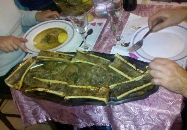
Petit parcours de golf en final (mais sans y jouer ;o), et, 12h10, de retour au parking pour un super bon repas au resto de la Forteresse.<br>
13 participants, mais... 17 à table.

Elevation profile

Photos

Points of interest

Point of interest Thoury-Férottes - 01 - Au sommet de la Montagne - Photo
randodan
Point of interest Thoury-Férottes - 02 - Repénétrons dans le Bois de la Montagne - Photo
randodan
Point of interest Thoury-Férottes - 03 - Dans le Bois de la Montagne - Photo
randodan
Point of interest Thoury-Férottes - 04 - Au pied de la Montagne, retour vers le Golf - Photo
randodan
Point of interest Thoury-Férottes - 05 - Au restaurant de la Forteresse - Photo
randodan

Positioning

Country:
France
Region :
Ile-de-France
Department/Province :
Seine-et-Marne
Municipality :
Thoury-Férottes
Location:
Unknown
Start:(UTM)
496462 ; 5349610 (31U) N.

Trails nearby

Trail Walking Voulx - Entre Yonne et Orvalle  - Photo
Walking
GUIDE
chessyca

Walking

Easy
Voulx, Ile-de-France, Seine-et-Marne, France
17.3 km | 21 km-effort
3h 34min
Yes
Trail On foot Ville-Saint-Jacques - Basse vallée de l'Orvanne - Photo
On foot
GUIDE+

On foot

Easy
Ville-Saint-Jacques, Ile-de-France, Seine-et-Marne, France
16 km | 19.1 km-effort
4h 20min
Yes
Trail On foot La Brosse-Montceaux - Les Plaines du Sud - Photo
On foot
GUIDE+

On foot

Easy
La Brosse-Montceaux, Ile-de-France, Seine-et-Marne, France
11.1 km | 12.7 km-effort
2h 52min
No
Trail On foot Montmachoux - Sentier des Croix - Photo
On foot
GUIDE+

On foot

Easy
Montmachoux, Ile-de-France, Seine-et-Marne, France
5.5 km | 6.5 km-effort
1h 28min
Yes
Trail Walking Thoury-Férottes - 180111 EnCours - Photo
Walking
MarcheEtReve

Walking

Very easy
Thoury-Férottes, Ile-de-France, Seine-et-Marne, France
16.7 km | 19.7 km-effort
5h 20min
Yes
Trail Walking Thoury-Férottes - Manu-170218 - Thoury-Dormelles - Photo
Walking
randodan

Walking

Easy
Thoury-Férottes, Ile-de-France, Seine-et-Marne, France
15.8 km | 18.8 km-effort
4h 45min
Yes
Trail Walking Dormelles - M&R-141219 - Dormelles - Photo
Walking
randodan

Walking

Easy
Dormelles, Ile-de-France, Seine-et-Marne, France
10.9 km | 12.7 km-effort
3h 0min
Yes
Trail Walking Dormelles - M&R-131210 - Dormelles - Photo
Walking
randodan

Walking

Very easy
Dormelles, Ile-de-France, Seine-et-Marne, France
16.1 km | 19.3 km-effort
4h 9min
Yes
Trail Walking Thoury-Férottes - SVG 180111 - Photo
Walking
MarcheEtReve

Walking

Very easy
Thoury-Férottes, Ile-de-France, Seine-et-Marne, France
14.9 km | 17.8 km-effort
7h 20min
No


Close
My subscriptions