Trail Walking Teror - Teror-Cruz Hoya Alta - Photo

Teror-Cruz Hoya Alta

 cgrbxl
cgrbxl

User

© OpenStreetMap contributors
Length
Length
8.7 km
Max alt
Max alt
974 m
Uphill gradient
Uphill gradient
402 m
Km-Effort
Km-Effort  
14.3 km
Min alt
Min alt
587 m
Downhill gradient
Downhill gradient
457 m
Boucle
Boucle
No
Creation date :
2017-01-21 00:00:00.0
Updated on :
2017-01-21 00:00:00.0

(0 Reviews)

Walking
Walking
3h04
Difficulty : Medium

Scan this QR Code to open this trail in the SityTrail application

FREE GPS app for hiking

Logo SityTrail SityTrail

IGN / Geographical institutes

Download SityTrail from the App Store Download SityTrail from Google Play

Logo SityTrail SityTrail World

The world is yours!

Download SityTrail from the App Store Download SityTrail from Google Play Download SityTrail on Huawei AppGallery

About

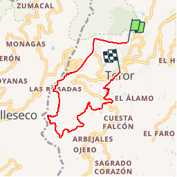
Trail Walking of 8.7 km to be discovered at Canary Islands, Las Palmas, Teror. This trail is proposed by cgrbxl.

Description

Circular 7 km muy al estilo Teror: pendientes teroríficas.

Elevation profile

Photos

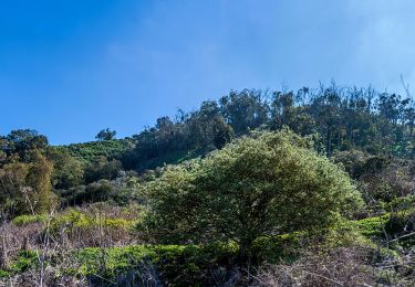
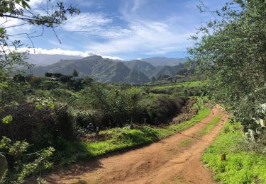
24 photos in total. Please click on a photo to see them all in the gallery.

Positioning

Country:
Spain
Region :
Canary Islands
Department/Province :
Las Palmas
Municipality :
Teror
Location:
Unknown
Start:(UTM)
446398 ; 3104664 (28R) N.

Trails nearby

Trail On foot Santa Brígida - Camino Pál Pino de Santa Brígida a Teror - Photo
On foot
PRO

On foot

Easy
Santa Brígida, Canary Islands, Las Palmas, Spain
3.3 km | 5.5 km-effort
1h 14min
No
Trail Walking Teror - Teror-Cruz Hoya Alta - Photo
Walking
cgrbxl

Walking

Medium
Teror, Canary Islands, Las Palmas, Spain
8.7 km | 14.3 km-effort
3h 4min
No
Trail Walking Teror - Osorio easy - Photo
Walking
cgrbxl

Walking

Easy
Teror, Canary Islands, Las Palmas, Spain
6.2 km | 8.6 km-effort
1h 53min
Yes
Trail Walking Firgas - Villa de Firgas - Photo
Walking
Tournan

Walking

Medium
Firgas, Canary Islands, Las Palmas, Spain
7.8 km | 14.1 km-effort
3h 7min
Yes


Close
My subscriptions