Trail Other activity Stallikon - Albiskette-Classic: Uetliberg Albispass Türlersee - Photo

Albiskette-Classic: Uetliberg Albispass Türlersee

© OpenStreetMap contributors
Length
Length
20 km
Max alt
Max alt
904 m
Uphill gradient
Uphill gradient
508 m
Km-Effort
Km-Effort  
28 km
Min alt
Min alt
501 m
Downhill gradient
Downhill gradient
824 m
Boucle
Boucle
No
Creation date :
2017-01-02 00:00:00.0
Updated on :
2017-01-02 00:00:00.0

(0 Reviews)

Other activity
Other activity
5h05
Difficulty : Easy

Scan this QR Code to open this trail in the SityTrail application

FREE GPS app for hiking

Logo SityTrail SityTrail

IGN / Geographical institutes

Download SityTrail from the App Store Download SityTrail from Google Play

Logo SityTrail SityTrail World

The world is yours!

Download SityTrail from the App Store Download SityTrail from Google Play Download SityTrail on Huawei AppGallery

About

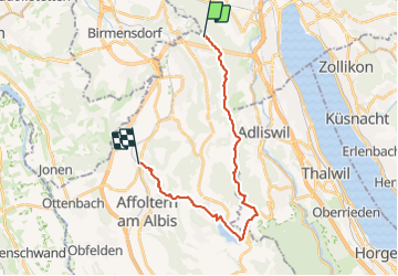
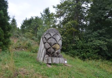
Trail Other activity of 20 km to be discovered at Zurich, Bezirk Affoltern, Stallikon. This trail is proposed by NicolasEngelke.

Description

Wir starteten auf dem Uetliberg und folgten dem Gratweg bis zur Albis-Passhöhe. Dort stiegen wir ab zum Türlersee, umrundeten
diesen bis zum Nordufer, von wo wir auf den Aeugsterberg aufstiegen und via den
Bisliker und Hedinger Weiher unser Ziel Hedingen erreichen.
Von dort bringt uns die S5 nach Zürich oder Zug resp. die S14 nach Zürich.
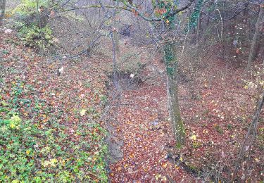
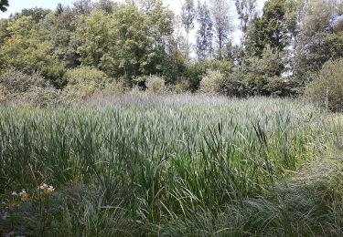
Diese Route bietet neben unzähligen Weit- und Tiefblicken schöne Passagen
entlang von drei kleineren stehenden Gewässern.

Elevation profile

Positioning

Country:
Switzerland
Region :
Zurich
Department/Province :
Bezirk Affoltern
Municipality :
Stallikon
Location:
Unknown
Start:(UTM)
461299 ; 5244409 (32T) N.

Trails nearby

Trail Walking Zurich - Uetliberg - Albispass - Türlersee - Photo
Walking
GUIDE+

Walking

Very easy
(1)
Zurich, Zurich, District Zurich, Switzerland
16 km | 22 km-effort
Unknown
No
Trail On foot Adliswil - Ober Leimbach - Waldi - Fixme - Photo
On foot
GUIDE+

On foot

Easy
Adliswil, Zurich, Bezirk Horgen, Switzerland
3.5 km | 5.4 km-effort
1h 14min
No
Trail On foot Zurich - Rigiblick - Stettbach Bahnhof - Photo
On foot
GUIDE+

On foot

Easy
Zurich, Zurich, District Zurich, Switzerland
4.8 km | 6.5 km-effort
1h 28min
No
Trail On foot Adliswil - Adliswil (Bahnhof) - Thalwil (Bahnhof) - Photo
On foot
GUIDE+

On foot

Easy
Adliswil, Zurich, Bezirk Horgen, Switzerland
5.4 km | 7.2 km-effort
1h 38min
No
Trail On foot Stallikon - Uitikon Waldegg Station - Uetliberg Kulm - Photo
On foot
GUIDE+

On foot

Easy
Stallikon, Zurich, Bezirk Affoltern, Switzerland
3.4 km | 4.3 km-effort
58min
No
Trail On foot Uitikon - Birmensdorf - Ringlikon - Photo
On foot
GUIDE+

On foot

Easy
Uitikon, Zurich, Bezirk Dietikon, Switzerland
3.3 km | 3.9 km-effort
53min
No
Trail On foot Uitikon - Birmensdorf - Ringlikon Haltestelle - Photo
On foot
GUIDE+

On foot

Easy
Uitikon, Zurich, Bezirk Dietikon, Switzerland
3.9 km | 5 km-effort
1h 7min
No
Trail On foot Wettswil am Albis - Birmensdorf - Wettswil - Photo
On foot
GUIDE+

On foot

Easy
Wettswil am Albis, Zurich, Bezirk Affoltern, Switzerland
4.5 km | 5.8 km-effort
1h 19min
No
Trail On foot Urdorf - Urdorf Weihermatt - Uitikon - Photo
On foot
GUIDE+

On foot

Easy
Urdorf, Zurich, Bezirk Dietikon, Switzerland
3.2 km | 4.5 km-effort
1h 1min
No


Close
My subscriptions