


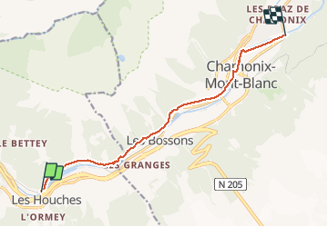

6.1 km | 9.4 km-effort


User


FREE GPS app for hiking
 SityTrail
IGN / Geographical institutes
SityTrail World
The world is yours!
Trail Walking of 10.3 km to be discovered at Auvergne-Rhône-Alpes, Upper Savoy, Les Houches. This trail is proposed by GerardBouche.
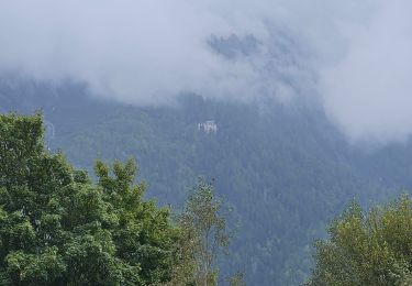
Depuis la station SNCF des Houches par le superbe sentier en rive droite de l'Arve avec une vue exceptionnelle sur l'Aiguille du Midi, les glaciers des Bossons et de Taconnaz.
 - Photo 1")
 - Photo 2")
 - Photo 3")
 - Photo 4")
 - Photo 5")
 - Photo 6")
 - Photo 7")
 - Photo 8")

Walking

Walking

Walking

Walking

Walking

Walking

Walking
Walking
Walking