Trail Other activity La Trinité-de-Réville - Haute Normandie - Ligne 400 - Echauffour - Bernay (Section de La Trinité de Réville à Bernay) 2 - Photo

Haute Normandie - Ligne 400 - Echauffour - Bernay (Section de La Trinité de Réville à Bernay) 2

 mich54
mich54

User

© OpenStreetMap contributors
Length
Length
15.8 km
Max alt
Max alt
162 m
Uphill gradient
Uphill gradient
100 m
Km-Effort
Km-Effort  
17.2 km
Min alt
Min alt
105 m
Downhill gradient
Downhill gradient
144 m
Boucle
Boucle
No
Creation date :
2016-12-24 00:00:00.0
Updated on :
2016-12-24 00:00:00.0

(0 Reviews)

Other activity
Other activity
5m
Difficulty : Unknown

Scan this QR Code to open this trail in the SityTrail application

FREE GPS app for hiking

Logo SityTrail SityTrail

IGN / Geographical institutes

Download SityTrail from the App Store Download SityTrail from Google Play

Logo SityTrail SityTrail World

The world is yours!

Download SityTrail from the App Store Download SityTrail from Google Play Download SityTrail on Huawei AppGallery

About

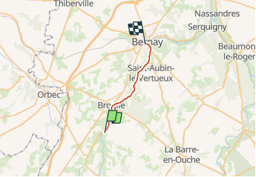
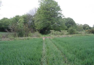
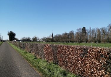
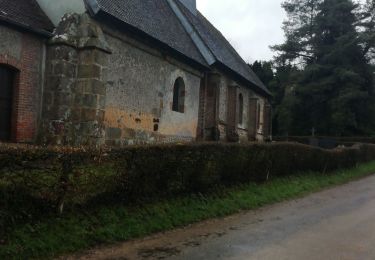
Trail Other activity of 15.8 km to be discovered at Normandy, Eure, La Trinité-de-Réville. This trail is proposed by mich54.

Description

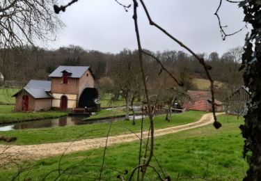
La ligne d'Échauffour à Bernay est une ancienne ligne de chemin de fer française, se trouvant dans les départements de l'Orne et de l'Eure, et les régions Basse-Normandie et Haute-Normandie.
Elle fut ouverte le 22 décembre 1881.
Le 15 mai 1938, le service des voyageurs est supprimé.(Source Wikipédia)

Le tracé étant incertain de la limite Eure/Orne à La Trinité de Réville, j'ai donc séparé le tracé en 2 parties.

Elevation profile

Positioning

Country:
France
Region :
Normandy
Department/Province :
Eure
Municipality :
La Trinité-de-Réville
Location:
Unknown
Start:(UTM)
318169 ; 5427548 (31U) N.

Trails nearby

Trail Walking Chamblac - Circuit de Bonneville  -  Chamblac - Photo
Walking
tracegps

Walking

Medium
Chamblac, Normandy, Eure, France
11.2 km | 12 km-effort
2h 45min
Yes
Trail Walking La Chapelle-Gauthier - La Mare Péreuse - La Chapelle-Gauthier - Photo
Walking
tracegps

Walking

Medium
La Chapelle-Gauthier, Normandy, Eure, France
10.3 km | 11.9 km-effort
2h 45min
Yes
Trail Cycle Broglie - Boucle des 3 Maréchaux  -  Broglie - Photo
Cycle
tracegps

Cycle

Medium
Broglie, Normandy, Eure, France
18.5 km | 20 km-effort
1h 15min
Yes
Trail Walking Broglie - Circuit du Prieuré - Broglie - Photo
Walking
tracegps

Walking

Difficult
(1)
Broglie, Normandy, Eure, France
13.2 km | 14.9 km-effort
3h 19min
Yes
Trail Mountain bike Mesnil-en-Ouche - Circuit de la campagne des bois - St-Pierre du Mesnil - Photo
Mountain bike
tracegps

Mountain bike

Easy
Mesnil-en-Ouche, Normandy, Eure, France
8.9 km | 9.5 km-effort
1h 0min
Yes
Trail Walking Mesnil-en-Ouche - Circuit de la campagne des bois - St-Pierre du Mesnil - Photo
Walking
tracegps

Walking

Medium
Mesnil-en-Ouche, Normandy, Eure, France
8.9 km | 9.5 km-effort
2h 15min
Yes
Trail Walking Chamblac - Le Chamblac - Photo
Walking
ymarvin

Walking

Easy
Chamblac, Normandy, Eure, France
9.1 km | 9.7 km-effort
1h 52min
Yes
Trail Walking Broglie - Broglie - Photo
Walking
werth

Walking

Medium
Broglie, Normandy, Eure, France
10.1 km | 11.8 km-effort
2h 50min
Yes
Trail Walking Montreuil-l'Argillé - autour de Montreuil l argilleé - Photo
Walking
ymarvin

Walking

Very easy
Montreuil-l'Argillé, Normandy, Eure, France
5.3 km | 6.2 km-effort
1h 11min
Yes


Close
My subscriptions