![](/images/other/stat-length.png)
![Trail Other activity Rouxmesnil-Bouteilles - Haute - Normandie - Ligne 356 - Rouxmesnil - Eu - Photo](https://media.geolcdn.com/t/1900/400/ext.pjpeg?maxdim=2&url=https%3A%2F%2Fstatic1.geolcdn.com%2Fsiteimages%2Fupload%2Ffiles%2F1545311037marcheuse_200dpi.jpg)
Haute - Normandie - Ligne 356 - Rouxmesnil - Eu
mich54
User
![Length](/images/other/stat-length.png)
![Max alt](https://static1.geolcdn.com/siteimages/upload/files/1508320355ic_sort_altitude_max_24dp.png)
![Uphill gradient](https://static1.geolcdn.com/siteimages/upload/files/1508320355ic_sort_den_pos_24dp.png)
![Km-Effort](/images/other/stat-length.png)
![Min alt](https://static1.geolcdn.com/siteimages/upload/files/1508320355ic_sort_altitude_min_24dp.png)
![Downhill gradient](https://static1.geolcdn.com/siteimages/upload/files/1508320355ic_sort_den_neg_24dp.png)
![Boucle](https://static1.geolcdn.com/siteimages/upload/files/16400158638029165_repeat_loop_refresh_sync_direction_icon.png)
![Other activity](https://static1.geolcdn.com/sitytour/trail-icons/900.png)
5m
Difficulty : Unknown
![Scan this QR Code to open this trail in the SityTrail application](https://capi.geolives.com/qq0zvz2zws4bq2lad0pu/sitytour/trails/674781/qr.png?size=200)
FREE GPS app for hiking
About
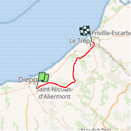
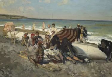
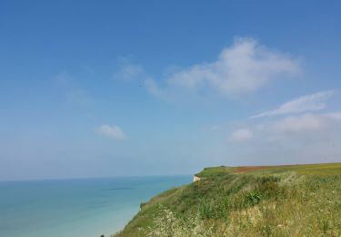
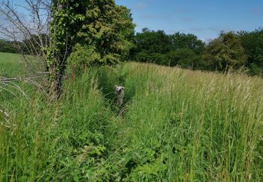
Trail Other activity of 37 km to be discovered at Normandy, Seine-Maritime, Rouxmesnil-Bouteilles. This trail is proposed by mich54.
Description
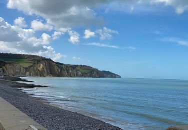
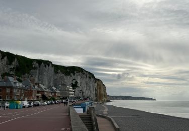
La ligne de Rouxmesnil à Eu, parfois dénommée ligne de Dieppe au Tréport, est une voie ferrée à écartement standard, sise dans le département français de Seine-Inférieure (aujourd'hui Seine-Maritime), établie par la Compagnie des chemins de fer de l'Ouest dans le cadre du plan Freycinet. Inauguré en 1885, ce chemin de fer fut fermé aux voyageurs en 1938 et progressivement aux marchandises à partir 1972. Une partie de son parcours reste toutefois en exploitation pour assurer des transports spéciaux à destination de la centrale nucléaire de Penly.(Source Wikipédia)
Positioning
Comments
Trails nearby
![Trail Walking Dieppe - GR21 : De Dieppe à Pourville-Sur-Mer - Photo](https://media.geolcdn.com/t/375/260/9af66fc9-7eaf-4a54-b63d-df14d7092c30.jpeg&format=jpg&maxdim=2)
![Walking Walking](https://static1.geolcdn.com/sitytour/trail-icons/101.png)
Walking
![](/images/other/stat-length.png)
![](https://static1.geolcdn.com/siteimages/upload/files/16400158638029165_repeat_loop_refresh_sync_direction_icon.png)
![Trail On foot Dieppe - Dieppe coté mer 1 - Photo](https://media.geolcdn.com/t/375/260/17716324-48c0-4442-af65-fedeb6808833.jpeg&format=jpg&maxdim=2)
![On foot On foot](https://static1.geolcdn.com/sitytour/trail-icons/100.png)
On foot
![](/images/other/stat-length.png)
![](https://static1.geolcdn.com/siteimages/upload/files/16400158638029165_repeat_loop_refresh_sync_direction_icon.png)
![Trail Walking Hautot-sur-Mer - Petit Appeville vers Pourville sur mer - Photo](https://media.geolcdn.com/t/375/260/f27eecc9-b419-4f96-979b-ca5c51e90ae0.jpg&format=jpg&maxdim=2)
![Walking Walking](https://static1.geolcdn.com/sitytour/trail-icons/101.png)
Walking
![](/images/other/stat-length.png)
![](https://static1.geolcdn.com/siteimages/upload/files/16400158638029165_repeat_loop_refresh_sync_direction_icon.png)
![Electric bike Electric bike](https://static1.geolcdn.com/sitytour/trail-icons/205.png)
Electric bike
![](/images/other/stat-length.png)
![](https://static1.geolcdn.com/siteimages/upload/files/16400158638029165_repeat_loop_refresh_sync_direction_icon.png)
![Trail Walking Arques-la-Bataille - Arques-la-Bataille 16 03 2024 - Photo](https://media.geolcdn.com/t/375/260/0c00a518-0b31-446c-85a9-d8fed485b0a0.jpg&format=jpg&maxdim=2)
![Walking Walking](https://static1.geolcdn.com/sitytour/trail-icons/101.png)
Walking
![](/images/other/stat-length.png)
![](https://static1.geolcdn.com/siteimages/upload/files/16400158638029165_repeat_loop_refresh_sync_direction_icon.png)
![Trail Walking Arques-la-Bataille - hameau de Florence - Photo](https://media.geolcdn.com/t/375/260/7ac94c9e-2dfb-4fc8-8cf5-5a58de40e3a4.jpg&format=jpg&maxdim=2)
![Walking Walking](https://static1.geolcdn.com/sitytour/trail-icons/101.png)
Walking
![](/images/other/stat-length.png)
![](https://static1.geolcdn.com/siteimages/upload/files/16400158638029165_repeat_loop_refresh_sync_direction_icon.png)
![Trail Walking Dieppe - Dieppe - Photo](https://media.geolcdn.com/t/375/260/25ca68d2-67d2-41cc-84f5-ed5d3a2e8f7b.jpg&format=jpg&maxdim=2)
![Walking Walking](https://static1.geolcdn.com/sitytour/trail-icons/101.png)
![Trail Walking Dieppe - Dieppe camp de cesar bracquemont - Photo](https://media.geolcdn.com/t/375/260/06cc6a1c-1a19-4b0b-ac23-786804dfa82e.jpg&format=jpg&maxdim=2)
![Walking Walking](https://static1.geolcdn.com/sitytour/trail-icons/101.png)
Walking
![](/images/other/stat-length.png)
![](https://static1.geolcdn.com/siteimages/upload/files/16400158638029165_repeat_loop_refresh_sync_direction_icon.png)
![Trail Walking Saint-Aubin-sur-Scie - Dieppe vertu offranville - Photo](https://media.geolcdn.com/t/375/260/5e801aaf-ab62-4549-b5e1-1ab7b9cb0760.jpg&format=jpg&maxdim=2)
![Walking Walking](https://static1.geolcdn.com/sitytour/trail-icons/101.png)
Walking
![](/images/other/stat-length.png)
![](https://static1.geolcdn.com/siteimages/upload/files/16400158638029165_repeat_loop_refresh_sync_direction_icon.png)