


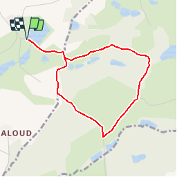

15 km | 19.6 km-effort


User


FREE GPS app for hiking
 SityTrail
IGN / Geographical institutes
SityTrail World
The world is yours!
Trail Walking of 3.8 km to be discovered at Auvergne-Rhône-Alpes, Isère, Saint-Jean-de-Bournay. This trail is proposed by yvos38.
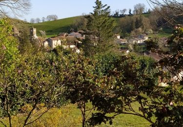
Petite promenade sympathique avec passage devant la chapelle St Hugon reconstruite dans les années soixante (chacun appréciera son architecture), puis passage devant le chêne St Hugon muticentenaire.
Walking

Walking

Mountain bike
Walking
Walking
Walking
Walking


sport
sport