


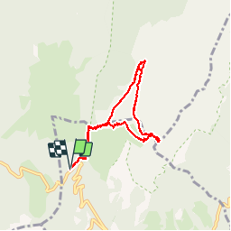


8.2 km | 17.7 km-effort

User


FREE GPS app for hiking
 SityTrail
IGN / Geographical institutes
SityTrail World
The world is yours!
Trail Walking of 7.9 km to be discovered at Auvergne-Rhône-Alpes, Isère, Plateau-des-Petites-Roches. This trail is proposed by patjobou.
ANF. 08/12/2016
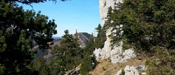
Qq névés et plaques de glace dus aux restes des premières neiges. Mieux vaut avoir le pas sûr à cette époque.
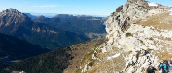
Vue exceptionnelle par un temps exceptionnel!
Montée: 2h; descente: 2h30


Walking

Walking

Walking

Walking

Walking

Walking

On foot

Touring skiing

Walking