


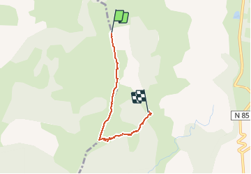

8.6 km | 18.5 km-effort


User


FREE GPS app for hiking
 SityTrail
IGN / Geographical institutes
SityTrail World
The world is yours!
Trail Walking of 4.4 km to be discovered at Provence-Alpes-Côte d'Azur, Hautes-Alpes, Gap. This trail is proposed by Dervalmarc.
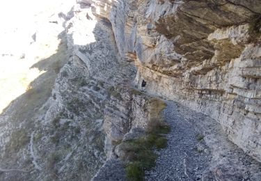
Plantage du GPS dans la montée.Comtper 569m de dénivelé au départ des Serigues,4km250,1h30 de montée.Attention parrcours aérien sur la crête de la Greysiniere.A déconseillé aux personnes sujettes au vertige.Beau panorama sur tout le Gapencais.
 - Photo 1")
 - Photo 2")
 - Photo 3")
 - Photo 4")
 - Photo 5")
 - Photo 6")

Walking

Walking

Walking

Walking

Walking

Walking

Walking

On foot
Walking